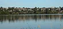
Phinney Ridge, Seattle

Phinney Ridge is a neighborhood in north central Seattle, Washington, USA. It is named after the ridge which runs north and south, separating Ballard from Green Lake, from approximately N. 45th to N. 85th Street. The ridge, in turn, is named after Guy C. Phinney, lumber mill owner and real estate developer, whose estate was bought by the city and turned into Woodland Park in 1899. Phinney's estate had included a private menagerie, and the western half of the park became what is now the Woodland Park Zoo.

The generally accepted boundaries of Phinney Ridge are Aurora Avenue N. (State Route 99) to the east, beyond which lies Green Lake and the eastern half of Woodland Park; N. 80th Street to the north, beyond which lies Greenwood; 8th Avenue N.W. to the west, beyond which lies Ballard, and N. 50th and Market Streets to the south, beyond which lies Fremont.
Phinney Ridge's main thoroughfare, which runs atop the ridge south of N. 67th Street, is Phinney Avenue N. North of N. 67th Street, the arterial swings a block to the west and becomes Greenwood Avenue N. The route is lined with many small businesses and shops, as well as the Phinney Neighborhood Center, located at the corner of Phinney and 67th. It has occupied the former John B. Allen Elementary School building, which was built in 1904, since 1981, when the school closed. Phinney Ridge's main east-west thoroughfare is N. 65th
Wildlife in the area, especially adjacent to Woodlawn Park, has always been a subject of discussion; at least two medium sized (8-15 individuals) coyote packs are known to inhabit the area feeding off the large population of released domestic rabbits that also called the park home until February 2006 (now have returned 06/01/09).
External links
| Wikimedia Commons has media related to Phinney Ridge, Seattle, Washington. |
- Seattle City Clerk's Neighborhood Map Atlas — Phinney Ridge
- Phinney Neighborhood Association
- Phinney Ridge History
- Phinney Ridge News
Coordinates: 47°40′27″N 122°21′35″W / 47.67417°N 122.35972°W