Philipstown, Northern Cape
| Philipstown | |
|---|---|
|
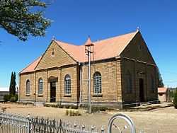
Reformed Church, Philipstown | |
 Philipstown
| |
| Coordinates: 30°26′S 24°28′E / 30.433°S 24.467°ECoordinates: 30°26′S 24°28′E / 30.433°S 24.467°E | |
| Country | South Africa |
| Province | Northern Cape |
| District | Pixley ka Seme |
| Municipality | Renosterberg |
| Established | 1863 |
| Area[1] | |
| • Total | 44.12 km2 (17.03 sq mi) |
| Population (2011)[1] | |
| • Total | 3,365 |
| • Density | 76/km2 (200/sq mi) |
| Racial makeup (2011)[1] | |
| • Black African | 36.3% |
| • Coloured | 58.5% |
| • Indian/Asian | 0.4% |
| • White | 4.5% |
| • Other | 0.3% |
| First languages (2011)[1] | |
| • Afrikaans | 70.2% |
| • Xhosa | 27.0% |
| • Other | 2.8% |
| Postal code (street) | 8795 |
| PO box | 8795 |
Philipstown is a town in the eastern Karoo region of South Africa.
Town 56 km north-east of De Aar. It was established in May 1863 on the farm Rietfontein and became a municipality in August 1876. Named after Sir Philip Edmond Wodehouse (1811-1887), Governor of the Cape Colony from 1861 to 1870.[2]
References
- ↑ 1.0 1.1 1.2 1.3 "Main Place Philipstown". Census 2011.
- ↑ "Dictionary of Southern African Place Names (Public Domain)". Human Science Research Council. p. 364.
| Wikimedia Commons has media related to Philipstown, Northern Cape. |
 |
Strydenburg | Orania | Petrusville | |
| |
||||
| ||||
| | ||||
| De Aar | Hanover | Colesberg |
| |||||||||||||||||||||||||||||||||||||||||
.svg.png)