Pfalzen
| Pfalzen | |
|---|---|
| Comune | |
| Gemeinde Pfalzen Comune di Falzes | |
 Pfalzen Location of Pfalzen in Italy | |
| Coordinates: 46°49′N 11°53′E / 46.817°N 11.883°ECoordinates: 46°49′N 11°53′E / 46.817°N 11.883°E | |
| Country | Italy |
| Region | Trentino-Alto Adige/Südtirol |
| Province | South Tyrol (BZ) |
| Frazioni | Greinwalden (Grimaldo), Issing (Issengo) |
| Government | |
| • Mayor | Josef Gatterer |
| Area | |
| • Total | 33.3 km2 (12.9 sq mi) |
| Elevation | 1,022 m (3,353 ft) |
| Population (2011) | |
| • Total | 2,620 |
| • Density | 79/km2 (200/sq mi) |
| Demonym |
German: Pfalzner Italian: di Falzes |
| Time zone | CET (UTC+1) |
| • Summer (DST) | CEST (UTC+2) |
| Postal code | 39030 |
| Dialing code | 0474 |
| Website | Official website |
Pfalzen (Italian: Falzes; Ladin: Falzes) is a comune (municipality) in South Tyrol in northern Italy, located about 50 kilometres (31 mi) northeast of Bolzano.
Geography
As of 30 November 2010, it had a population of 2,612 and an area of 33.3 square kilometres (12.9 sq mi).[1]
Pfalzen borders the following municipalities: Bruneck, Kiens, Gais, St. Lorenzen and Mühlwald.
Frazioni
The municipality of Pfalzen contains the frazioni (subdivisions, mainly villages and hamlets) Greinwalden (Grimaldo) and Issing (Issengo).
History
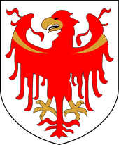
Coat-of-arms
The escutcheon is party per pale of gules and argent; with a sickle in each side of opposite color. It is the coat of arms of the Plazoll zu Assling, Lords of Pfalzen in the Middle Ages, who built the castle of Sichelburg (sichel in German means sickle). The emblem was adopted in 1967.[2]
Society
Linguistic distribution
According to the 2011 census, 96.25% of the population speak German, 2.36% Italian and 1.39% Ladin as first language.[3]
Demographic evolution

References
- ↑ All demographics and other statistics: Italian statistical institute Istat.
- ↑ "Stemma Comune di PFALZEN".
- ↑ "Volkszählung 2011/Censimento della popolazione 2011". astat info (Provincial Statistics Institute of the Autonomous Province of South Tyrol) (38): 6–7. June 2012. Retrieved 2012-06-14.
External links
![]() Media related to Pfalzen at Wikimedia Commons
Media related to Pfalzen at Wikimedia Commons
- (German) (Italian) Homepage of the municipality