Petrolia, Texas
| Petrolia, Texas | |
|---|---|
| City | |
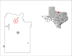
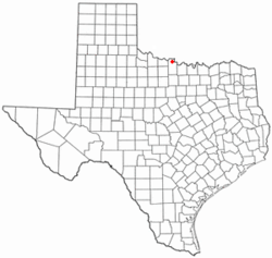 Location of Petrolia, Texas | |
 | |
| Coordinates: 34°0′47″N 98°13′54″W / 34.01306°N 98.23167°WCoordinates: 34°0′47″N 98°13′54″W / 34.01306°N 98.23167°W | |
| Country | United States |
| State | Texas |
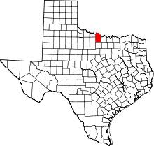
| County | Clay |
| Area | |
| • Total | 0.7 sq mi (1.9 km2) |
| • Land | 0.7 sq mi (1.9 km2) |
| • Water | 0.0 sq mi (0.0 km2) |
| Elevation | 997 ft (304 m) |
| Population (2000) | |
| • Total | 782 |
| • Density | 1,051.1/sq mi (405.8/km2) |
| Time zone | Central (CST) (UTC-6) |
| • Summer (DST) | CDT (UTC-5) |
| ZIP code | 76377 |
| Area code(s) | 940 |
| FIPS code | 48-57044[1] |
| GNIS feature ID | 1365114[2] |
Petrolia is a city in Clay County, Texas, United States. It is part of the Wichita Falls, Texas Metropolitan Statistical Area. The population was 782 at the 2000 census.
Geography
Petrolia is located at 34°0′47″N 98°13′54″W / 34.01306°N 98.23167°W (34.013107, -98.231655).[3]
According to the United States Census Bureau, the city has a total area of 0.7 square miles (1.8 km2), all of it land.
Demographics
As of the census[1] of 2000, there were 782 people, 305 households, and 215 families residing in the city. The population density was 1,051.1 people per square mile (408.0/km²). There were 338 housing units at an average density of 454.3/sq mi (176.4/km²). The racial makeup of the city was 94.88% White, 0.77% African American, 1.41% Native American, 1.15% from other races, and 1.79% from two or more races. Hispanic or Latino of any race were 3.96% of the population.
There were 305 households out of which 32.1% had children under the age of 18 living with them, 53.8% were married couples living together, 13.1% had a female householder with no husband present, and 29.2% were non-families. 26.6% of all households were made up of individuals and 13.8% had someone living alone who was 65 years of age or older. The average household size was 2.56 and the average family size was 3.07.
In the city the population was spread out with 26.9% under the age of 18, 9.5% from 18 to 24, 26.9% from 25 to 44, 22.1% from 45 to 64, and 14.7% who were 65 years of age or older. The median age was 36 years. For every 100 females there were 77.7 males. For every 100 females age 18 and over, there were 78.2 males.
The median income for a household in the city was $27,386, and the median income for a family was $31,250. Males had a median income of $26,136 versus $16,731 for females. The per capita income for the city was $12,825. About 16.6% of families and 17.6% of the population were below the poverty line, including 20.2% of those under age 18 and 20.5% of those age 65 or over.
Notable people
- Reed Hadley, actor on Racket Squad and The Public Defender, was born in Petrolia in 1911.
- David Nelson, NFL football player for the New York Jets
Education
The City of Petrolia is served by the Petrolia Independent School District and home to the Petrolia High School Pirates.
References
- ↑ 1.0 1.1 "American FactFinder". United States Census Bureau. Retrieved 2008-01-31.
- ↑ "US Board on Geographic Names". United States Geological Survey. 2007-10-25. Retrieved 2008-01-31.
- ↑ "US Gazetteer files: 2010, 2000, and 1990". United States Census Bureau. 2011-02-12. Retrieved 2011-04-23.
External links
- See historic photos of Petrolia from the Clay County Historical Society, hosted by the Portal to Texas History
| |||||||||||||||||||||||||