Peruíbe
| |||
| Statistics | |||
|---|---|---|---|
| State: | São Paulo | ||
| Metropolitan Regions: | Baixada Santista | ||
| Founded: | 1959 | ||
| Area: | 326 km² | ||
| Population: | 57,205 (2004) | ||
| Population density: | 175.48/km² | ||
| Elevation: | sea level | ||
| Postal code: | 11750-xxx | ||
| Area/distance code: | (00)55-13 | ||
| Website: | www.peruibe.sp.gov.br | ||

Coordinates: 23°50′46″S 46°37′47″W / 23.84611°S 46.62972°W Peruíbe is a municipality in the state of São Paulo in Brazil. The population in 2003 was 57,205, with a population density of 175.48/km² and a total area of 326 square kilometres (126 sq mi). Peruíbe is located to the southwest of the city of São Paulo, west of Santos and east of Sorocaba.
Peruíbe is linked with the superhighway Padre Manuel da Nóbrega which extends to the west of Santos and is the westernmost terminus with future plans to extend westward, the number is SP-55. Peruíbe's urban area is entirely along the Atlantic Ocean fronting its famous beach which is one of the longest in the state. The urban area covers a small part of the municipality, with population growth steady. Most of the area north of downtown Peruíbe is forested with trees, and is hilly or mountainous as part of the Sea Mountain Range. An Indian Reservation named Terra Indígena Piaçagüera (Piaçagüera Indigenous Land) which is home to the Guaraní tribe named Nhandhevá covers an area of 27.95 square kilometres (10.79 sq mi) with a perimeter of 38 km.
History
Peruíbe in the Tupi language (spoken by many Tupi tribes along the Brazilian coast in the 16th century) means river of the shark. Originally as the region of Mongaguá, Peruibe belonged to the Itanhaém territory that stretched from São Vicente (Saint Vincent) to Cananeia, both Portuguese villages founded during the colonial times. As Mongagua (nowadays a city), Peruibe, as a municipality, was created back in the 20th century for administrative convenience. Back in the 16th century, the region of Peruibe (and the one of Itanhaém) would have had a bad reputation since most Tupiniquim Indians living there were put into slavery by the Portuguese, working in sugarcane plantations around Saint Vincent. The Abarebebe as the Indigenous peoples called Father Leonardo Nunes, or "the priest that flies" – since he was seen frequently walking on foot all around the long beach between Itanhaem and Peruibe, was the one who fought against this practice that hurt so many Indian families. He even converted an Indian Chaser who was then killed by the Indians, dying as a martyr. It was there, on the rock of Abarebebe that the Jesuits (also Father Joseph of Anchieta) built the first church of that part of the coast, named Church of Saint John Baptist that served also as a school and refuge against the Indian attacks. The sacred objects were taken to Itanhaem when its first church was finished a little later.
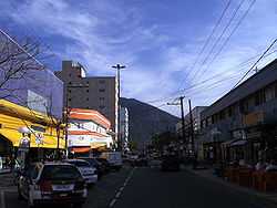
Nowadays Peruibe is a modern city presenting many luxury boroughs and restaurants. The public interest for the city is rising since there is a nature reserve named Parque da Juréia (Jureia Natural Park), featuring pristine beaches (Prainha, Guarau, Parnapoa or Parnapuã, Juquiazinho,Desertinha, Carambore and Barra do Una), which is also a "local caiçara" (native) community of fishermen, sheltering also an immense diversity of flora and fauna. The city is surrounded by the Sea Mountain Range (Serra do Mar) the south end of which, near Barra do Una, is called Jureia Mountain Range.
Tourism
Peruíbe attracts many tourists throughout the year. In Peruibe there are two areas of tourist interest: urban and ecological. The principal urban attractions are the Tower of TV and Mirante (Torre de TV e Mirante), Ruins of the Abarebebe (Ruínas do Abarebebê), Flórida square (Praça Florida), New Commercial Center-Padre Anchieta Avenue (Centro Comercial Novo-Avenida Padre Anchieta), Old Commercial Center-region of the Estação (Centro Comercial Velho-Região da Estação), Ambrósio Baldin Square (Praça Ambrósio Baldin) and Portinho.
Ecological tourist spots include the Rio Preto Bridge (Ponte do Rio Preto), Costão Beach (Praia do Costão), Mountain range of the Itatins (Serra do Itatins), Quarter of the Guaraú (Bairro do Guaraú), Guaraú River (Rio Guaraú), Guaraú Beach (Praia do Guaraú), Prainha, Bar of Una (Barra do Una), Una River (Rio Una) and Una Beach (Praia do Una).

Notable people
- Viviane Brunieri (1976), Pentecostal pastor, former model and porn star.
External links
- (Portuguese) http://www.peruibe.sp.gov.br
- (Portuguese) Juréia Itatins
- (Portuguese) citybrazil.com.br
| North: Itanhaém | ||
| West: Itariri and Pedro de Toledo | Peruíbe | East: Atlantic Ocean and Mongaguá |
| South: Iguape |
| ||||||