Perth East, Ontario
| Perth East | |
|---|---|
| Township (lower-tier) | |
| Township of Perth East | |
 | |
 Perth East | |
| Coordinates: 43°28′N 80°57′W / 43.467°N 80.950°WCoordinates: 43°28′N 80°57′W / 43.467°N 80.950°W | |
| Country |
|
| Province |
|
| County | Perth |
| Formed | January 1, 1998 |
| Government | |
| • Mayor | Bob McMillan |
| • Federal riding | Perth—Wellington |
| • Prov. riding | Perth—Wellington |
| Area[1] | |
| • Land | 713.39 km2 (275.44 sq mi) |
| Population (2011)[1] | |
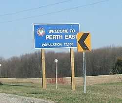
| • Total | 12,028 |
| • Density | 16.9/km2 (44/sq mi) |
| Time zone | EST (UTC-5) |
| • Summer (DST) | EDT (UTC-4) |
| Postal Code | N0K |
| Area code(s) | 519 and 226 |
| Website | www.pertheast.ca |
The Township of Perth East is a municipality located in Perth County, Ontario, Canada and situated north of Stratford. It was created in 1998 when the Ontario government amalgamated the village of Milverton with the surrounding former townships of Ellice, Mornington, North Easthope and South Easthope.
Milverton is the major community of the township, where the municipal administration is based. The mayor is Ian Forrest, who was elected in November, 2006. The population in 2011 was 12,028 in an area of 713.39 km².
Milverton was mentioned in the Season 4 episode Old King Clancy of How I Met Your Mother.[2]
Communities
The township comprises the communities of Amulree, Brocksden, Brunner, Burns, Carthage, Dorking, Fernbank, Gads Hill, Hesson, Kinkora, Kuhryville, Mennonite Corner, Millbank, Milverton, Moserville, Newton, Nithburg, Peffers, Poole, Ratzburg, Rostock, Sebastopol, Shakespeare, Topping, Tralee and Wartburg. It also includes a portion of the hamlet of Punkeydoodles Corners, which straddles the municipal boundaries of Perth East, East Zorra – Tavistock and Wilmot.
Demographics
Population trend:[3]
- Population in 2011: 12,028
- Population in 2006: 12,041 (or 11,986 when adjusted for 2011 boundaries)
- Population in 2001: 12,218 (or 12,119 when adjusted for 2006 boundaries)
- Population in 1996: 12,089
Private dwellings occupied by usual residents: 3897 (total dwellings: 4022)
See also
References
- ↑ 1.0 1.1 "Perth East, Ontario (Code 3531030) census profile". 2011 Census of Population. Statistics Canada. Retrieved 2012-08-10.
- ↑ http://how-i-met-your-mother.hypnoweb.net/episodes-/saison-4/resume-l-episode-418/script-vo-418.63.1027/
- ↑ Statistics Canada: 1996, 2001, 2006 census
- "Topographic Map sheets 40P6, 40P7, 40P10 & 40P11". Atlas of Canada. Natural Resources Canada. 2006-02-06. Retrieved 2008-12-21.
- "Map/Directions". Township of Perth East. Retrieved 2008-12-21.
External links
 |
North Perth | Mapleton | | |
| West Perth | |
Wellesley Wilmot | ||
| ||||
| | ||||
| Perth South, Stratford, Zorra | East Zorra-Tavistock |
| ||||||||||||||||||||||||||