Perry Township, Stark County, Ohio
| Perry Township, Stark County, Ohio | |
|---|---|
| Township | |
|
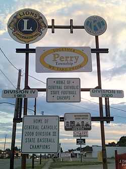
Welcome sign for Perry Township | |
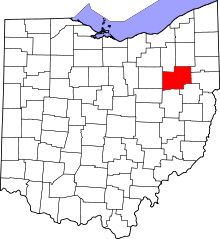
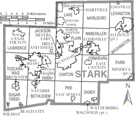 Municipalities and townships of Stark County | |
| Coordinates: 40°47′4″N 81°28′0″W / 40.78444°N 81.46667°WCoordinates: 40°47′4″N 81°28′0″W / 40.78444°N 81.46667°W | |
| Country | United States |
| State | Ohio |
| County | Stark |
| Area | |
| • Total | 24.3 sq mi (63.0 km2) |
| • Land | 24.1 sq mi (62.4 km2) |
| • Water | 0.2 sq mi (0.6 km2) |
| Elevation[1] | 1,079 ft (329 m) |
| Population (2000) | |
| • Total | 29,167 |
| • Density | 1,211.4/sq mi (467.7/km2) |
| Time zone | Eastern (EST) (UTC-5) |
| • Summer (DST) | EDT (UTC-4) |
| FIPS code | 39-62078[2] |
| GNIS feature ID | 1086986[1] |
Perry Township is one of the seventeen townships of Stark County, Ohio, United States. It is an urban township; the 2000 census found 29,167 people in the township.[3]
Geography
Located in the western part of the county, it borders the following townships:
- Jackson Township - north
- Plain Township - northeast corner
- Canton Township - east
- Pike Township - southeast corner
- Bethlehem Township - south
- Sugar Creek Township - southwest corner
- Tuscarawas Township - west
- Lawrence Township - northwest corner
Several populated places are located in Perry Township:
- Most of the city of Massillon is located in the western half of Perry Township
- A small part of the village of Navarre, in the southwest
- The census-designated place of Perry Heights, in the northeast
- A very small portion of the city of Canton, in the east. Furthermore, many eastern portions of the township have Canton mailing addresses.
- The unincorporated community of Reedurban, in the east
- The unincorporated community of Richville, in the south
Name and history
On December 7, 1813, Stark County Commissioners named Township 10, Range 9, Perry Township. It was named in honor of Oliver Hazard Perry, hero of the War of 1812. Commander Perry was the victor of a battle on Lake Erie on September 10, 1812.
The first formal settlement in the township was Kendal founded in 1812 by Thomas Rotch and his wife who were Quakers from Massachusetts. Other settlers arriving with the Rotch Family were Arvine Wales and Charles Skinner. They utilized Sippo Creek and operated a woolen factory and saw mill.
In 1826, James Duncan founded Massillon. The Ohio/Erie Canal was opened to Massillon in 1828 and the entire area and surrounding communities grew exponentially.
Johnny Appleseed (Jonathan Chapman) planted the first orchard in Perry Township on the south side of the Canton–Massillon Road on the Daum Farm. Dr. William Gardner was believed to have been the first physician to settle in Perry Township. He came from New York in 1814. The first religious society was the Religious Society of Friends in Kendal about 1813. Methodists soon populated the area.
In 1833, Perry Township contained three gristmills, seven saw mills, one fulling mill, two tanneries, and sixteen stores.[4]
The first school in the township was established in Kendal. Public schools or common schools came into existence in Perry Township in 1825. By 1875, Perry Township had seven one-room schools.
The construction of Reedurban, Genoa, and Richville Schools brought the one-room era to an end. In the 1950s, Whipple, Watson, Lohr, and Perry High were built. The 1956 opening of Perry High School signifies the first time Perry Local Schools offered secondary education. The growth of the school system continued with the construction of Edison Junior High in 1962 and a vocational wing on the High School in 1964.
Perry Township as a community experienced rapid growth. The agricultural farms from the early days have been reborn as housing developments, commercial and industrial sites, medical facilities, and municipal structures. In the 1970s, housing developments in the township were advertised as "the convenience of the city and the charm of the country".
Today, Perry Township is a stable, united community with a population of nearly 30,000 residents. Even though most of the land has been developed, there is still a hint of the agricultural history in some sections of the township.
It is one of twenty-six Perry Townships statewide.[5]
Government
The township is governed by a three-member board of trustees, who are elected in November of odd-numbered years to a four-year term beginning on the following January 1. Two are elected in the year after the presidential election and one is elected in the year before it. There is also an elected township fiscal officer,[6] who serves a four-year term beginning on April 1 of the year after the election, which is held in November of the year before the presidential election. Vacancies in the fiscal officership or on the board of trustees are filled by the remaining trustees.
References
- ↑ 1.0 1.1 "US Board on Geographic Names". United States Geological Survey. 2007-10-25. Retrieved 2008-01-31.
- ↑ "American FactFinder". United States Census Bureau. Retrieved 2008-01-31.
- ↑ Stark County, Ohio — Population by Places Estimates Ohio State University, 2007. Accessed 15 May 2007.
- ↑ Kilbourn, John (1833). "The Ohio Gazetteer, or, a Topographical Dictionary". Scott and Wright. p. 367. Retrieved 12 December 2013.
- ↑ "Detailed map of Ohio" (PDF). United States Census Bureau. 2000. Retrieved 2007-02-16.
- ↑ §503.24, §505.01, and §507.01 of the Ohio Revised Code. Accessed 4/30/2009.
External links
| |||||||||||||||||||||||||||||||||