Perama, Ioannina
| Perama Πέραμα | |
|---|---|
 Perama | |
|
Location within the regional unit 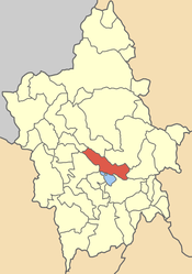 | |
| Coordinates: 39°42′N 20°51′E / 39.700°N 20.850°ECoordinates: 39°42′N 20°51′E / 39.700°N 20.850°E | |
| Country | Greece |
| Administrative region | Epirus |
| Regional unit | Ioannina |
| Municipality | Ioannina |
| Population (2001)[1] | |
| • Municipal unit | 5,743 |
| Time zone | EET (UTC+2) |
| • Summer (DST) | EEST (UTC+3) |
| Vehicle registration | ΙΝ |
Perama (Greek: Πέραμα) is a town and a former municipality in the Ioannina regional unit, Epirus, Greece. Since the 2011 local government reform it is part of the municipality Ioannina, of which it is a municipal unit.[2] It lies about 4 km north of central Ioannina. The town's name means "passage" and it lies on the northern edge of lake Pamvotis (Greek Παμβώτις). It is famous for its cave, known as the "Cave of Perama" (Greek Σπήλαιον Περάματος). The cave, extending five kilometres below the ground and having been explored fully only up to one kilometre, has a remarkable arrangement of stalagmites and stalactites. An 11th-century church in the town dedicated to Saint Haralambos and reputedly built by Byzantine Emperor Alexius Comnenus is in a bad state of repair and is rarely open to the general public. The town lies on GR-6 between Igoumenitsa and Metsovo.
The municipal unit has a land area of 105.725 km² and a population of 5,743 inhabitants. The municipality's largest settlements are Pérama (pop. 2,693 in 2001), Amfithéa (555), Perívleptos (509), Krýa (358), Agía Marína (331), and Kranoúla (301).
External links
- Official website (English) (Greek)
- Perama Cave website (English) (Greek)
References
- ↑ De Facto Population of Greece Population and Housing Census of March 18th, 2001 (PDF 39 MB). National Statistical Service of Greece. 2003.
- ↑ Kallikratis law Greece Ministry of Interior (Greek)
| ||||||||||||||||||||||||||