Pennsylvania Route 239
| |||||||
|---|---|---|---|---|---|---|---|
 | |||||||
| Route information | |||||||
| Maintained by PennDOT | |||||||
| Length: | 36.86 mi[1] (59.32 km) | ||||||
| Major junctions | |||||||
| South end: |
| ||||||
|
| |||||||
| North end: |
| ||||||
| Location | |||||||
| Counties: | Luzerne, Columbia, Lycoming | ||||||
| Highway system | |||||||
| |||||||

Pennsylvania Route 239 (designated by the Pennsylvania Department of Transportation as SR 239) is a 36.86-mile-long (59.32 km) state highway located in Luzerne, Columbia and Lycoming Counties in Pennsylvania. The southern terminus is at Route 93 in Nescopeck Township. The northern terminus is at Route 42 in North Mountain.
Route description
Luzerne County
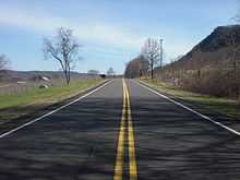
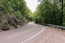
PA 239 begins at an intersection with PA 93 (Berwick Hazleton Highway) in Nescopeck Township. The route progresses eastward through the rural areas east of Nescopeck as Hobbie Road, entering the small community of Briggsville, made up mostly of farms. After leaving Briggsville, PA 239 intersects with Wapwallopen Road, where the designation turns off of Hobbie Road and onto Wapwallopen Road. Now heading northward, the highway goes through a stretch of residential homes and soon into a long stretch of farmlands until the intersection with East Cherry Road, where PA 239 makes a gradual curve into woodlands surrounding Wapwallopen Creek. Paralleling the creek, the highway crosses some power lines and heads westward through dense forests until reaching a switchback turn and enters Wapwallopen. At the intersection with River Road, PA 239 turns eastward and enters the short downtown of Wapwallopen. Through Wapwallopen, the highway turns northward, passing the rural community and paralleling the nearby Susquehanna River. PA 239 heads northward through a mix of woods and fields until following the riverbank of the Susquehanna directly. PA 239 soon gains the designation of Pond Hill Road and enters the community of Mocanaqua. The highway passes through mostly residences on the eastern side of the community before darting west on Main Street, which soon turns to the north again. PA 239 continues on Main Street until crossing the Susquehanna River into the community of Dogtown, where it intersects with U.S. Route 11 (US 11).[2]
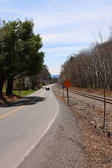
A short distance after Dogtown, US 11 and PA 239 head northward into Shickshinny. Entering downtown Shickshinny, the two highways become South Main Street and pass commercial businesses. At the intersection with Union Street, US 11 continues northward along North Main Street while PA 239 turns left onto West Union Street. As it leaves Shickshinny, the road passes more residences and commercial businesses before leaving civilization in favor of woodlands once again. The route crosses under power lines and enters the community of Koonsville, where the woodlands give way for a short time to residences. After the intersection with Sunshine Road, PA 239 turns northwestward and leaves Koonsville for Union Township. Progressing northwestward, the route passes Hillcrest Lake and turns westward through a stretch of sporadic residences. After the intersection with Thorne Hill Road, PA 239 turns to the southwest, and then northwest through a small stretch of homes. This changes to farmlands as the highway winds its way through Huntington Township. Residences return as PA 239 enters the hamlet of Huntington Mills, where the road crosses a creek and continues northwest through Huntington Township until Town Hill Road, where it heads southwestward into the community of Register. Register is a community of a few homes and after Valley View Road, PA 239 continues on. After Register, the highway continues northeast, crossing south of the community of Cambra. Just after the intersection with Bonnieville Road, PA 239 crosses into Columbia County.[2]
Columbia and Lycoming Counties

After PA 239 enters Columbia County, the highway gains the name of Shickshinny Road. The surroundings remain the same for a long distance between shifts between woodlands and fields in Benton Township. After passing the Hughes Mobile Home Park, PA 239 makes a long dive to the southwest through woodlands entering downtown Benton. The highway gains the moniker of Benton-Shickshinny Road. Just south of downtown Benton, PA 239 intersects with PA 487 (Mill Street). The two designations become concurrent and head northward into Benton, changing monikers from Mill Street to Main Street. The commercial businesses surround PA 239 and PA 487 the entire time northward, leaving Benton for a more rural segment after North Street. The name soon changes to Red Rock Road, passing through farmlands before the two routes split. PA 487 continues north along Red Rock Road, while PA 239 turns to the northwest along Beach Glen Road.[2]
PA 239 continues northward, winding its way to the north through the hillsides. The surroundings are rural, with a mix of fields and woods into Jackson Township. The northward progression continues as it approaches the community of Divide. PA 239 makes a short stint to the north, turning west and crossing into Lycoming County. Entering Lycoming County, PA 239 enters the community of Divide, and intersects with PA 118 just south of the Sullivan County line. PA 239 heads westward through Lycoming County, paralleling PA 118 for a distance. The dense forestry around Divide gives way back to fields and soon the reverse as the highway enters the hamlet of Lungerville. After passing the few residences that make up Lungerville, PA 239 turns to the northwest and enters North Mountain. In North Mountain, PA 239 enters a clearing and terminates at an intersection with PA 42.[2]
Major intersections
| County | Location | mi[1] | km | Destinations | Notes |
|---|---|---|---|---|---|
| Luzerne | Nescopeck Township | 0.00 | 0.00 | ||
| Shickshinny | 9.31 | 14.98 | South end of US 11 concurrency | ||
| 9.85 | 15.85 | North end of US 11 concurrency | |||
| Columbia | Benton | 24.18 | 38.91 | South end of PA 487 concurrency | |
| Benton Township | 25.30 | 40.72 | North end of PA 487 concurrency | ||
| Columbia–Lycoming county line | Jackson Township– Jordan Township | 31.96 | 51.43 | ||
| Lycoming | Franklin Township | 36.86 | 59.32 | ||
1.000 mi = 1.609 km; 1.000 km = 0.621 mi
| |||||
See also
- U.S. Roads portal
- Pennsylvania portal
References
External links
| Wikimedia Commons has media related to Pennsylvania Route 239. |
- Kitsko, Jeffrey J. (2015). "PA 239". Pennsylvania Highways.