Penn Township, St. Joseph County, Indiana
| Penn Township | |
|---|---|
| Township | |
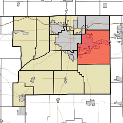 Location in St. Joseph County | |
| Coordinates: 41°38′45″N 86°08′04″W / 41.64583°N 86.13444°WCoordinates: 41°38′45″N 86°08′04″W / 41.64583°N 86.13444°W | |
| Country |
|
| State |
|
| County | St. Joseph |
| Government | |
| • Type | Indiana township |
| Area | |
| • Total | 63.58 sq mi (164.67 km2) |
| • Land | 62.5 sq mi (161.86 km2) |
| • Water | 1.08 sq mi (2.81 km2) 1.71% |
| Elevation | 738 ft (225 m) |
| Population (2000) | |
| • Total | 64,322 |
| • Density | 1,029.2/sq mi (397.4/km2) |
| ZIP codes | 46544, 46545, 46561, 46613, 46614 |
| GNIS feature ID | 0453714[1] |
Penn Township is one of thirteen townships in St. Joseph County, Indiana, United States. As of the 2000 census, its population was 64,322.[2]
History
Penn Township was formed in 1832.[3]
Geography
According to the United States Census Bureau, Penn Township covers an area of 63.58 square miles (164.7 km2); of this, 62.5 square miles (162 km2) (98.29 percent) is land and 1.08 square miles (2.8 km2) (1.71 percent) is water.
Cities, towns, villages
- Mishawaka (partial)
- Osceola
- South Bend (partial)
Unincorporated towns
- Hi-View Addition at 41°36′30″N 86°10′42″W / 41.608381°N 86.178338°W
- Pleasant Valley at 41°41′39″N 86°04′28″W / 41.694215°N 86.074447°W
- Tamarack Grange at 41°35′46″N 86°08′16″W / 41.596159°N 86.137781°W
(This list is based on USGS data and may include former settlements.)
Adjacent townships
- Harris Township (north)
- Cleveland Township, Elkhart County (northeast)
- Baugo Township, Elkhart County (east)
- Olive Township, Elkhart County (southeast)
- Madison Township (south)
- Centre Township (west)
- Portage Township (west)
- Clay Township (northwest)
Cemeteries
The township contains these seven cemeteries: Chapel Hill Memorial Gardens, Eutzler, Fairview, Ferrisville, Pleasant Valley, Saint Josephs and Saint Josephs.
Major highways
Lakes
- Willow Lake
School districts
- Penn-Harris-Madison School Corporation
- School City Of Mishawaka
Political districts
- Indiana's 2nd congressional district
- State House District 21
- State House District 5
- State House District 6
- State Senate District 10
- State Senate District 11
- State Senate District 9
References
- United States Census Bureau 2008 TIGER/Line Shapefiles
- United States Board on Geographic Names (GNIS)
- IndianaMap
- ↑ "Penn Township". Geographic Names Information System. United States Geological Survey. Retrieved 2009-07-07.
- ↑ United States Census Bureau American FactFinder
- ↑ History of Osceola and Eastern Penn Township
External links
 |
Clay Township | Harris Township | Cleveland Township, Elkhart County | |
| Centre Township Portage Township |
|
Baugo Township, Elkhart County | ||
| ||||
| | ||||
| Madison Township | Olive Township, Elkhart County |
| |||||||||||||||||||||||||||||||||