Pelland, Minnesota
| Pelland, Minnesota | |
|---|---|
| Unincorporated community | |
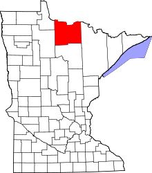
 Pelland, Minnesota Location of the community of Pelland | |
| Coordinates: 48°31′22″N 93°34′31″W / 48.52278°N 93.57528°WCoordinates: 48°31′22″N 93°34′31″W / 48.52278°N 93.57528°W | |
| Country | United States |
| State | Minnesota |
| County | Koochiching |
| Elevation | 1,115 ft (340 m) |
| Time zone | Central (CST) (UTC-6) |
| • Summer (DST) | CDT (UTC-5) |
| ZIP code | 56649 |
| Area code(s) | 218 |
| GNIS feature ID | 649252[1] |
Pelland is an unincorporated community in Koochiching County, Minnesota, United States; located along the Rainy River.
The community is located southwest of International Falls at the junction of U.S. Highway 71 (U.S. 71) and State Highway 11 (MN 11).
Pelland is located within Rainy Lake Unorganized Territory.
Nearby places include International Falls, Littlefork, and Loman. Pelland is located 11 miles southwest of International Falls; and 8 miles north of Littlefork. ZIP codes 56649 (International Falls), 56653 (Littlefork), and 56654 (Loman) all meet near Pelland.
Pelland is also known locally as Pelland Junction or the "Y". The Rainy River, the Big Fork River, and the Little Fork River are all in the vicinity.
Community
Pelland is home to a public water access area for fishing. Local businesses include a convenience store, greenhouse, and a bar.
History
Pelland was named after two brothers, Joseph (Joe) and François (Frank) Pelland, who were loggers. Both were natives of Joliette, Quebec, Canada. The brothers had lived in Spalding, Michigan before settling in Minnesota in the mid-1800s. The Rainy River at Pelland was used to transport wood products.
References
- Rand McNally Road Atlas – 2007 edition – Minnesota entry
- Official State of Minnesota Highway Map – 2011/2012 edition
- Mn/DOT map of Koochiching County – Sheet 4 – 2011 edition
| |||||||||||||||||||||||||||||