Pelagie Islands
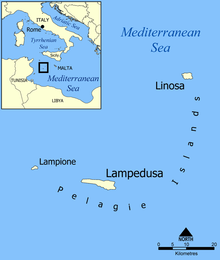
The Pelagie Islands (Italian: Isole Pelagie, Sicilian: Ìsuli Pilaggî), from the Greek πέλαγος, pélagos meaning "open sea", are the three small islands of Lampedusa, Linosa, and Lampione, located in the Mediterranean Sea between Malta and Tunisia, south of Sicily. To the northwest lie the island of Pantelleria and the Strait of Sicily. Geographically part of the archipelago (Lampedusa and Lampione) belongs to the African continent;[1] politically and administratively the islands fall within the Sicilian province of Agrigento and represent the southernmost part of Italy.
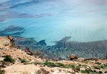
Despite pockets of agriculture, the islands are unnaturally barren due to wanton deforestation and the disappearance of the native olive groves, juniper and carob plantations. Fifty years ago much of the landscape was farmland bounded by dry stone walls but today, the local economy is based on fishing – sponge fishing and canning – supplemented by tourism in Lampedusa.
Marine protected area

The Loggerhead Turtle
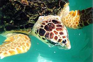
Of particular ecological concern in the islands is the protection of the Loggerhead sea turtle (Caretta caretta) which is endangered throughout the Mediterranean as a result of its nesting sites being taken over by tourism. In Italy the beaches of Pozzolana di Ponente on Linosa and Isola dei conigli on Lampedusa are two of the last remaining sites where the turtle regularly lays its eggs, the others (larger) being in southern Calabria (close to Reggio Calabria). The Area Marina Protetta Isole Pelagie nature reserve, covering all three islands, was instituted in 2002.
References
- ↑ "Pelagie". Treccani.it. 2010. Retrieved 22 December 2011.
Outlying territories of European countries |
|---|
| Territories under European sovereignty but closer to or on continents other than Europe (see inclusion criteria for further information). | | | Denmark | |
|---|
| | France | |
|---|
| | Italy | |
|---|
| | Netherlands | |
|---|
| | Norway | |
|---|
| | Portugal | |
|---|
| | Spain | |
|---|
| | United Kingdom | |
|---|
|
|
|---|
| | Sovereign states | |
|---|
| | Partially recognized state | |
|---|
| | Territories | |
|---|
| 1Entirely claimed by both Morocco and the SADR. 2Spanish exclaves claimed by Morocco. 3Disputed between Sudan and Egypt. 4Terra nullius located between Egypt and Sudan. 5Disputed between Sudan and South Sudan. 6Part of Chad, formerly claimed and occupied by Libya. 7Disputed between Morocco and Spain |
|


