Pekela
| Pekela | |||
|---|---|---|---|
| Municipality | |||
|
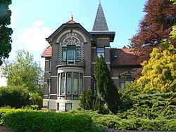
Historic villa in Oude Pekela | |||
| |||
.svg.png) Location in Groningen | |||
| Coordinates: 53°6′N 7°0′E / 53.100°N 7.000°ECoordinates: 53°6′N 7°0′E / 53.100°N 7.000°E | |||
| Country | Netherlands | ||
| Province | Groningen | ||
| Government[1] | |||
| • Body | Municipal council | ||
| • Mayor | Meindert Schollema (PvdA) | ||
| Area[2] | |||
| • Total | 50.20 km2 (19.38 sq mi) | ||
| • Land | 49.10 km2 (18.96 sq mi) | ||
| • Water | 1.10 km2 (0.42 sq mi) | ||
| Elevation[3] | 1 m (3 ft) | ||
| Population (May 2014)[4] | |||
| • Total | 12,709 | ||
| • Density | 259/km2 (670/sq mi) | ||
| Time zone | CET (UTC+1) | ||
| • Summer (DST) | CEST (UTC+2) | ||
| Postcode | 9662–9669 | ||
| Area code | 0597 | ||
| Website |
www | ||

Pekela (Dutch pronunciation: [ˈpeːkəlaː]) is a municipality in the northeastern Netherlands created in 1990 as a merger between Oude Pekela and Nieuwe Pekela.
Population centres
- Boven Pekela
- Nieuwe Pekela
- Oude Pekela
Local government
The municipal government of Pekela consists of 15 seats, which are divided as follows:
| Municipality seats | |||||||||||||||
|---|---|---|---|---|---|---|---|---|---|---|---|---|---|---|---|
| Party | 1998 | 2002 | 2006 | 2010 | 2014 | ||||||||||
| PvdA | 6 | 6 | 7 | 3 | 2 | ||||||||||
| GroenLinks | 4 | 3 | 1 | 2 | 1 | ||||||||||
| CDA | 2 | 3 | 2 | 1 | 2 | ||||||||||
| VVD | 2 | 2 | 1 | 2 | 1 | ||||||||||
| SP | - | - | 3 | 3 | 4 | ||||||||||
| ChristenUnie | 1 | 1 | 1 | - | 1 | ||||||||||
| Samen Voor Pekela | - | - | - | 4 | 3 | ||||||||||
| VCP | - | - | - | - | 1 | ||||||||||
| Total | 15 | 15 | 15 | 15 | 15 | ||||||||||
References
- ↑ "Burgemeester" [Mayor] (in Dutch). Gemeente Pekela. Retrieved 3 February 2014.
- ↑ "Kerncijfers wijken en buurten" [Key figures for neighbourhoods]. CBS Statline (in Dutch). CBS. 2 July 2013. Retrieved 12 March 2014.
- ↑ "Postcodetool for 9665JD". Actueel Hoogtebestand Nederland (in Dutch). Het Waterschapshuis. Retrieved 3 February 2014.
- ↑ "Bevolkingsontwikkeling; regio per maand" [Population growth; regions per month]. CBS Statline (in Dutch). CBS. 26 June 2014. Retrieved 24 July 2014.
External links
| Wikimedia Commons has media related to Pekela. |
 |
Menterwolde | Oldambt | | |
| Veendam | |
Bellingwedde | ||
| ||||
| | ||||
| Stadskanaal |
| |||||||||||||
