Pavlohrad Raion
| Pavlohrad Raion Павлоградський район | |||
|---|---|---|---|
| Raion | |||
| |||
 | |||
| Coordinates: 48°38′33″N 35°59′43.1″E / 48.64250°N 35.995306°ECoordinates: 48°38′33″N 35°59′43.1″E / 48.64250°N 35.995306°E | |||
| Country |
| ||
| Region | Dnipropetrovsk Oblast | ||
| Admin. center | Pavlohrad | ||
| Subdivisions |
List
| ||
| Area | |||
| • Total | 1,450 km2 (560 sq mi) | ||
| Population | |||
| • Total | 28 459 | ||
| Time zone | EET (UTC+2) | ||
| • Summer (DST) | EEST (UTC+3) | ||
| Area code | +380 | ||


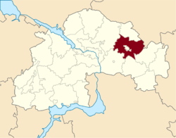
Pavlohrad Raion (Ukrainian: Павлоградський район) is a raion (district) of Dnipropetrovsk Oblast, southeastern-central Ukraine. Its administrative centre is located at Pavlohrad, which is separately incorporated as a town of oblast significance and does not belong to the district. Population: 28,459 (2013 est.)[1].
References
- ↑ "Чисельність наявного населення України (Actual population of Ukraine)" (in Ukrainian). State Statistics Service of Ukraine. Retrieved 21 January 2015.
| ||||||||||||||||||||||||||||