Pau dos Ferros
| Pau dos Ferros | |||
|---|---|---|---|
| The Municipality of Pau dos Ferros | |||
|
Clockwise: Independence Avenue; Church of Nossa Senhora da Conceição; Tourist Terminal Lindalva Torquato; Aerial view of the Pau dos Ferros; Pau dos Ferros Dam and Monsignor Caminha Square, with the Obelisk at found. | |||
| |||
| Nickname(s): Princesinha do Oeste (Princess of the West) and PDF | |||
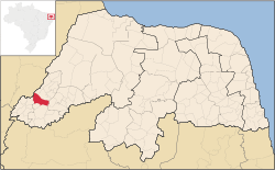 Location in the state of Rio Grande do Norte. | |||
 Pau dos Ferros Location in Brazil | |||
| Coordinates: 06°06′39″S 38°12′32″W / 6.11083°S 38.20889°W | |||
| Country |
| ||
| Region | Nordeste | ||
| State | Rio Grande do Norte | ||
| Mesoregion | Oeste Potiguar | ||
| Microregion | Pau dos Ferros | ||
| Elevation | 633 ft (193 m) | ||
| Population (2009) | |||
| • Total | 27 809 | ||
| • Density | 270/sq mi (106/km2) | ||
| est. IBGE/2009 [1] | |||
| Demonym | Pauferrense | ||
| Time zone | UTC -3 | ||
| Postal Code | 59900-000 | ||
| Website | http://paudosferros.com | ||
.jpg)
.png)
.png)
Pau dos Ferros is a municipality in the homonymous microregion, in Rio Grande do Norte state, Northeast Brazil.[1][2][3][4]
History
The city was founded on September 4, 1856, initially as a village and then the town today is a city that has as its main form of economy the industrial sector and to a lesser extent agriculture.[5]
See also
References
- ↑ 1.0 1.1 "Estimativas da população para 1º de julho de 2009" (PDF). Estimativas de População. Instituto Brasileiro de Geografia e Estatística (IBGE). 14 August 2009. Retrieved 16 August 2009.
- ↑ "Divisão Territorial do Brasil" (in Portuguese). Divisão Territorial do Brasil e Limites Territoriais, Instituto Brasileiro de Geografia e Estatística (IBGE). July 1, 2008. Retrieved December 17, 2009.
- ↑ "Ranking decrescente do IDH-M dos municípios do Brasil" (in Portuguese). Atlas do Desenvolvimento Humano, Programa das Nações Unidas para o Desenvolvimento (PNUD). 2000. Retrieved December 17, 2009.
- ↑ "Produto Interno Bruto dos Municípios 2002-2005" (in Portuguese). Instituto Brasileiro de Geografia e Estatística (IBGE). December 19, 2007. Retrieved December 17, 2009.
- ↑ Pau dos Ferros History in Portuguese