Pau Pyrénées Airport
| Pau Pyrénées Airport Aéroport Pau Pyrénées | |||||||||||
|---|---|---|---|---|---|---|---|---|---|---|---|
|
Control tower of Pau Pyrénées Airport | |||||||||||
| IATA: PUF – ICAO: LFBP | |||||||||||
| Summary | |||||||||||
| Airport type | Public | ||||||||||
| Operator | Pau Chamber of Commerce | ||||||||||
| Location | Pau, Pyrénées-Atlantiques | ||||||||||
| Elevation AMSL | 616 ft / 188 m | ||||||||||
| Coordinates | 43°22′48″N 000°25′07″W / 43.38000°N 0.41861°WCoordinates: 43°22′48″N 000°25′07″W / 43.38000°N 0.41861°W | ||||||||||
| Maps | |||||||||||
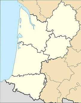
 Location of Aquitaine region in France | |||||||||||
 LFBP Location of airport in Aquitaine region | |||||||||||
| Runways | |||||||||||
| |||||||||||
Pau Pyrénées Airport (French: Aéroport Pau Pyrénées) (IATA: PUF, ICAO: LFBP) is an airport serving Pau, France. It is located 10 km (6.2 mi) northwest of Pau in Uzein, a commune of the département of Pyrénées-Atlantiques (named for the Pyrénées mountains and the Atlantic Ocean).
Airlines and destinations
| Airlines | Destinations |
|---|---|
| Air France | Paris-Orly |
| Air France operated by HOP! | Paris-Charles de Gaulle, Paris-Orly Seasonal: Bastia |
| HOP! | Lyon |
| Twin Jet | Marseille |
Military usage
Apart from the civilian terminal, there are military installations on the south side of the airfield. These host the 4th Special Forces Helicopter Regiment, the 5th Combat Helicopter Regiment and the French Army's paratrooper's training.
Accidents and incidents
- On 25 January 2007, Air France Flight 7775 from Pau to Paris crashed shortly after take-off. All 54 passengers and crew escaped from the Fokker 100 although one person was killed on the ground.[1] An investigation by the BEA revealed that the cause of the accident was ice on the wings of the aircraft involved.[2]
References
- ↑ "Picture: Truck driver killed as Air France Régional Fokker 100 hits vehicle during overrun in Pau". Flight Global. Retrieved 2 January 2009.
- ↑ "Icing led to Air France Fokker take-off crash: investigators". Flight Global. Retrieved 2 January 2009.
- French Aeronautical Information Publication for LFBP (PDF) – PAU PYRÉNÉES
External links
- Pau Pyrénées Airport (English)
- Aéroport Pau Pyrénées (French)
- Aéroport de Pau – Pyrénées (Union des Aéroports Français) (French)
- Airport information for LFBP at World Aero Data. Data current as of October 2006.
| ||||||||||||||||||
