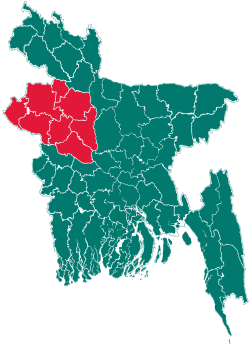
Patnitala Upazila
| Patnitala পত্নীতলা | |
|---|---|
| Upazila | |
 Patnitala Location in Bangladesh | |
| Coordinates: 25°3′N 88°44′E / 25.050°N 88.733°ECoordinates: 25°3′N 88°44′E / 25.050°N 88.733°E | |
| Country | Bangladesh |
| Division | Rajshahi Division |
| District | Naogaon District |
| Area | |
| • Total | 382.39 km2 (147.64 sq mi) |
| Population (1991) | |
| • Total | 198,164 |
| • Density | 518/km2 (1,340/sq mi) |
| Time zone | BST (UTC+6) |
| Website | Official Map of Patnitala |
Patnitala (Bengali: পত্নীতলা, means Wife's Place) is an Upazila of Naogaon District in the Division of Rajshahi, Bangladesh.
Administrative
Patnitala has 11 Unions/Wards, 297 Mauzas/Mahallas, and 292 villages.[1]
M P :Adv. Alhajj Shahidujjaman Sharker Bablu. Chairman of Patnitala Upozila: Abdul Hamid. Mayor of Nagipur Municipality: Nazmul Haque SonyAnowar Hossain.
Patnitala Press Club
Shovapoti: Alhajj Bulbul Chowdhury (01721033664). Secretary: Alhajj Monibur Rahman Golden.
Educational institutes
- Najipur High school
- Chalkmuli High School
- Kharamzai Fazil Madrasha
- Nakhucha High School
- Takipur high school & takipur primary school.
- Kundon High School
- Bankroil High School
- Dibor High School
- Shimuliya High School
- Gaganpur High School
- Gaganpur Wazedia Fazil Madrasha
- Amair high school
- Mallickpur High School
- Patnitala High School
Geography
Potnitala is located at 25°03′00″N 88°44′00″E / 25.0500°N 88.7333°E. It has 35570 units of households and total area 382.39 km². The major rivers are the Atrai and the Shiba.[1]
Demographics
As of the 1991 Bangladesh census, Potnitala has a population of 1 98 164. Males constitutes 51.26% of the population and females 48.74%. This upazila's eighteen up population was 98279. Potnitala has an average literacy rate of 32.9% (7+ years), and the national average of 32.4% literate.[2]
Famous places of Naogaon
- Dibor Dighi, Patnitola
- Gahon pirbabar Mazar, Patnitola
- Kancon, Hazarat Zahor Uddin Cistia Babar Mazar, Patnitola
- Katabari Mazar, Patnitola
See also
References
- ↑ 1.0 1.1 Shamsul Arefin Tuhin (2012). "Patnitala Upazila". In Sirajul Islam and Ahmed A. Jamal. Banglapedia: National Encyclopedia of Bangladesh (Second ed.). Asiatic Society of Bangladesh.
- ↑ "Population Census Wing, BBS.". Archived from the original on 2005-03-27. Retrieved November 10, 2006.
| |||||||||||||||||||||||||||||||||||||||||
