Pata Anqasi
| Pata Anqasi | |
|---|---|
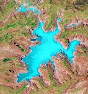 The glaciated Rit'ipampa area with Pata Anqasi shown in the lower right part of this satellite image (NASA, 2010) | |
| Elevation | 5,000 m (16,000 ft)[1] |
| Location | |
 Pata Anqasi Peru | |
| Location | Peru, Puno Region |
| Range | Andes, Willkanuta |
| Coordinates | 13°56′55″S 70°45′46″W / 13.94861°S 70.76278°WCoordinates: 13°56′55″S 70°45′46″W / 13.94861°S 70.76278°W |
Pata Anqasi (Quechua pata elevated place; above, at the top; edge; bank (of a river), shore, anqasi cobalt salt used for dyeing,[2][3] also spelled Pata Anjasi) is a mountain in the Willkanuta mountain range in the Andes of Peru, about 5,000 metres (16,404 ft) high. It is located in the Puno Region, Carabaya Province, Corani District. Pata Anqasi is situated east of the large glaciated area of Rit'ipampa (Quechua for "snow plain") and the peaks of Hatun Qinamari, and southeast of Kunkunani. Anqasi lies to the east. It is slightly lower.[1]
References
- ↑ 1.0 1.1 escale.minedu.gob.pe - UGEL map of the Carabaya Province (Puno Region)
- ↑ Teofilo Laime Ajacopa, Diccionario Bilingüe Iskay simipi yuyayk'ancha, La Paz, 2007 (Quechua-Spanish dictionary)
- ↑ Diccionario Quechua - Español - Quechua, Academía Mayor de la Lengua Quechua, Gobierno Regional Cusco, Cusco 2005 (Quechua-Spanish dictionary)