Paspébiac
| Paspébiac | |
|---|---|
| City | |
 | |
 Location within Bonaventure RCM. | |
 Paspébiac Location in eastern Quebec. | |
| Coordinates: 48°02′N 65°15′W / 48.033°N 65.250°WCoordinates: 48°02′N 65°15′W / 48.033°N 65.250°W[1] | |
| Country |
|
| Province |
|
| Region |
Gaspésie– Îles-de-la-Madeleine |
| RCM | Bonaventure |
| Settled | 1755 |
| Constituted | August 20, 1997 |
| Government[2] | |
| • Mayor | Paul-Arthur Blais |
| • Federal riding |
Gaspésie— Îles-de-la-Madeleine |
| • Prov. riding | Bonaventure |
| Area[2][3] | |
| • Total | 95.20 km2 (36.76 sq mi) |
| • Land | 94.54 km2 (36.50 sq mi) |
| Population (2011)[3] | |
| • Total | 3,198 |
| • Density | 33.8/km2 (88/sq mi) |
| • Pop 2006-2011 |
|
| • Dwellings | 1,470 |
| Time zone | EST (UTC−5) |
| • Summer (DST) | EDT (UTC−4) |
| Postal code(s) | G0C 2K0 |
| Area code(s) | 418 and 581 |
| Highways |
|
| Website |
www |
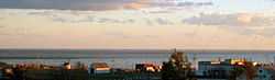
Paspébiac is a city on Baie des Chaleurs in the Gaspésie region of eastern Quebec, Canada. The population was 3,198 as of the Canada 2011 Census. The town is noted for the Banc de Pêche de Paspébiac, a large sandbar jutting out into the bay which has been designated a National Historic Site of Canada.[4]
Paspébiac was Quebec's first cod fishing port. The town also has Portuguese roots and an accent which is different from the rest of the region. Its name comes from the Mi'kmaq espression papgeg ipsigiag, meaning "split flats" or "lagoon".[1]
In addition to Paspébiac itself, the town's territory also includes the communities of Duret, Paspébiac-Ouest, and Rivière-Paspébiac.
History

In 1707, the area was granted as a seignory to Pierre Haimard (1674–1724) and this marked the beginning of the colonization of Gaspésie's southern shores. But it only saw periodic visits during the fishing season until 1755 when settlers from Acadia, Normandy, Basque, and Jersey arrived. In 1767, the Charles Robin Company established there a permanent fishing operation. This, together with its natural harbour, made Paspébiac the region's main commercial centre.[1]
In 1796, the local parish was founded, and in 1832, its post office opened. In 1855, the place was incorporated as the Township Municipality of Cox, named after the geographic township that in turn was named in honour of Nicholas Cox (ca. 1724-1794), Lieutenant Governor of the Gaspé District. In 1877, this township municipality ceased to exist when it was divided into the Municipalities of Paspébiac and New Carlisle.[1]
In 1922, the western part of the municipality split off to form the Municipality of Paspébiac-Ouest. But on August 6, 1997, Paspébiac-Ouest was merged back into Paspébiac. In 1999, it changed its status to ville (town).[1]
Demographics
Population
| |||||||||||||||||||
| Historical Census Data - Paspébiac, Quebec[7] | ||||||||||||||||||||||||||
|---|---|---|---|---|---|---|---|---|---|---|---|---|---|---|---|---|---|---|---|---|---|---|---|---|---|---|
|
|
| ||||||||||||||||||||||||
(P) pre-merger combined totals for the municipalities of Paspébiac and Paspébiac-Ouest. | ||||||||||||||||||||||||||
Language
Mother tongue (2011):[8]
- French only: 95.2%
- English only: 3.9%
- English and French: 0.6%
- Other language: 0.1%
See also
- List of cities in Quebec
References
- ↑ 1.0 1.1 1.2 1.3 1.4 "Paspébiac (Ville)" (in French). Commission de toponymie du Québec. Retrieved 2011-12-29.
- ↑ 2.0 2.1 "Paspébiac". Répertoire des municipalités (in French). Ministère des Affaires municipales, des Régions et de l'Occupation du territoire. Retrieved 2011-12-29.
- ↑ 3.0 3.1 3.2 "Paspébiac census profile". 2011 Census data. Statistics Canada. Retrieved 2011-12-29.
- ↑ Banc de Pêche de Paspébiac. Canadian Register of Historic Places. Retrieved 4 March 2012.
- ↑ "2006 Community Profiles". Canada 2006 Census. Statistics Canada. March 30, 2011. Retrieved 2011-12-29.
- ↑ "2001 Community Profiles". Canada 2001 Census. Statistics Canada. February 17, 2012. Retrieved 2011-12-29.
- ↑ Statistics Canada: 1996, 2001, 2006, 2011 census
- ↑ "Paspébiac community profile". 2011 Census data. Statistics Canada. Retrieved 2015-01-11.
External links
| Wikimedia Commons has media related to Paspébiac. |
 |
Saint-Elzéar | | ||
| Saint-Elzéar New Carlisle |
|
Hope Twp. | ||
| ||||
| | ||||
| Chaleur Bay |
| ||||||||||||||||||||||||||