Paropamisadae
 | ||||||||||||||||||||||||||||||||||||||||||
| History of Afghanistan | ||||||||||||||||||||||||||||||||||||||||||
|---|---|---|---|---|---|---|---|---|---|---|---|---|---|---|---|---|---|---|---|---|---|---|---|---|---|---|---|---|---|---|---|---|---|---|---|---|---|---|---|---|---|---|
| Timeline | ||||||||||||||||||||||||||||||||||||||||||
|
Ancient
|
||||||||||||||||||||||||||||||||||||||||||
|
Medieval
|
||||||||||||||||||||||||||||||||||||||||||
|
Modern
|
||||||||||||||||||||||||||||||||||||||||||
| ||||||||||||||||||||||||||||||||||||||||||
Paropamisadae (/ˌpærɵˌpæmɨˈseɪdiː/; Greek: Παροπαμισάδαι) or Paropamisus (/ˌpærɵˈpæmɨsəs/; Greek: Παροπαμισσός) was the ancient Greek name for a region of the Hindu-Kush (Caucasus Indicus) in eastern Afghanistan, centered on the cities of Kabul and Kapisa (modern Bagram).
History
In the ancient Buddhist texts, the Mahajanapada kingdom of Kamboja compassed the territories of Paropamisus and extended to the southwest of Kashmir as far as Rajauri. The region came under Achaemenid Persian control in the late 6th century BC, either during the reign of Cyrus the Great or Darius I.
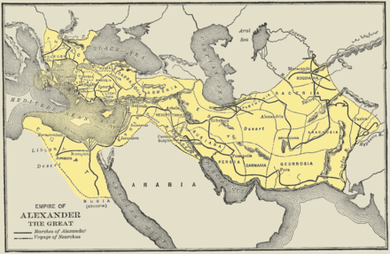
In the 320s BC, Alexander the Great conquered the entire Persian Empire, beginning the Hellenistic period. The Greek name Παροπαμισάδαι or Παροπαμισσός was used extensively in Greek literature to describe the conquests of Alexander and those of the Greco-Bactrian and Indo-Greek kings, from the 3rd to the 1st centuries BCE. (The name possibly comes from an Avestan expression for "higher than an eagle can fly").
After Alexander's death in 323 BC, the area came under control of the Seleucid Empire, which gave the region to the Mauryan Dynasty of India in 305 BC. After the fall of the Mauryans in 185 BC, the Greco-Bactrians under King Demetrius I annexed the northwestern regions of the former Mauryan Empire, including Paropamisadae, and it became part of his Euthydemid Indo-Greek Kingdom. The Eucratidians seized the area soon after the death of Menander I, but lost it to the Yuezhi or Tocharians around 125 BC.
Geography and peoples
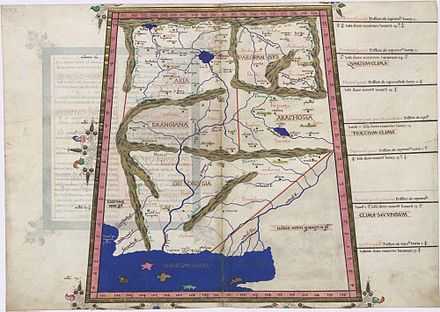
The Paropamisadae was located north of Arachosia and Drangiana, east of Aria, south of Bactria, and west of Kashmir. There were two main rivers flowing through the land, the Coas or Cophen (Κωφήν) and the Dorgamanes (Δοργαμάνης) or Orgomanes (Ὀργομάνης) farther north.
The name Paropamisadae was originally used to refer to the collection of peoples inhabiting the region, and was later used as a toponym for the area itself. These nations were: the Cabolitae (Καβολῖται) in the north near modern Kabul; the Parsii (Πάρσιοι) in the northwest, the Ambautae (Ἀμβαῦται) in the east and the Par(g)yetae (Παρ(γ)υῆται) in the south, who were also found in Arachosia. The major cities of the land were the city of Ortospana (Ὀρτοσπάνα) or Carura (Κάρουρα), probably identifiable with Kabul, Gauzaca (Γαύζακα), probably modern Ghazni, Capissa (Καπίσσα) in the northeast, and Parsia (Παρσία), the capital of the Parsii.
Paropamisus Mountains
The name Paropamisus Mountains was formerly used by Western geographers and geologists during the 19th and 20th centuries (and perhaps earlier) to describe the Siah Koh, Safed Koh, Chalap Dalan, and Malmand Mountain Ranges of western Afghanistan.
See also
- Indo-Greek kingdom
- Greco-Bactrian kingdom
References
- "The Greeks in Bactria and India" by W.W. Tarn, Cambridge University Press