Parbatipur Upazila
| Parbatipur পার্বতীপুর | |
|---|---|
| Upazila | |
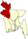
 Parbatipur Location in Bangladesh | |
| Coordinates: 25°39′12″N 88°54′56″E / 25.6533°N 88.9155°ECoordinates: 25°39′12″N 88°54′56″E / 25.6533°N 88.9155°E | |
| Country |
|
| Division | Rangpur Division |
| District | Dinajpur District |
| Area | |
| • Total | 395.1 km2 (152.5 sq mi) |
| Population (1991) | |
| • Total | 270,904 |
| • Density | 686/km2 (1,780/sq mi) |
| Time zone | BST (UTC+6) |
| Website | Official Map of Parbatipur |
Parbatipur (Bengali: পার্বতীপুর ) is an upazila (subdistrict) of Dinajpur District in the Rangpur Division, Bangladesh.
Geography
Parbatipur is located at 25°39′12″N 88°54′56″E / 25.6533°N 88.9155°E . It has 53,146 households and a total area 395.1 km².
Historical and Popular places
Parbatipur Junctino Central Locomative Workshop Natun Bazar Puratun Bazar
Demographics
As of the 1991 Bangladesh census, Parbatipur has a population of 270,904. Males constitute 51.46% of the population, and females 48.54%. Upazila's population of people eighteen years old or older is 139,294. Parbatipur has an average literacy rate of 29.7% (7+ years), compared to the national average of 32.4%.[1]
Administrative
Parbatipur has 10 unions, 1 paurasava, 194 mauzas/mahallas, 230 villages and 1 cantonment situated in it.
See also
- Parbatipur Junction
- Upazilas of Bangladesh
- Districts of Bangladesh
- Divisions of Bangladesh
- LAMB Hospital, Bangladesh
References
- ↑ "Population Census Wing, BBS.". Archived from the original on 2005-03-27. Retrieved November 10, 2006.
| |||||||||||||||||||||||||||||||||||||||||