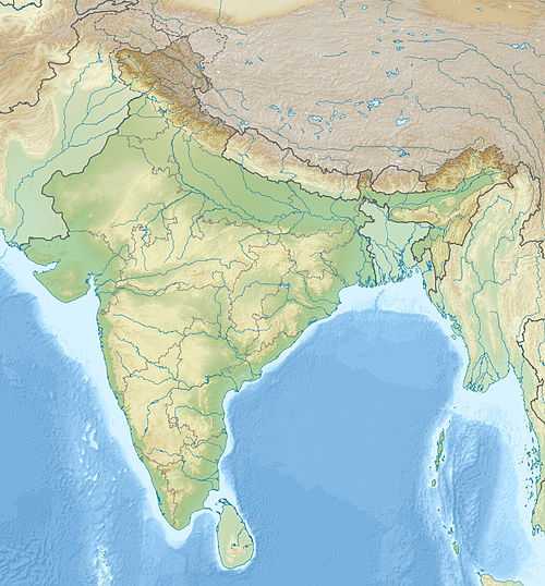
Pandoh Dam
| Pandoh Dam |
|---|
|
|
|
Location of Pandoh Dam |
| Country |
India |
|---|
| Location |
Mandi district |
|---|
| Coordinates |
31°40′17″N 77°04′01″E / 31.67139°N 77.06694°E / 31.67139; 77.06694Coordinates: 31°40′17″N 77°04′01″E / 31.67139°N 77.06694°E / 31.67139; 77.06694 |
|---|
| Status |
Operational |
|---|
| Opening date |
1977 |
|---|
| Owner(s) |
Bhakra Management Board Karamchari Sangh |
|---|
| Dam and spillways |
|---|
| Type of dam |
Embankment |
|---|
| Impounds |
Beas River |
|---|
| Height |
76 m (249 ft) |
|---|
| Length |
255 m (837 ft) |
|---|
| Dam volume |
1,580,000 m3 (2,066,562 cu yd) |
|---|
| Spillway capacity |
9,939 m3/s (350,992 cu ft/s) |
|---|
| Reservoir |
|---|
| Creates |
Pandoh Lake |
|---|
| Total capacity |
41,000,000 m3 (33,239 acre·ft) |
|---|
| Surface area |
1.7 km2 (1 sq mi)[1] |
|---|
| Power station |
|---|
| Hydraulic head |
335 m (1,099 ft) |
|---|
| Turbines |
6 x 165 MW (221,000 hp) Francis-type |
|---|
| Installed capacity |
990 MW (1,330,000 hp) |
|---|
The Pandoh Dam is an embankment dam on the Beas River in Mandi district of Himachal Pradesh, India. Under the Beas Project, the dam was completed in 1977 and its primary purpose is hydroelectric power generation. Part of a run-of-the-river power scheme, it diverts the waters of the Beas to the southwest through a 38 km (24 mi) long system of tunnels and channels. The water is used for power generation at the Dehar Power House before being discharged into the Sutlej River, connecting both rivers. The power house has an installed capacity of 990 megawatts (1,330,000 hp).[2]
Design and operation
Water diverted by the 76 m (249 ft) tall Pandoh Dam is first sent south through the 13.1 km (8 mi) Pandoh-Baggi Tunnel which terminates at the beginning of a 11.8 km (7 mi) long channel.[3] At the end of the channel, the water is stored at the Sundar Nagar Balancing Reservoir at 31°32′05″N 76°53′11″E / 31.53472°N 76.88639°E / 31.53472; 76.88639 (Sundar Nagar Balancing Reservoir). The reservoir has a live capacity of 3,700,000 m3 (3,000 acre·ft). From the balancing reservoir, water is again sent south through the 12.38 km (8 mi) long Sundar Nagar Slapper tunnel. The tunnel ends just before the Dehar Power Plant at 31°24′47″N 76°52′06″E / 31.41306°N 76.86833°E / 31.41306; 76.86833 (Dehar Power House). It splits into three sections followed by six penstocks before reaching the power house. Water from each penstock is fed into a single 165 MW Francis turbine-generator and then discharged in the Sutlej. The change in elevation affords a hydraulic head of 335 m (1,099 ft).[4][5]
See also
- Pong Dam – located 140 km (87 mi) downstream, the second phase of the Beas Project
References
|
|---|
| | Rivers | |
|---|
| | Lakes |
- See
 Lakes of Hmachal Pradesh classified altitude-wise Lakes of Hmachal Pradesh classified altitude-wise
|
|---|
| | Dams, Barrages | |
|---|
| Related topics/
templates |
- Geography of Himachal Pradesh
|
|---|
| | Hydrography of surrounding areas |
- Jammu and Kashmir
- Punjab, India
- Haryana
- Uttarakhand
|
|---|
|
