Panay
 Panay island in red, its associated islands in yellow | |
.svg.png) Location within the Philippines | |
| Geography | |
|---|---|
| Location | South East Asia |
| Coordinates | Coordinates: 11°09′N 122°29′E / 11.150°N 122.483°E |
| Archipelago | Visayas |
| Area | 12,011 km2 (4,637 sq mi) |
| Area rank | 65th |
| Highest elevation | 2,117 m (6,946 ft) |
| Highest point | Mount Madias |
| Country | |
|
Philippines | |
| Provinces | Aklan, Antique, Capiz, Iloilo |
| Largest settlement | Iloilo (pop. 424,619) |
| Demographics | |
| Population | 4,031,636 (as of 2010 census) |
| Density | 335.66 /km2 (869.36 /sq mi) |
| Ethnic groups | Ati, Visayan (Aklanon, Capiznon, Caluyanon, Hiligaynon, Karay-a), Suludnon |
Panay (/pəˈnaɪ/; Tagalog: [pɐˈnaj]) is an island in the Philippines located in the western part of the Visayas. It is about 100 miles across.[1] Politically, it is divided into four provinces: Aklan, Antique, Capiz, and Iloilo, all in the Western Visayas Region. It is located southeast of the island of Mindoro and northwest of Negros, separated by the Guimaras Strait. Between Negros and Panay Island lie the island-province of Guimaras. To the north is the Sibuyan Sea and the islands of Romblon; to the southwest is the Sulu Sea[2] and the Panay Gulf.
The island has many rivers including Akean, Halaur River, Banica, Iloilo, and Panay.
Panay was the seat of the ancient Confederation of Madja-as—the first pre-Hispanic Philippine state within the Visayas islands region, and the second Srivijayan colony in the Philippine Archipelago, next to the Sulu Archipelago.[3] The island is purportedly named after the long-lasting but betrayed state of Pannai which was a militant-country fronting the strait of Malacca and responsible for policing the shipping of the area as well as expelling invasions from Arabs, Indians and Chinese until the state was felled by a surprise attack from the back-flank emanating from the occupied capital of Sri Vijaya. Madya-as was established by nine rebel datus or high officials connected with the court of Brunei, who were forced to leave that are on account of enmity of the Rajah at that time ruling the land. The datus, together with their wives and children, as well as few faithful servants and followers were secretly escorted out of the country by the Rajah's Chief Minister, whose name was Datu Puti.[3] The local folklore says that the name of the Bornean Rajah was Makatunao.
Their ultimate origins may be traced to the sacking of the kingdom of Pannai at North Sumatra by the Chola dynasty who had placed puppet Rajahs on the throne after their invasion. (Hence the motive for the Sri Vijayan Datus to rebel against this, and go elsewhere). The island of Panay having been named after the dissolved kingdom of Pannai.
They embarked on sailing rafts of the type used by the Visayans (the term used in the Malay settlements, of what is now Borneo and Philippines, to refer to Srivijayans) in Sumatra and Borneo.[3] According to tradition, which survive in the local culture of Western Visayas, this seafaring vessel is called Balangay, from which Barangay—the smallest social unit in the present-day Philippines—came from.
The semi-democratic confederation reached its peak during the 15th century under the leadership of Datu Padojinog when it warred against the Chinese Empire, the Rajahnate of Butuan, and the sultanates of Sulu and Maguindanao. It was also feared by the people of the Kingdom of Maynila and Tondo.[4] It was integrated to the Spanish Empire through pacts and treaties (c.1569) by Miguel López de Legazpi and his grandson Juan de Salcedo. During the time of their hispanization, the principalities of the Confederation were already developed settlements with distinct social structure, culture, customs, and religion.[5] Among the archaeological proofs of the existence of this Hiligaynon nation are the artifacts found in pre-Hispanic tombs from many parts of the island, which are now in display at Iloilo Museum. Another testimony of the antiquity of this civilization is the longest and oldest epic in the region, the Hinilawod.
History
According to Beyer and other historians, the migration of the settlers from the collapsing Srivijayan Empire to Panay happened in this way:
Sailing northward from Borneo along the coast of Palawan, the ten Datus crossed the intervening sea, and reached the island of Panay. They landed at the point, which is near the present town of San Joaquin. They had been able to reach the place directly because their small fleet was piloted by a sailor who had previously visited these regions on a ship engaged in commerce and trade.[3]
Soon after the expedition had landed, the Borneans came in contact with the native people of the island, who were called Atis. Some writers have interpreted these Atis as Negritos, other sources present evidence that they were not at all a dwarfed primitive people of Negrito type, but were rather tall, dark-skinned Indonesian type. These native Atis lived in villages of fairly well-constructed houses. They possessed drums and other musical instruments, as well as a variety of weapons and personal adornments, which were much superior to those known among the Negritos.[6]
Negotiations were conducted between the newcomers and the native Atis for the possession of a wide area of land along the coast, centering around the place called Andona, at a considerable distance from the original landing place. Some of the gifts of the Visayans in exchange of those lands are spoken of as being, first, a string of gold beads so long that it touched the ground when worn and, second, a salakot, or native hat covered with gold.[7] The term (which survive in the present Hiligaynon language) for that necklace is Manangyad, from the Hiligaynon term sangyad, which means "touching the ground when worn". There were also a variety of many beads, combs, as well as pieces of cloth for the women and fancifully decorated weapons for men. The sale was celebrated by a feast of friendship between the newcomers and the natives, following which the latter formally turned over possession of the settlement.[7] Afterwards, a great religious ceremony was held, with a sacrifice to the settlers' ancient gods performed by a priest whom they had brought with them from Borneo.[7]


Following the religious ceremony, the priest indicated that it was the will of the gods that they should settle not at Andona, but rather at a place some distance to the east called Malandog (now a Barangay in Hamtik, Province of Antique, where there was both much fertile agricultural land and an abundant supply of fish in the sea. After nine days, the entire group of newcomers was transferred to Malandog. At this point, Datu Puti announced that he must now return to Borneo. He appointed Datu Sumakwel, the oldest, wisest and most educated of the datus, as chief of the Panayan settlement.[7]
Not all the Datus, however, remained in Panay. Two of them, with their families and followers, set out with Datu Puti and voyaged northward. After a number of adventures, they arrived at the bay of Taal, which was also called Lake Bombon on Luzon. Datu Puti returned to Borneo by way of Mindoro and Palawan, while the rest settled in Lake Taal.[8]
The original Panayan settlements continued to grow and later split up into three groups: one of which remained in the original district (Irong-irong), while another settled at the mouth of Aklan River in northern Panay. The third group moved to the district called Hantik. These settlements continued to exist down to the time of the Spanish regime and formed centers, around which the later population of the three provinces of Iloilo, Capiz, and Antique grew up.[9]
An old manuscript Margitas of uncertain date (discovered by the anthropologist H. Otley Beyer)[10] give interesting details about the laws, government, social customs, and religious beliefs of the early Visayans, who settled Panay within the first half of the thirteenth century.[9] The term Visayan was first applied only to them and to their settlements eastward in the island of Negros, and northward in the smaller islands, which now compose the province of Romblon. In fact, even at the early part of Spanish colonialization of the Philippines, the Spaniards used the term Visayan only for these areas. While th people of Cebu, Bohol, and Leyte were for a long time known only as Pintados. The name Visayan was later extended to them because, as several of the early writers state, their languages are closely allied to the Visayan dialect of Panay.[11]
Grabiel Ribera, captain of the Spanish royal infantry in the Philippine Islands, also distinguished Panay from the rest of the Pintados Islands. In his report (dated 20 March 1579) regarding a campaign to pacify the natives living along the rivers of Mindanao (a mission he received from Dr. Francisco de Sande, Governor and Captain-General of the Archipelago), Ribera mentioned that his aim was to make the inhabitants of that island "vassals of King Don Felipe… as are all the natives of the island of Panay, the Pintados Islands, and those of the island of Luzon…" [12]
During the early part of the colonial period in the Archipelago, the Spaniards led by Miguel López de Legazpi transferred their camp from Cebu to Panay in 1569. On 5 June 1569, Guido de Lavezaris, the royal treasurer in the Archipelago, wrote to Philip II reporting about the Portuguese attack to Cebu in the preceding autumn. A letter from another official, Andres de Mirandaola (dated three days later, 8 June), also described briefly this encounter with the Portuguese. The danger of another attack led the Spaniards to remove their camp from Cebu to Panay, which they considered a safer place. Legazpi himself, in his report to the Viceroy in New Spain (dated 1 July 1569), mentioned the same reason for the relocation of Spaniards to Panay.[13] It was in Panay that the conquest of Luzon was planned, and later launched on 8 May 1570.[14]
How the island itself came to be called Panay is uncertain. It was, however, once referred as Aninipay by the indigenous Aetas, after a plant that abounded in the island. Later, the Malay settlers, who first arrived in the island in the 12th century, called it Madja-as.[15]
Legend has it that Legazpi and his men, in search of food as they moved away from Cebu, exclaimed upon seeing the island, "Pan hay en esta isla"!. So they established their first settlement in the island at the mouth of the Banica River in Capiz, and called it Pan-ay. This was the second Spanish settlement in the Philippines, after San Miguel, Cebu.[13]
The account of early Spanish explorers about Panay and its People
During the early part of the Spanish colonization of the Philippines, the Spanish Augustinian Friar Gaspar de San Agustín, O.S.A. described Panay as: "…very similar to that of Sicily in its triangular form, as well as in it fertility and abundance of provision. It is the most populated island after Manila and Mindanao, and one of the largest (with over a hundred leagues of coastline). In terms of fertility and abundance, it is the first. […] It is very beautiful, very pleasant, and full of coconut palms… Near the river Alaguer (Halaur), which empties into the sea two leagues from the town of Dumangas…, in the ancient times, there was a trading center and a court of the most illustrious nobility in the whole island." [16] Padre Francisco Colin (1592-1660), an early Jesuit missionary and Provincial of his Order in the Philippines also records in the chronicles of the Society of Jesus (published later in 1663 as Labor euangelica) that Panay is the island which is most abundant and fertile.[17]
Miguel de Loarca, who was among the first Spanish settlers in the Island, made one of the earliest account about Panay and its people according to a Westerner's point of view. In June 1582, while he was in Arevalo (Iloilo), he wrote in his Relacion de las Yslas Filipinas the following observations:
The island is the most fertile and well-provisioned of all the islands discovered, except the island of Luzon: for it is exceedingly fertile, and abounds in rice, swine, fowls, wax, and honey; it produces also a great quantity of cotton and abacá fiber.[18]
"The villages are very close together, and the people are peaceful and open to conversion. The land is healthful and well-provisioned, so that the Spaniards who are stricken in other islands go thither to recover their health." [18]
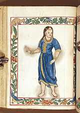
"The natives are healthy and clean, and although the island of Cebu is also healthful and had a good climate, most of its inhabitants are always afflicted with the itch and buboes. In the island of Panay, the natives declare that no one of them had ever been afflicted with buboes until the people from Bohol – who, as we said above, abandoned Bohol on account of the people of Maluco – came to settle in Panay, and gave the disease to some of the natives. For these reasons the governor, Don Gonzalo Ronquillo, founded the town of Arevalo, on the south side of this island; for the island runs north and south, and on that side live the majority of the people, and the villages are near this town, and the land here is more fertile." [18] This probably explains why there are reference of presence of Pintados in the Island.
"The island of Panay provides the city of Manila and other places with a large quantity of rice and meat…"[19] ... "As the island contains great abundance of timber and provisions, it has almost continuously had a shipyard on it, as is the case of the town of Arevalo, for galleys and fragatas. Here the ship 'Visaya' was launched."[20]
Another Spanish chronicler in the early Spanish period, Dr. Antonio de Morga (Year 1609) is also responsible for recording other Visayan customs. Customs such as Visayans' affinity for singing among their warrior-castes as well as the playing of gongs and bells in naval battles.
Their customary method of trading was by bartering one thing for another, such as food, cloth, cattle, fowls, lands, houses, fields, slaves, fishing-grounds, and palm-trees (both nipa and wild). Sometimes a price intervened, which was paid in gold, as agreed upon, or in metal bells brought from China. These bells they regard as precious jewels; they resemble large pans and are very sonorous. They play upon these at their feasts, and carry them to the war in their boats instead of drums and other instruments.[21]
The island lent its name to several United States Navy vessels including the USS Panay (PR-5), sunk in 1937 by the Japanese in the Panay incident.
Geography
Administrative divisions
The island is covered by 4 provinces, 91 municipalities, and, as of 2014, 3 cities (92 municipalities if the associated islands of Caluya are included), all under the jurisdiction of the Western Visayas region.
| Seal | Province | Population (2010)[22] | Land area (km2) | Population density (per km2) | Capital | Municipalities (including associated islands*) | Cities | Location |
|---|---|---|---|---|---|---|---|---|
| |
||||||||
 | Aklan | 535,725 | 1,821.42 | 294.1 | Kalibo | 17 towns
|
- |  |
| | Antique | 546,031 | 2,729.17 | 200.1 | San Jose de Buenavista | 18 towns
|
- |  |
 | Capiz | 719,685 | 2,594.64 | 277.4 | Roxas City | 16 towns
|
Roxas City |  |
 | Iloilo | 1,805,576 | 5,079.17 | 355.5 | Iloilo City | 42 towns
|
Passi City Iloilo City |
 |
| Seal | Province | Population (2010) | Land area (km2) | Density (per km2) | Capital | Municipalities | Cities | Location |
*The municipality of Caluya in Antique province is covered by separate islands which are included under the island group of Panay.
See also
| Look up Panay in Wiktionary, the free dictionary. |
| Wikimedia Commons has media related to Panay. |
- Macario Peralta, Jr.
- Panay Railways
- Church of Panay
References
- ↑ http://www.britannica.com/EBchecked/topic/440887/Panay
- ↑ C.Michael Hogan. 2011. Sulu Sea
- ↑ 3.0 3.1 3.2 3.3 G. Nye Steiger, H. Otley Beyer, Conrado Benitez, A History of the Orient, Oxford: 1929, Ginn and Company, p. 120.
- ↑ Prehispanic Source Materials Page 74 by William Henry Scott (NEW DAY PUBLISHERS INC.)
- ↑ In Panay, the existence of highly developed and independent principalities of Ogtong (Oton) and Araut (Dumangas) was well known to early Spanish settlers in the Philippines. The Augustinian historian Gaspar de San Agustin, for example, wrote about the existence of an ancient and illustrious nobility in Araut, in his book Conquistas de las Islas Filipinas (1565–1615). He said: "También fundó convento el Padre Fray Martin de Rada en Araut—que ahora se llama el convento de Dumangas—con la advocación de nuestro Padre San Agustín … Está fundado este pueblo casi a los fines del río de Halaur, que naciendo en unos altos montes en el centro de esta isla (Panay) … Es el pueblo muy hermoso, ameno y muy lleno de palmares de cocos. Antiguamente era el emporio y corte de la más lucida nobleza de toda aquella isla." Gaspar de San Agustin, O.S.A., Conquistas de las Islas Filipinas (1565–1615), Manuel Merino, O.S.A., ed., Consejo Superior de Investigaciones Cientificas: Madrid 1975, pp. 374–375.
- ↑ G. Nye Steiger, H. Otley Beyer, Conrado Benitez, A History of the Orient, Oxford: 1929, Ginn and Company, pp. 120–121.
- ↑ 7.0 7.1 7.2 7.3 G. Nye Steiger, H. Otley Beyer, Conrado Benitez, A History of the Orient, Oxford: 1929, Ginn and Company, p. 121.
- ↑ G. Nye Steiger, H. Otley Beyer, Conrado Benitez, A History of the Orient, Oxford: 1929, Ginn and Company, pp. 121–122.
- ↑ 9.0 9.1 G. Nye Steiger, H. Otley Beyer, Conrado Benitez, A History of the Orient, Oxford: 1929, Ginn and Company, p. 122.
- ↑ Scott, William Henry, Pre-hispanic Source Materials for the study of Philippine History, 1984: New Day Publishers, pp. 101, 296.
- ↑ G. Nye Steiger, H. Otley Beyer, Conrado Benitez, A History of the Orient, Oxford: 1929, Ginn and Company, pp. 122–123.
- ↑ Cf. BLAIR, Emma Helen & ROBERTSON, James Alexander, eds. (1911). The Philippine Islands, 1493–1803. Volume 04 of 55 (1493–1803). Historical introduction and additional notes by Edward Gaylord BOURNE. Cleveland, Ohio: Arthur H. Clark Company. ISBN 978-0554259598. OCLC 769945704. "Explorations by early navigators, descriptions of the islands and their peoples, their history and records of the catholic missions, as related in contemporaneous books and manuscripts, showing the political, economic, commercial and religious conditions of those islands from their earliest relations with European nations to the beginning of the nineteenth century.", pp. 257–260.
- ↑ 13.0 13.1 Cf. BLAIR, Emma Helen & ROBERTSON, James Alexander, eds. (1911). The Philippine Islands, 1493–1803. Volume 03 of 55 (1493–1803). Historical introduction and additional notes by Edward Gaylord BOURNE. Cleveland, Ohio: Arthur H. Clark Company. ISBN 978-0554259598. OCLC 769945704. "Explorations by early navigators, descriptions of the islands and their peoples, their history and records of the catholic missions, as related in contemporaneous books and manuscripts, showing the political, economic, commercial and religious conditions of those islands from their earliest relations with European nations to the beginning of the nineteenth century.", pp. 15–16.
- ↑ Cf. BLAIR, Emma Helen & ROBERTSON, James Alexander, eds. (1911). The Philippine Islands, 1493–1803. Volume 03 of 55 (1493–1803). Historical introduction and additional notes by Edward Gaylord BOURNE. Cleveland, Ohio: Arthur H. Clark Company. ISBN 978-0554259598. OCLC 769945704. "Explorations by early navigators, descriptions of the islands and their peoples, their history and records of the catholic missions, as related in contemporaneous books and manuscripts, showing the political, economic, commercial and religious conditions of those islands from their earliest relations with European nations to the beginning of the nineteenth century.", p. 73.
- ↑ Cf, Sebastian Sta. Cruz Serag, The Remnants of the Great Ilonggo Nation, Sampaloc, Manila: Rex Book Store, 1997, p. 21.
- ↑ Mamuel Merino, O.S.A., ed., Conquistas de las Islas Filipinas (1565–1615), Madrid: Consejo Superior de Investigaciones Cientificas, 1975, pp. 374–376.
- ↑ Francisco Colin, S.J., Labor euangelica, ministerios apostolicos de los obreros de la Compañia de Iesus : fundacion, y progressos de su Prouincia en las islas Filipinas historiados, Madrid:1663, Lib. I, Cap. VII, p. 63.
- ↑ 18.0 18.1 18.2 Miguel de Loarca, Relacion de las Yslas Filipinas (Arevalo: June 1582) in BLAIR, Emma Helen & ROBERTSON, James Alexander, eds. (1903). The Philippine Islands, 1493–1803. Volume 05 of 55 (1582–1583). Historical introduction and additional notes by Edward Gaylord BOURNE. Cleveland, Ohio: Arthur H. Clark Company. ISBN 978-0554259598. OCLC 769945704. "Explorations by early navigators, descriptions of the islands and their peoples, their history and records of the catholic missions, as related in contemporaneous books and manuscripts, showing the political, economic, commercial and religious conditions of those islands from their earliest relations with European nations to the beginning of the nineteenth century.", p. 67.
- ↑ Miguel de Loarca, Relacion de las Yslas Filipinas (Arevalo: June 1582) in BLAIR, Emma Helen & ROBERTSON, James Alexander, eds. (1903). The Philippine Islands, 1493–1803. Volume 05 of 55 (1582–1583). Historical introduction and additional notes by Edward Gaylord BOURNE. Cleveland, Ohio: Arthur H. Clark Company. ISBN 978-0554259598. OCLC 769945704. "Explorations by early navigators, descriptions of the islands and their peoples, their history and records of the catholic missions, as related in contemporaneous books and manuscripts, showing the political, economic, commercial and religious conditions of those islands from their earliest relations with European nations to the beginning of the nineteenth century.", p. 69.
- ↑ Miguel de Loarca, Relacion de las Yslas Filipinas (Arevalo: June 1582) in BLAIR, Emma Helen & ROBERTSON, James Alexander, eds. (1903). The Philippine Islands, 1493–1803. Volume 05 of 55 (1582–1583). Historical introduction and additional notes by Edward Gaylord BOURNE. Cleveland, Ohio: Arthur H. Clark Company. ISBN 978-0554259598. OCLC 769945704. "Explorations by early navigators, descriptions of the islands and their peoples, their history and records of the catholic missions, as related in contemporaneous books and manuscripts, showing the political, economic, commercial and religious conditions of those islands from their earliest relations with European nations to the beginning of the nineteenth century.", p. 71.
- ↑ http://ilongo.weebly.com/iloilo-history-part-2.html
- ↑ "Population and Annual Growth Rates for The Philippines and Its Regions, Provinces, and Highly Urbanized Cities Based on 1990, 2000, and 2010 Censuses" (PDF). 2010 Census and Housing Population. National Statistics Office. Retrieved 12 October 2012.
Bibliography
- C. Michael Hogan. 2011. Sulu Sea. Encyclopedia of Earth. Eds. P. Saundry & C. J. Cleveland. Washington DC