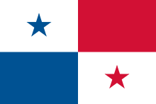
Panama
| Republic of Panama República de Panamá
|
||||||
|---|---|---|---|---|---|---|
|
||||||
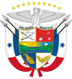
| Motto: "Pro Mundi Beneficio" (Latin) "For the Benefit of the World" |
||||||
| Anthem: Himno Istmeño (Spanish) |
||||||
.svg.png) |
||||||
| Capital and largest city | Panama City 8°58′N 79°32′W / 8.967°N 79.533°W | |||||
| Official languages | Spanish | |||||
| Ethnic groups | ||||||
| Demonym | Panamanian | |||||
| Government | Unitary presidential constitutional republic | |||||
| - | President | Juan Carlos Varela | ||||
| - | Vice President | Isabel Saint Malo | ||||
| Legislature | National Assembly | |||||
| Independence | ||||||
| - | from Spain | November 28, 1821 | ||||
| - | from Colombia | November 3, 1903 | ||||
| Area | ||||||
| - | Total | 75,517 km2 (118th) 29,157 sq mi |
||||
| - | Water (%) | 2.9 | ||||
| Population | ||||||
| - | July 2014 est. census | 3,608,431 [1] | ||||
| - | Density | 54,2/km2 (156th) 140.6/sq mi |
||||
| GDP (PPP) | 2015 estimate | |||||
| - | Total | $83.421 billion[2] | ||||
| - | Per capita | $21,634[2] | ||||
| GDP (nominal) | 2015 estimate | |||||
| - | Total | $49.142 billion[2] | ||||
| - | Per capita | $12,744[2] | ||||
| Gini (2012) | high |
|||||
| HDI (2013) | high · 65th |
|||||
| Currency | (PAB, USD) | |||||
| Time zone | EST (UTC−5) | |||||
| Drives on the | right | |||||
| Calling code | +507 | |||||
| Internet TLD | .pa | |||||
Panama (![]() i/ˈpænəmɑː/ PAN-ə-mah ; Spanish: Panamá [panaˈma]), officially called the Republic of Panama (Spanish: República de Panamá), is a country in Central America situated between North and South America. It is bordered by Costa Rica to the west, Colombia to the southeast, the Caribbean to the north and the Pacific Ocean to the south. The capital and largest city is Panama City, whose metro area is home to nearly half of the country's 3.6 million people.
i/ˈpænəmɑː/ PAN-ə-mah ; Spanish: Panamá [panaˈma]), officially called the Republic of Panama (Spanish: República de Panamá), is a country in Central America situated between North and South America. It is bordered by Costa Rica to the west, Colombia to the southeast, the Caribbean to the north and the Pacific Ocean to the south. The capital and largest city is Panama City, whose metro area is home to nearly half of the country's 3.6 million people.
Panama was inhabited by several indigenous tribes prior to settlement by the Spanish in the 16th century. It broke away from Spain in 1821 and joined a union of Nueva Granada, Ecuador, and Venezuela named the Republic of Gran Colombia. When Gran Colombia dissolved in 1831, Panama and Nueva Granada remained joined, eventually becoming the Republic of Colombia. With the backing of the United States, Panama seceded from Colombia in 1903, allowing the Panama Canal to be built by the U.S. Army Corps of Engineers between 1904 and 1914. In 1977, an agreement was signed for the total transfer of the Canal from the United States to Panama by the end of the 20th century, which culminated on 31 December 1999.[5]
Revenue from canal tolls continues to represent a significant portion of Panama's GDP, although commerce, banking, and tourism are major and growing sectors. Panama has the second largest economy in Central America[6] and is also the fastest growing economy and largest per capita consumer in Central America. In 2013, Panama ranked 5th among Latin American countries in terms of the Human Development Index, and 59th in the world.[7] Since 2010, Panama remains the second most competitive economy in Latin America, according to the World Economic Forum's Global Competitiveness Index. Covering around 40 percent of its land area, Panama's jungles are home to an abundance of tropical plants, animals and birds – some of them to be found nowhere else on the planet.[8]
Etymology
There are several theories about the origin of the name "Panama". Some believe that the country was named after a commonly found species of trees. Others believe that the first settlers arrived in Panama in August, when butterflies abound, and that the name means "many butterflies" in an indigenous language.
The best-known version is that a fishing village and its nearby beach bore the name "Panamá", which meant "an abundance of fish". Captain Antonio Tello de Guzmán, while exploring the Pacific side in 1515, stopped in the small indigenous fishing town. This was communicated to the Crown and in 1517 Don Gaspar De Espinosa, a Spanish lieutenant, decided to settle a post there. In 1519, Pedrarias Dávila decided to establish the Empire's Pacific city in this site. The new settlement replaced Santa María La Antigua del Darién, which had lost its function within the Crown's global plan after the beginning of the Spanish exploitation of the riches in the Pacific.
Blending all of the above together, Panamanians believe in general that the word Panama means "abundance of fish, trees and butterflies". This is the official definition given in social studies textbooks approved by the Ministry of Education in Panama. However, others believe the word Panama comes from the Kuna word "bannaba" which means "distant" or "far away".[9]
History
At the time of the arrival of the Spanish in the 16th century, the known inhabitants of Panama included the Cuevas and the Coclé tribes. These people nearly disappeared and they had no immunity from European infectious diseases.[10]
Pre-Columbian period
The Isthmus of Panama was formed about 3 million years ago when the land bridge between North and South America finally closed, after which plants and animals gradually crossed it in both directions. The existence of the isthmus had an impact on the dispersal of people, agriculture and technology throughout the American continent from the appearance of the first hunters and collectors to the era of villages and cities.[11][12]
The earliest artifacts discovered of indigenous peoples in Panama have included Paleo-Indians projectile points. Later central Panama was home to some of the first pottery-making in the Americas, such as the Monagrillo cultures dating to about 2500–1700 BC. These evolved into significant populations that are best known through the spectacular burials (dating to c. 500–900 AD) at the Monagrillo archaeological site, and the beautiful polychrome pottery of the Gran Coclé style. The monumental monolithic sculptures at the Barriles (Chiriqui) site are other important evidence of the ancient isthmian cultures.
Prior to the arrival of Europeans, Panama was widely settled by Chibchan, Chocoan, and Cueva peoples, among whom the largest group were the Cueva (whose specific language affiliation is poorly documented). There is no accurate knowledge of the size of the indigenous population of the isthmus at the time of the European conquest. Estimates range as high as two million people, but more recent studies place that number closer to 200,000. Archaeological finds as well as testimonials by early European explorers describe diverse native isthmian groups exhibiting cultural variety and suggesting people already conditioned by regular regional routes of commerce.
When Panama was colonized, the indigenous peoples fled into the forest and nearby islands. Scholars believe that, among the various contributing factors, infectious disease was the main cause of the population decline of the American natives. The indigenous peoples had no acquired immunity to such diseases, which had been chronic in Eurasian populations for centuries.[13]
Conquest to 1799
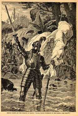
Rodrigo de Bastidas, sailing westward from Venezuela in 1501 in search of gold, was the first European to explore the isthmus of Panama. A year later, Christopher Columbus visited the isthmus and established a short-lived settlement in the Darien. Vasco Núñez de Balboa's tortuous trek from the Atlantic to the Pacific in 1513 demonstrated that the Isthmus was, indeed, the path between the seas, and Panama quickly became the crossroads and marketplace of Spain's empire in the New World. Gold and silver were brought by ship from South America, hauled across the isthmus, and loaded aboard ships for Spain. The route became known as the Camino Real, or Royal Road, although it was more commonly known as Camino de Cruces (Road of the Crosses) because of the abundance of gravesites along the way.
Panama, under Spanish rule for 300 years (1538–1821) became part of the Viceroyalty of Peru, along with all other Spanish possessions in South America. From the outset, Panamanian identity was based on a sense of "geographic destiny", and Panamanian fortunes fluctuated with the geopolitical importance of the isthmus. The colonial experience also spawned Panamanian nationalism as well as a racially complex and highly stratified society, the source of internal conflicts that ran counter to the unifying force of nationalism.
In 1538, the Real Audiencia de Panama was established, initially with jurisdiction from Nicaragua to Cape Horn before the conquest of Peru. A Real Audiencia (royal audiency) was a judicial district that functioned as an appeals court. Each audiencia had oidores (Spanish: hearer, a judge).
Spanish authorities exercised little control over much of the territory of Panama, large sections managing to resist conquest until very late in the colonial era. Because of this, indigenous people of the area were often referred to as "indios de guerra" (war Indians) and resisted Spanish attempts to conquer them or missionize them. However, Panama was enormously important to Spain strategically because it was the easiest way to transship silver mined in Peru to Europe. Silver cargos were landed at Panama and then taken overland to Portobello or Nombre de Dios on the Caribbean side of the isthmus for further shipment.
Because of the incomplete Spanish control, the Panama route was vulnerable to attack from pirates (mostly Dutch and English) and from 'new world' Africans called cimarrons who had freed themselves from enslavement and lived in communes or palenques around the Camino Real in Panama's Interior, and on some of the islands off Panama's Pacific coast. One such famous community amounted to a small kingdom under Bayano, which emerged in the 1552 to 1558. Sir Francis Drake's famous raids on Panama in 1572–73 were aided by Panama cimarrons, and Spanish authorities were only able to bring them under control by making an alliance with them that guaranteed their freedom in exchange for military support in 1582.[14]
The prosperity enjoyed during the first two centuries (1540–1740) while contributing to colonial growth; the placing of extensive regional judicial authority (Real Audiencia) as part of its jurisdiction; and the pivotal role it played at the height of the Spanish Empire – the first modern global empire – helped define a distinctive sense of autonomy and of regional or national identity within Panama well before the rest of the colonies.
The end of the encomienda system in Azuero, however, sparked the conquest of Veraguas in that same year. Under the leadership of Francisco Vázquez, the region of Veraguas passed into Castillan rule in 1558. In the newly conquered region, the old system of encomienda was imposed. On the other hand, the Panamanian movement for independence can be indirectly attributed to the abolishment of the encomienda system in the Azuero Peninsula, set forth by the Spanish Crown, in 1558 because of repeated protests by locals against the mistreatment of the native population. In its stead, a system of medium and smaller-sized landownership was promoted, thus taking away the power from the large landowners and into the hands of medium and small sized proprietors.
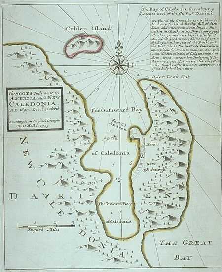
Panama was the site of the ill-fated Darien scheme, which set up a Scottish colony in the region in 1698. This failed for a number of reasons, and the ensuing debt contributed to the union of England and Scotland in 1707.[15]
In 1671, the privateer Henry Morgan, licensed by the English government, sacked and burned the city of Panama – the second most important city in the Spanish New World at the time. In 1717, the viceroyalty of New Granada (northern South America) was created in response to other Europeans trying to take Spanish territory in the Caribbean region. The Isthmus of Panama was placed under its jurisdiction. However, the remoteness of New Granada's capital, Santa Fe de Bogotá (the modern capital of Colombia) proved a greater obstacle than the Spanish crown anticipated as the authority of New Granada was contested by the seniority, closer proximity, and previous ties to the viceroyalty of Lima and even by Panama's own initiative. This uneasy relationship between Panama and Bogotá would persist for centuries.
In 1744, Bishop Francisco Javier de Luna Victoria DeCastro established the College of San Ignacio de Loyola and on June 3, 1749 founded La Real y Pontificia Universidad de San Javier. By this time, however, Panama's importance and influence had become insignificant as Spain's power dwindled in Europe and advances in navigation technique increasingly permitted to round Cape Horn in order to reach the Pacific. While the Panama route was short it was also labor-intensive and expensive because of the loading and unloading and laden-down trek required to get from the one coast to the other.
During the last half of the 18th century and the first half of the 19th century, migrations to the countryside decreased Panama City's population and the isthmus' economy shifted from the tertiary to the primary sector.
1800s
As the Spanish American wars of independence were heating up all across Latin America, Panama City was preparing for independence; however, their plans were accelerated by the unilateral Grito de La Villa de Los Santos (Cry From the Town of Saints), issued on November 10, 1821 by the residents of Azuero without backing from Panama City to declare their separation from the Spanish Empire. In both Veraguas and the capital this act was met with disdain, although on differing levels. To Veraguas, it was the ultimate act of treason, while to the capital, it was seen as inefficient and irregular, and furthermore forced them to accelerate their plans.
Nevertheless, the Grito was an event that shook the isthmus to its very core. It was a sign, on the part of the residents of Azuero, of their antagonism towards the independence movement in the capital. Those in the capital region in turn regarded the Azueran movement with contempt, since the separatists in Panama City believed that their counterparts in Azuero were fighting not only for independence from Spain, but also for their right to self-rule apart from Panama City once the Spaniards were gone.
It was an incredibly brave move on the part of Azuero, which lived in fear of Colonel José Pedro Antonio de Fábrega y de las Cuevas (1774–1841), and with good reason; the Colonel was a staunch loyalist, and had the entirety of the isthmus' military supplies in his hands. They feared quick retaliation and swift retribution against the separatists.
What they had counted on, however, was the influence of the separatists in the capital. Ever since October 1821, when the former Governor General, Juan de la Cruz Murgeón, left the isthmus on a campaign in Quito and left the Veraguan colonel in charge, the separatists had been slowly converting Fábrega to the separatist side. As such, by November 10, Fábrega was now a supporter of the independence movement. Soon after the separatist declaration of Los Santos, Fábrega convened every organization in the capital with separatist interests and formally declared the city's support for independence. No military repercussions occurred because of the skillful bribing of royalist troops.
Post-colonial Panama
In the first eighty years following independence from Spain, Panama was a department of Colombia, since voluntarily becoming part of it at the end of 1821. The people of the isthmus made several attempts to secede and came close to success in 1831, and again during the Thousand Days' War of 1899–1902. When the Senate of Colombia rejected the Hay–Herrán Treaty, the United States decided to support the Panamanian independence movement.
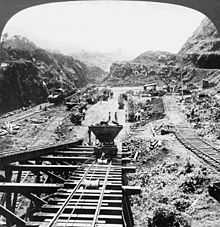
In November 1903 Panama proclaimed its independence and concluded the Hay–Bunau-Varilla Treaty with the United States. The treaty granted rights to the United States "as if it were sovereign" in a zone roughly 16 km (10 mi) wide and 80 km (50 mi) long. In that zone, the U.S. would build a canal, then administer, fortify, and defend it "in perpetuity." In 1914, the United States completed the existing 83 km (52 mi) canal. The early 1960s saw the beginning of sustained pressure in Panama for the renegotiation of this treaty.
The United States of America's intentions to influence the area (especially the Panama Canal construction and control) led to the separation of Panama from Colombia in 1903 and the establishment of it as a nation (the United States intensively encouraged the Panamanian separatist movement).[16] From 1903 until 1968, Panama was a constitutional democracy dominated by a commercially oriented oligarchy. During the 1950s, the Panamanian military began to challenge the oligarchy's political hegemony.
Amidst negotiations for the Robles–Johnson treaty, Panama held elections in 1968. The candidates were Dr. Arnulfo Arias Madrid, Antonio González Revilla, and engineer David Samudio, who had the government's support. Samudio was the candidate of Alianza del Pueblo ("People's Alliance"), Arias Madrid was the candidate of Unión Nacional ("National Union"), and González Revilla was the candidate of Democracia Cristiana ("Christian Democrats") (see Pizzurno Gelós and Araúz, Estudios sobre el Panamá republicano 508).[17]
Arias Madrid was declared the winner of elections that were marked by violence and accusations of fraud against Alianza del Pueblo. On October 1, 1968, Arias Madrid took office as president of Panama, promising to lead a government of "national union" that would end the reigning corruption and pave the way for a new Panama. A week and a half later, on October 11, 1968, the National Guard (Guardia Nacional) ousted Arias and initiated the downward spiral that would culminate with the United States' invasion in 1989. Arias, who had promised to respect the hierarchy of the National Guard, broke the pact and started a large restructuring of the Guard. To preserve the Guard's interests, Lieutenant Colonel Omar Torrijos Herrera and Major Boris Martínez commanded the first coup of a military force against a civilian government in Panamanian republican history.[17]
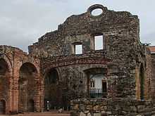
The military justified itself by declaring that Arias Madrid was trying to install a dictatorship, and promised a return to constitutional rule. In the meantime, the Guard began a series of populist measures that would gain support for the coup. Amongst them were the freezing of prices on food, medicine[18] and other goods until January 31, 1969, the freezing of renting prices, and the legalization of the permanence of squatting families in boroughs surrounding the historic site of Panama Viejo.[17] Parallel to this, the military began a policy of repression against the opposition, who were labeled communists. The military appointed a Provisional Government Junta that would arrange new elections. However, the National Guard would prove to be very reluctant to abandon power and soon began calling itself El Gobierno Revolucionario ("The Revolutionary Government").
Post-1970

During Omar Torrijos's control, the military regime transformed the political and economic structure of the country by initiating massive coverage of social security services and expanding public education. The constitution was changed in 1972. For the reform to the constitution, the military created a new organization, the Assembly of Corregimiento Representatives, which replaced the National Assembly. The new assembly, also known as the Poder Popular ("Power of the People"), was composed of 505 members selected by the military without the participation of political parties, which had been eliminated by the military. The new constitution proclaimed Omar Torrijos the "Maximum Leader of the Panamanian Revolution", and conceded him unlimited power for six years, although, to keep a façade of constitutionality, Demetrio B. Lakas was appointed president for the same period (Pizzurno Gelós and Araúz, Estudios sobre el Panamá republicano 541).[17]
In 1981, Torrijos died in a plane crash. Torrijos' death altered the tone of Panama's political evolution. Despite the 1983 constitutional amendments, which proscribed a political role for the military, the Panama Defense Forces (PDF), as they were then known, continued to dominate Panamanian political life. By this time, General Manuel Noriega was firmly in control of both the PDF and the civilian government.

In the 1984 elections, the candidates were Nicolás Ardito Barletta Vallarino, supported by the military in a union called UNADE; Dr. Arnulfo Arias Madrid, for the opposition union ADO; the ex-General Rubén Darío Paredes, who had been forced to an early retirement by Noriega, running for Partido Nacionalista Popular PNP ("Popular Nationalist Party"), and Carlos Iván Zúñiga, running for Partido Acción Popular (PAPO) meaning "Popular Action Party". Nicolás Ardito Barletta was declared the winner of elections that had been clearly won by Arnulfo Arias Madrid. Ardito Barletta inherited a country in economic ruin and hugely indebted to the IMF and the World Bank. Amidst the economic crisis and Barletta's efforts to calm the country's creditors, street protests arose, and so did military repression.
Meanwhile, Noriega's regime had fostered the development of a well-hidden criminal economy that operated as a parallel source of income for the military and their allies, providing revenues from drugs and money laundering. Towards the end of the military dictatorship, a new wave of Chinese migrants arrived on the isthmus in the hope of migrating to the United States. The smuggling of Chinese became an enormous business, with revenues of up to 200 million dollars for Noriega's regime (see Mon 167).[19]
The military dictatorship, at that time supported by the United States, perpetrated the assassination and torture of more than one hundred Panamanians and forced into exile at least another hundred dissidents (see Zárate 15).[20] Noriega also began playing a double role in Central America under the supervision of the CIA. While the Contadora group conducted diplomatic efforts to achieve peace in the region, Noriega supplied the Nicaraguan Contras and other guerrillas in the region with weapons and ammunition.[17]
On June 6, 1987, the recently retired Colonel Roberto Díaz Herrera, resentful for Noriega's violation of the "Torrijos Plan" of succession that would turn him into the chief of the military after Noriega, decided to denounce the regime. He revealed details of the electoral fraud, accused Noriega of planning Torrijos's death, declared that Torrijos had received 12 million dollars from the Shah of Iran so that Panama would give the exiled Iranian leader asylum, and blamed Noriega for the assassination by decapitation of opposition leader Dr. Hugo Spadafora.[17]
On the night of June 9, 1987, the Cruzada Civilista ("Civic Crusade") was created and began organizing actions of civil disobedience. The Crusade called for a general strike. In response, the military suspended constitutional rights and declared a state of emergency in the country. On July 10, the Civic Crusade called for a massive demonstration that was violently repressed by the "Dobermans", the military's special riot control unit. That day, later known as El Viernes Negro ("Black Friday"), left six hundred people injured and another six hundred detained, many of whom were later tortured and raped.
United States President Ronald Reagan began a series of sanctions against the military regime. The United States froze economic and military assistance to Panama in the summer of 1987 in response to the domestic political crisis in Panama and an attack on the U.S. Embassy. Yet these sanctions did little to overthrow Noriega but instead severely damaged Panama's economy. The sanctions hit the Panamanian population hard and caused the Gross Domestic Product (GDP) to decline almost 25% between 1987–1989 (see Acosta n.p.).[21]
On February 5, 1988, General Manuel Antonio Noriega was accused of drug trafficking by federal juries in Tampa and Miami.
In April 1988, the U.S. President Ronald Reagan invoked the International Emergency Economic Powers Act, freezing Panamanian government assets in all U.S. organizations. In May 1989 Panamanians voted overwhelmingly for the anti-Noriega candidates. The Noriega regime promptly annulled the election and embarked on a new round of repression.
U.S. invasion (1989)
The United States government justified Operation Just Cause, which commenced on December 20, 1989 as necessary to safeguard the lives of U.S. citizens in Panama, defend democracy and human rights, combat drug trafficking, and secure the neutrality of the Canal as required by the Torrijos–Carter Treaties (New York Times, A Transcript of President Bush's Address n.p.).[22] The U.S. reported 23 servicemen killed and 324 wounded, with estimated Panamanian casualties around 450. It was estimated that there were 200 to 300 Panamanian civilian fatalities. Some were killed by the Panamanian Defense Forces (the police) and others "inadvertently" by US troops. The United Nations put the Panamanian civilian death toll at 500. Others had much more inflated numbers.[23] The number of U.S. civilians (and their dependents), who had worked for the Panama Canal Commission and the U.S. Military, and were killed by the Panamanian Defense Forces, has never been fully disclosed.
The urban population, with many living below the poverty level, was greatly affected by the 1989 intervention. As pointed out in 1995 by a UN Technical Assistance Mission to Panama, the intervention caused the displacement of 5,000 people. The most heavily affected district was impoverished El Chorrillo, where several blocks of apartments were completely destroyed by a fire. The economic damage caused by the intervention has been estimated to be between 1.5 and 3 million dollars. n.p.).[21] Most Panamanians supported the intervention.[24][25]
Post-intervention era

Panama's Electoral Tribunal moved quickly to restore the civilian constitutional government, reinstated the results of the May 1989 election on December 27, 1989, and confirmed the victory of President Guillermo Endara and Vice Presidents Guillermo Ford and Ricardo Arias Calderon.
During its five-year term, the often-fractious government struggled to meet the public's high expectations. Its new police force was a major improvement over its predecessor but was not fully able to deter crime. Ernesto Pérez Balladares was sworn in as President on September 1, 1994, after an internationally monitored election campaign.
Perez Balladares ran as the candidate for a three-party coalition dominated by the Democratic Revolutionary Party (PRD), the erstwhile political arm of military dictatorships. Perez Balladares worked skillfully during the campaign to rehabilitate the PRD's image, emphasizing the party's populist Torrijos roots rather than its association with Noriega. He won the election with only 33% of the vote when the major non-PRD forces splintered into competing factions. His administration carried out economic reforms and often worked closely with the U.S. on implementation of the Canal treaties.
On September 1 1999, Mireya Moscoso, the widow of former President Arnulfo Arias Madrid, took office after defeating PRD candidate Martin Torrijos, son of Omar Torrijos, in a free and fair election. During her administration, Moscoso attempted to strengthen social programs, especially for child and youth development, protection, and general welfare. Moscoso's administration successfully handled the Panama Canal transfer and was effective in the administration of the Canal.
The PRD's Martin Torrijos won the presidency and a legislative majority in the National Assembly in 2004. Torrijos ran his campaign on a platform of, among other pledges, a "zero tolerance" for corruption, a problem endemic to the Moscoso and Perez Balladares administrations. After taking office, Torrijos passed a number of laws which made the government more transparent. He formed a National Anti-Corruption Council whose members represented the highest levels of government, as well as civil society, labor organizations, and religious leadership. In addition, many of his closest Cabinet ministers were non-political technocrats known for their support for the Torrijos government's anti-corruption aims. Despite the Torrijos administration's public stance on corruption, many high-profile cases, particularly involving political or business elites, were never acted upon.
Conservative supermarket magnate Ricardo Martinelli was elected to succeed Martin Torrijos with a landslide victory at the May 2009 presidential election. Mr. Martinelli's business credentials drew voters worried by slowing growth due to the world financial crisis.[26] Standing for the four-party opposition Alliance for Change, Mr. Martinelli gained 60% of the vote, against 37% for the candidate of the governing left-wing Democratic Revolutionary Party.
Geography
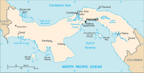
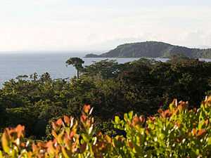
Panama is located in Central America, bordering both the Caribbean Sea and the Pacific Ocean, between Colombia and Costa Rica. It mostly lies between latitudes 7° and 10°N, and longitudes 77° and 83°W (a small area lies west of 83°). Some people consider the territory east of the Panama Canal as part of South America although this is rare.
Its location on the Isthmus of Panama is strategic. By 2000, Panama controlled the Panama Canal which connects the Atlantic Ocean and the Caribbean Sea to the North of the Pacific Ocean. Panama's total area is 75,515 km2.
The dominant feature of Panama's landform is the central spine of mountains and hills that forms the continental divide. The divide does not form part of the great mountain chains of North America, and only near the Colombian border are there highlands related to the Andean system of South America. The spine that forms the divide is the highly eroded arch of an uplift from the sea bottom, in which peaks were formed by volcanic intrusions.
The mountain range of the divide is called the Cordillera de Talamanca near the Costa Rican border. Farther east it becomes the Serranía de Tabasará, and the portion of it closer to the lower saddle of the isthmus, where the Panama Canal is located, is often called the Sierra de Veraguas. As a whole, the range between Costa Rica and the canal is generally referred to by geographers as the Cordillera Central.
The highest point in the country is the Volcán Barú, which rises to 3,475 metres (11,401 ft). A nearly impenetrable jungle forms the Darien Gap between Panama and Colombia where Colombian guerrilla and drug dealers are operating with hostage-taking. This and forest protection movements create a break in the Pan-American Highway, which otherwise forms a complete road from Alaska to Patagonia.
Panama's wildlife holds the most diversity of all the countries in Central America. It is home to many South American species as well as North American wildlife.

Waterways
Nearly 500 rivers lace Panama's rugged landscape. Mostly unnavigable, many originate as swift highland streams, meander in valleys, and form coastal deltas. However, the Río Chagres (Rio Chagres) is one of the few wide rivers and a source of enormous hydroelectric power. The river is located in central Panama. The central part of the river is dammed by the Gatun Dam and forms Gatun Lake, an artificial lake that constitutes part of the Panama Canal. The lake was created between 1907 and 1913 by the building of the Gatun Dam across the Chagres River. When it was created, Gatun Lake was the largest man-made lake in the world, and the dam was the largest earth dam. It drains northwest into the Caribbean. The Kampia and Madden Lakes (also filled from the Río Chagres) provide hydroelectricity for the area of the former Canal Zone.
The Río Chepo, another source of hydroelectric power, is one of the more than 300 rivers emptying into the Pacific. These Pacific-oriented rivers are longer and slower running than those of the Caribbean side. Their basins are also more extensive. One of the longest is the Río Tuira which flows into the Golfo de San Miguel and is the nation's only river navigable by larger vessels.
Harbors
The Caribbean coastline is marked by several good natural harbors. However, Cristóbal, at the Caribbean terminus of the canal, had the only important port facilities in the late 1980s. The numerous islands of the Archipiélago de Bocas del Toro, near the Beaches of Costa Rica, provide an extensive natural roadstead and shield the banana port of Almirante. The over 350 San Blas Islands, near Colombia, are strung out for more than 160 km along the sheltered Caribbean coastline.
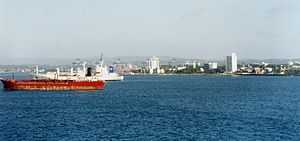
Currently, the terminal ports located at each end of the Panama Canal, namely the Port of Cristobal and the Port of Balboa, are ranked second and third respectively in Latin America in terms of numbers of containers units (TEU) handled.[27] The Port of Balboa covers 182 hectares and contains four berths for containers and two multi-purpose berths. In total, the berths are over 2,400 meters long with alongside depth of 15 meters. The Port of Balboa has 18 super post-Panamax and Panamax quay cranes and 44 gantry cranes. The Port of Balboa also contains 2,100 square meters of warehouse space.[28]
The Ports of Cristobal (encompassing the container terminals of Panama Ports Cristobal, Manzanillo International Terminal and Colon Container Terminal) handled 2,210,720 TEU in 2009, second only to the Port of Santos, Brazil, in Latin America.
Excellent deep water ports capable of accommodating large VLCC (Very Large Crude Oil Carriers) are located at Charco Azul, Chiriquí (Pacific) and Chiriquí Grande, Bocas del Toro (Atlantic) near Panama's western border with Costa Rica. The Trans-Panama pipeline, running across the isthmus with a length of 131 km, has been operating between Charco Azul and Chiriquí Grande since 1979.[29]
Climate
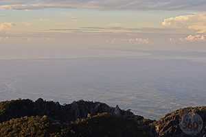
Panama has a tropical climate. Temperatures are uniformly high—as is the relative humidity—and there is little seasonal variation. Diurnal ranges are low; on a typical dry-season day in the capital city, the early morning minimum may be 24 °C (75.2 °F) and the afternoon maximum 30 °C (86.0 °F). The temperature seldom exceeds 32 °C (89.6 °F) for more than a short time. Temperatures on the Pacific side of the isthmus are somewhat lower than on the Caribbean, and breezes tend to rise after dusk in most parts of the country. Temperatures are markedly cooler in the higher parts of the mountain ranges, and frosts occur in the Cordillera de Talamanca in western Panama.
Climatic regions are determined less on the basis of temperature than on rainfall, which varies regionally from less than 1,300 millimeters (51.2 in) to more than 3,000 millimeters (118.1 in) per year. Almost all of the rain falls during the rainy season, which is usually from April to December, but varies in length from seven to nine months. In general, rainfall is much heavier on the Caribbean than on the Pacific side of the continental divide. The annual average in Panama City is little more than half of that in Colón. Although rainy-season thunderstorms are common, the country is outside the hurricane belt.
Panama's tropical environment supports an abundance of plants. Forests dominate, interrupted in places by grasslands, scrub, and crops. Although nearly 40% of Panama is still wooded, deforestation is a continuing threat to the rain-drenched woodlands. Tree cover has been reduced by more than 50% since the 1940s. Subsistence farming, widely practiced from the northeastern jungles to the southwestern grasslands, consists largely of corn, bean, and tuber plots. Mangrove swamps occur along parts of both coasts, with banana plantations occupying deltas near Costa Rica. In many places, a multi-canopied rain forest abuts the swamp on one side of the country and extends to the lower reaches of slopes in the other.
Politics
Panama's politics take place in a framework of a presidential representative democratic republic, whereby the President of Panama is both head of state and head of government, and of a multi-party system. Executive power is exercised by the government. Legislative power is vested in both the government and the National Assembly. The judiciary is independent of the executive and the legislature.
For all people national elections are universal and mandatory for all citizens 18 years and older. National elections for the executive and legislative branches take place every five years. Members of the judicial branch (justices) are appointed by the head of state. Panama's National Assembly is elected by proportional representation in fixed electoral districts, so many smaller parties are represented. Presidential elections do not require a simple majority; out of the four last presidents only one, incumbent president Ricardo Martinelli, was elected with over 50% of the popular vote.[30]
Political culture
In December 1989 the United States invaded Panama to depose the dictator Manuel Noriega. Since the U.S. invasion, and resulting end to the 21-year military dictatorship, Panama has successfully completed four peaceful transfers of power to opposing political factions. The political landscape is dominated by two major parties and many smaller parties, many of which are driven by individual leaders more than ideologies. Former President Martin Torrijos is the son of Maximum Leader of the Panamanian Revolution Omar Torrijos. He succeeded Mireya Moscoso, the widow of Arnulfo Arias. Panama's most recent national elections occurred on May 4, 2014 with Incumbent Vice-President Juan Carlos Varela declared the victor.
Administrative divisions

Panama is divided into ten provinces with their respective local authorities (governors), which are divided into districts and corregimientos (townships) and has a total of ten cities. Also, there are five Comarcas (literally: "Shires") populated by a variety of indigenous groups.
- Provinces
- Bocas del Toro
- Chiriquí
- Coclé
- Colón
- Darién
- Herrera
- Los Santos
- Panamá
- West Panamá
- Veraguas
- Regions
- Emberá
- Guna Yala
- Ngöbe-Buglé Comarca
- Kuna de Madugandí
- Kuna de Wargandí
Economy

According to the CIA World Factbook, as of 2012 Panama had an unemployment rate of 2.7%.[5] A food surplus was registered in August 2008. On the Human Development Index, Panama ranked 58th in 2012. In recent years, Panama's economy has experienced a boom, with growth in real gross domestic product (GDP) averaging over 10.4% from 2006–2008. Panama's economy has been among the fastest growing and best managed in Latin America. Latin Business Chronicle had predicted that Panama would be the fastest growing economy in Latin America during the five years 2010–14, matching Brazil's 10% rate.[31]
The expansion project of the Panama Canal, combined with the conclusion of a free trade agreement with the United States, are expected to boost and extend economic expansion for some time.
Despite Panama's upper-middle per capita GDP, it remains a country of stark contrasts. Perpetuated by dramatic educational disparities, over 25% of Panama's population lived in national poverty in 2013 and 3% of the population lives in extreme poverty, according to latest reports by the World Bank.[32][33]
Economic sectors
Panama's economy, because of its key geographic location, is mainly based on a well developed service sector especially commerce, tourism, and trading. The handover of the Canal and military installations by the United States has given rise to large construction projects.
A project to build of a third set of locks for the Panama Canal A was overwhelmingly approved in referendum (with low voter turnout, however) on October 22, 2006. The official estimated cost of the project is US$5.25 billion. The canal is of major economic importance because it pumps millions of dollars from toll revenue to the national economy and provides massive employment. Transfer of control of the Canal to the Panamanian government began in 1999, according to the Torrijos–Carter Treaties of 1977, after being controlled by the US for 85 years.
Copper and gold deposits are being developed by foreign investors, to the dismay of some environmental groups, as all of the projects are located within protected areas.[34]
Tourism

Tourism in Panama is rapidly growing. It has maintained its growth over the past 5 years due to government tax and price discounts to foreign guests and retirees. These economic incentives have caused Panama to be regarded as a relatively good place to retire in the world. Real estate developers in Panama have increased the number of tourism destinations in the past five years because of the interest for these visitor incentives.[35] 2,200,000 tourists arrived in 2012
The number of tourists from Europe grew by 23.1% during the first nine months of 2008. According to the Tourism Authority of Panama (ATP), from January to September, 71,154 tourists from Europe entered Panama, which is 13,373 more than figures for same period the previous year. Most of the European tourists were Spaniards (14,820), followed by Italians (13,216), French (10,174) and British (8,833). There were 6997 from Germany, the most populous country in the European Union. Europe has become one of the key markets to promote Panama as a tourist destination.
In 2012, 4.345.5 million entered into the Panamanian economy as a result of tourism. This accounted for 9.5% of gross domestic product in the country, surpassing other productive sectors.
Panama's Law No. 9 is still the most modern and comprehensive law for the promotion of tourism investment in Latin America and the Caribbean. In so-called Special Tourism Zones, Law 8 offers incentives such as 100% exemption from income tax, real estate tax, import duties for construction materials and equipment, and other taxes. Panama has declared different parts of the country as Special Tourism Zones which are benefited with multiple tax exemptions and tax holidays.
Currency
The Panamanian currency is officially the balboa, fixed at a rate of 1:1 with the United States dollar since independence in 1903. In practice Panama is dollarized: US dollars are legal tender and used for all paper currency, while Panama has its own coinage. Because of the tie to US dollars, Panama has traditionally had low inflation. According to the Economic Commission for Latin American and the Caribbean, Panama's inflation in 2006 was 2.0% as measured by weight Consumer Price Index (CPI).[36]
The balboa replaced the Colombian peso in 1904 after Panama's independence. Balboa banknotes were printed in 1941 by President Arnulfo Arias. They were recalled several days later, giving them the name "The Seven Day Dollar". The notes were burned after the seven days but occasionally balboa notes can be found with collectors. These were the only banknotes issued by Panama and U.S. notes have circulated both before and since.
International trade
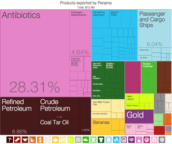
The high levels of Panamanian trade are in large part from the Colón Free Trade Zone, the largest free trade zone in the Western Hemisphere. Last year the zone accounted for 92% of Panama's exports and 64% of its imports, according to an analysis of figures from the Colon zone management and estimates of Panama's trade by the United Nations Economic Commission for Latin America and the Caribbean. Panama's economy is also very much supported by the trade and export of coffee and other agricultural products.
The Bilateral Investment Treaty (BIT) between the governments of the United States and Panama was signed on October 27, 1982. The treaty protects US investment and assists Panama in its efforts to develop its economy by creating conditions more favorable for US private investment and thereby strengthening the development of its private sector. The BIT was the first such treaty signed by the US in the Western Hemisphere.[37] A Panama - United States Trade Promotion Agreement (TPA) was signed in 2007, approved by Panama on July 11, 2007 and by US President Obama on October 21, 2011, and the agreement entered into force on October 31, 2012.[38]
Demographics

Panama had a population of 3,405,813 in May 2010.[39] The CIA World Factbook gives the following statististics for the population: "70% mestizo (mixed Amerindian and white), 14% Black/mulatto, 10% white, and 6% Amerindian".[5] The Amerindian population includes seven indigenous peoples:[40] Ngäbe, Kuna (Guna), Emberá, Buglé, Wounaan, Naso Tjerdi (Teribe), and Bri Bri.
More than half the population lives in the Panama City–Colón metropolitan corridor, which spans several cities. Panama's urban population exceeds 70%, making the country's population the most urbanized in Central America. The 2010 census in Panama classified approximately 12.3% of the nation's population as indigenous. The Amerindian population figure stood at 417,500 individuals in 2010.[41]
The culture, customs, and language of the Panamanians are predominantly Caribbean and Spanish. Spanish is the official and dominant language. About 93% of the population speak Spanish as their first language, though many citizens speak both English and Spanish or native languages, such as Ngäbere.[42] Some new statistics show that as second language, English is spoken by 8%, French by 4% and Arabic by 1%.
Panama, partly owing to its historical reliance on commerce, is an ethnically diverse society. It has considerable populations of Afro-Antillean and Chinese origin. The first Chinese immigrated to Panama from southern China to help build the Panama Railroad in the 19th century. There followed several waves of immigrants whose descendants number around 50,000. Starting in the 1970s, a further 80,000 have immigrated from various parts of China.[43][44]
Afro-Panamanians played a significant role in the creation of the republic. The descendants of the Africans who arrived during the colonial era are intermixed in the general population or live in small Afro-Panamanian communities along the Atlantic Coast and in villages within the Darién jungle. Most of the people in Darien are fishermen or small-scale farmers growing crops such as bananas, rice and coffee as well as raising livestock. Other Afro-Panamanians descend from later migrants from the Caribbean who came to work on railroad-construction projects, commercial agricultural enterprises, and (especially) the canal. Important Afro-Caribbean community areas include towns and cities such as Colón, Cristobal and Balboa, in the former Canal Zone, as well as the Río Abajo area of Panama City. Another region with a large Afro-Caribbean population is the province of Bocas del Toro on the Caribbean coast just south of Costa Rica.[45]
Most of the Panamanian population of West Indian descent owe their presence in the country to the monumental efforts to build the Panama Canal in the late 19th and early 20th centuries. Three-quarters of the 50,000 workers who built the canal were Afro Caribbean migrants from the British West Indies. Thousands of Afro-Caribbean workers were recruited from Jamaica, Barbados and Trinidad.[45]
Panama is second-smallest Spanish-speaking Latin American country in terms of population after Uruguay.
Religion
The government of Panama does not collect statistics on the religious affiliation of citizens, but various sources estimate that 75% to 85% of the population identifies itself as Roman Catholic and 15%–25% as evangelical Christian.[1][46] The Bahá'í Faith community of Panama is estimated at 2.00% of the national population, or about 60,000[47] including about 10% of the Guaymí population.[48]
The Church of Jesus Christ of Latter-day Saints (LDS Church) claim more than 40,000 members.[49] Smaller religious groups include Seventh-day Adventists, Jehovah's Witnesses, Episcopalians with between 7,000 and 10,000 members, Jewish and Muslim communities with approximately 10,000 members each, Hindus, Buddhists, and other Christians.[46] Indigenous religions include Ibeorgun (among Kuna) and Mamatata (among Ngobe).[46] There are also a small number of Rastafarians.[46]
Culture

The culture of Panama derived from European music, art and traditions that were brought over by the Spanish to Panama. Hegemonic forces have created hybrid forms of this by blending African and Native American culture with European culture. For example, the tamborito is a Spanish dance that was blended with African rhythms, themes and dance moves.[50]
Dance is a symbol of the diverse cultures that have coupled in Panama. The local folklore can be experienced through a multitude of festivals, dances and traditions that have been handed down from generation to generation. Local cities host live reggae en español, reggaeton, haitiano (compas), jazz, blues, salsa, reggae, and rock music performances.
Handicraft
Outside Panama City, regional festivals take place throughout the year featuring local musicians and dancers. Another example of Panama's blended culture is reflected in the traditional products, such as woodcarvings, ceremonial masks and pottery, as well as in its architecture, cuisine and festivals. In earlier times, baskets were woven for utilitarian uses, but now many villages rely almost exclusively on the baskets they produce for tourists.
An example of undisturbed, unique culture in Panama is that of the Guna who are known for molas. Mola is the Guna word for blouse, but the term mola has come to mean the elaborate embroidered panels made by Guna women, that make up the front and back of a Guna woman's blouse. They are several layers of cloth, varying in color, that are loosely stitched together, made using an appliqué process referred to as "reverse appliqué".
Holidays and festivities
The Christmas parade, known as El desfile de Navidad, is celebrated in the capital, Panama City. This holiday is celebrated on December 25. The floats in the parade are decorated with the Panamanian colors, and the women dress in dresses called Pollera while the men dress in the traditional Montuno. In addition, the marching band in the parade, consisting of drummers, keeps the crowds entertained. In the city, a big Christmas tree is lit with Christmas lights, and everybody surrounds the tree and sings Christmas carols.[51]
Traditional cuisine
The traditional Panamanian dish for Christmas usually includes chicken tamales, arroz con pollo (chicken and rice), puerca asada, pernil, pavo (turkey), and relleno (stuffing). Bowls of fruits and fruitcake are set out on the tables along with the dishes. Along with these foods and dessert, a traditional drink is served, called Ron Ponche (eggnog), consisting of two cans of condensed milk, three cans of evaporated milk, six eggs, and a half a bottle of rum and nutmeg for some extra flavor.
Traditional clothing
Panamanian men's traditional clothing consists of white cotton shirts, trousers and woven straw hat.
The traditional women's clothing is the pollera. It originated in Spain in the 16th century, and by the early 1800s it was a typical in Panama, worn by women servants, especially wet nurses (De Zarate 5). Later, it was adopted by upper-class women.
A pollera is made of "cambric" or "fine linen" (Baker 177). It is white, and is usually about 13 yards of material.
The original pollera consists of a ruffled blouse worn off the shoulders and a skirt is on the waistline with gold buttons. The skirt is also ruffled, so that when it is lifted up, it looks like a peacock's tail or a mantilla fan. The designs on the skirt and blouse are usually flowers or birds. Two large matching pom poms (mota) are on the front and back, four ribbons hang from the front and back on the waist line, five gold chains (caberstrillos) hang from the neck to the waist, a gold cross or medallion on a black ribbon is worn as a choker, and a silk purse is worn on the waistline. Earrings (zaricillos) are usually gold or coral. Slippers usually match the color of the pollera. Hair is usually worn in a bun, held by three large gold combs that have pearls (tembleques) worn like a crown. Quality pollera can cost up to $10,000, and may take a year to complete.
Today, there are different types of polleras; the pollera de gala consists of a short-sleeved ruffle skirt blouse, two full-length skirts and a petticoat. Girls wear tembleques in their hair. Gold coins and jewelry are added to the outfit. The pollera montuna is a daily dress, with a blouse, a skirt with a solid color, a single gold chain, and pendant earrings and a natural flower in the hair. Instead of an off-the-shoulder blouse is a fitted white jacket with, shoulder pleats, and a flared hem.[52]
Traditional clothing in Panama can be worn in parades, where the females and males do a traditional dance. Females do a gentle sway and twirl their skirts, while the men hold their hats in their hands and dance behind the females.
Literature
According to Professor Rodrigo Miró, the first story about Panama was written by Gonzalo Fernández de Oviedo y Valdés and published as part of the Historia General y Natural de Las Indias in 1535. Some poets and novelists born in Panamá are Manuel María Ayala (1785–1824), Amelia Denis de Icaza (1836–1911), Darío Herrera (1870–1914), Ricardo Miró (1883–1940), Gaspar Octavio Hernández (1893–1918), Demetrio Korsi (1899–1957), Ricardo Bermúdez (1914–2000), Mario Augusto Rodriguez (1917–2008), José María Sánchez (1918–1973), Ramón H. Jurado (1922–1978), Carlos Francisco Changmarín (1922– ), Joaquín Beleño (1922–1988), Tristán Solarte (1924– ), Pedro Rivera (1939– ), Moravia Ochoa López (1941– ), Gloria Guardia (1940– ), Dimas Lidio Pitty (1941– ), Roberto Fernández Iglesias (1941– ), Jarl Ricardo Babot (1946– ), Manuel Orestes Nieto (1951– ), Moisés Pascual (1955– ), Héctor Miguel Collado (1960– ), David Robinson Orobio (1960– ), Katia Chiari (1969– ), Carlos Oriel Wynter Melo (1971– ), José Luis Rodríguez Pittí (1971– ) and Sofía Santim (1982– ).[53]
Sports
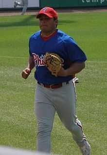
The U.S. influence in Panama can be seen in the country's sports. Baseball is Panama's national sport and the country has regional teams and a national team that represents it in international events. At least 140 Panamanian players have played professional baseball in the United States, more than any other Central American country.[54] Notable players include Bruce Chen, Rod Carew, Mariano Rivera, Carlos Lee, Manny Sanguillén, and Carlos Ruiz.
In boxing, four Panamanians are in the International Boxing Hall of Fame: Roberto Durán, Eusebio Pedroza, Ismael Laguna and Panama Al Brown. Panama presently has two reigning world boxing champions: Guillermo Jones and Anselmo Moreno.
Basketball is popular in Panama, there are regional teams as well as a squad that competes internationally. Among Panama's most prominent basketball players are Rolando Blackman (four-time NBA All-Star) and Harlem Globetrotters' star Kevin Daley. Long jumper Irving Saladino became the first Panamanian Olympic gold medalist in 2008.
Other popular sports include volleyball, taekwondo, soccer, golf, and tennis. A long-distance hiking trail called the TransPanama Trail is being built from Colombia to Costa Rica.
Other non-traditional sports in the country have had great importance such as the triathlon that has captured the attention of many athletes nationwide and the country has hosted international competitions. Flag football has also been growing in popularity in both men and women and with international participation in world of this discipline being among the best teams in the world, the sport was introduced by Americans residing in the Canal Zone for veterans and retirees who even had a festival called the Turkey Ball. Other popular sports are American football, rugby, hockey, softball and other amateur sports including skateboarding, BMX and surfing, because the many beaches of Panama such as Santa Catalina and Venao that have hosted events the likes of ISA World Surfing Games.
In 2012, eight different athletes represented Panama in the London 2012 Olympics. Irving Saladino in Long Jump, Alonso Edward in Track and Field, Andrea Ferris in Track and Field, Diego Castillo in Swimming, and the youngest on the team, Carolena Carstens who was 16 competing in the taekwondo. She was the first representative to compete for Panama in that sport.
Education
Originally, during the 16th century, education in Panama was provided by Jesuit priests. Public education, as a national and governmental institution, began only in 1903. The principles underlying this early education system were that children should receive different types of education in accordance with their social class and therefore the position they were expected to occupy in society.
Public education began in Panama soon after the separation from Colombia in 1903. The first efforts were guided by an extremely paternalistic view of the goals of education, as evidenced in comments made in a 1913 meeting of the First Panamanian Educational Assembly, "The cultural heritage given to the child should be determined by the social position he will or should occupy. For this reason education should be different in accordance with the social class to which the student should be related." This elitist focus changed rapidly under United States influence.[55]
In 2010, it was estimated that 94.1% of the population was literate (94.7% of males and 93.5% of females).[1] Education in Panama is compulsory for the children of age group between 6 and 18. In recent decades, school enrollment at all levels, but especially at upper levels, has increased significantly. Panama used to participate in the PISA exams but due to debts and unsatisfactory exam results is postponing participation until 2018.[56]
See also
- Foreign relations of Panama
- Index of Panama-related articles
- International rankings of Panama
- List of Panamanians
- Outline of Panama
References
- ↑ 1.0 1.1 1.2 "The World Factbook". Retrieved October 25, 2014.
- ↑ 2.0 2.1 2.2 2.3 "World Economic Outlook Database: Panama". International Monetary Fund. October 2014. Retrieved 3 January 2015.
- ↑ "Gini Index". World Bank. Retrieved January 3, 2015.
- ↑ "2014 Human Development Report Summary" (PDF). United Nations Development Programme. 2014. pp. 21–25. Retrieved 27 July 2014.
- ↑ 5.0 5.1 5.2 "Panama". CIA – The World Factbook. Retrieved December 23, 2010.
- ↑ "CIA – The World Factbook – Field Listing – GDP (official exchange rate)". CIA. Retrieved January 12, 2010. And: "CIA – The World Factbook – Country Comparison – National product". CIA. Retrieved January 12, 2010. See also: IMF.org
- ↑ UNDP Human Development Report 2010. Table 1: Human development index 2010 and its components (PDF). UNDP. p. 144. Retrieved November 6, 2010.
- ↑ "Country profile: Panama". BBC News. June 30, 2010.
- ↑ "Origen del Nombre Panamá". República de Panamá. Retrieved July 25, 2010.
- ↑ Austin Alchon, Suzanne (2003). A pest in the land: new world epidemics in a global perspective. University of New Mexico Press. pp. 67–74. ISBN 0-8263-2871-7.
- ↑ Mayo, J. (2004). La Industria prehispánica de conchas marinas en 'Gran Coclé', Panamá. Diss. U Complutense de Madrid, pp. 9–10.
- ↑ Piperno, D. R. (1984). The Application of Phytolith Analysis to the Reconstruction of Plant Subsistence and Environments in Prehistoric Panama. Dissertation, Temple University. Philadelphia, vol. 8 pp. 21–43.
- ↑ Hays, J. N. (2005). Epidemics and pandemics: their impacts on human history, ABC-CLIO, pp. 82–83, ISBN 1-85109-658-2
- ↑ Pike, Ruth (2007). "Black Rebels: Cimarrons in Sixteenth Century Panama". The Americas 64 (2): 243–66. doi:10.1353/tam.2007.0161.
- ↑ "The Darien Scheme – The Fall of Scotland", Historic UK
- ↑ "The 1903 Treaty and Qualified Independence". U.S. Library of Congress. 2009. Retrieved 2009-05-01.
- ↑ 17.0 17.1 17.2 17.3 17.4 17.5 Pizzurno Gelós, Patricia and Celestino Andrés Araúz (1996) Estudios sobre el Panamá Republicano (1903–1989). Colombia: Manfer S.A.
- ↑ Pizzurno Gelós, Patricia and Celestino Andrés Araúz (1996) Estudios sobre el Panamá Republicano (1903–1989). Colombia: Manfer S.A., p. 529.
- ↑ Mon Pinzón, Ramón Arturo (1979). Historia de la Migración China Durante la Construcción del Ferrocarril de Panamá. Masters Thesis. México: El Colegio de México.
- ↑ Zárate, Abdiel (November 9, 2003). "Muertos y desaparecidos durante la época militar." Extra-centennial issue of La Prensa.
- ↑ 21.0 21.1 Acosta, Coleen (October 24, 2008). "Iraq: a Lesson from Panama Imperialism and Struggle for Sovereignty". Journals of the Stanford Course on Prejudice and Poverty.
- ↑ New York Times. A Transcript of President Bush's Address on the Decision to Use Force, December 21, 1989. Web. Jan. 2, 2008.
- ↑ John Pike. "Operation Just Cause". Retrieved October 25, 2014.
- ↑ "Panama". Human Rights Watch World Report 1989. hrw.org
- ↑ Pastor, Robert A. (2001) Exiting the Whirlpool: U.S. Foreign Policy Toward Latin America and the Caribbean, p. 96, ISBN 0813338115.
- ↑ "Panama Country Profile". BBC. June 30, 2010. Retrieved July 25, 2010.
- ↑ CEPAL – Naciones Unidas (March 22, 2010). "Ranking 2009 de Actividad portuaria de contenedores en América Latina y el Caribe". Eclac.cl. Retrieved December 23, 2010.
- ↑ "Port of Balboa". World Port Source. Retrieved December 23, 2010.
- ↑ "Our History". Petroterminal.com. February 9, 1997. Retrieved December 23, 2010.
- ↑ Tycoon elected Panama's president Retrieved July 25, 2010
- ↑ "Latin Business Chronicle". Latin Business Chronicle. October 7, 2009. Retrieved June 26, 2010.
- ↑ "Panama". World Bank. April 15, 2010. Retrieved July 25, 2010.
- ↑ "Poverty headcount ratio at $1.25 a day (PPP) (% of population)". World Bank. Retrieved October 25, 2013.
- ↑ Oancea, Dan (January 2009). Mining in Central America. Magazine.mining.com, pp. 10–12.
- ↑ Redfrogbeach.com, Isla Palenque, examples
- ↑ "CEPAL.org" (PDF). Retrieved June 26, 2010.
- ↑ "List of BITs currently in effect". Tcc.export.gov. Retrieved June 26, 2010.
- ↑ "The United States-Panama Trade Promotion Agreement (TPA)". trade.gov. Retrieved October 31, 2012.
- ↑ INEC. National Census 2010. censos2010.gob.pa
- ↑ "Update 2011 – Panama". Iwgia.org. Retrieved 2013-06-15.
- ↑ "Corredor Transístmico Panamá -Colón". Retrieved August 5, 2010.
- ↑ "Panama". Retrieved August 5, 2010.
- ↑ Jackson, Eric (May 2004). "Panama's Chinese community celebrates a birthday, meets new challenges". The Panama News 10 (9). Retrieved November 7, 2007.
- ↑ "President Chen's State Visit to Panama". Government Information Office, Republic of China. October 2003. Archived from the original on August 14, 2007. Retrieved November 7, 2007.
- ↑ 45.0 45.1 "Panama : Afro-Panamanians". Minority Rights Group International. Retrieved June 26, 2010.
- ↑ 46.0 46.1 46.2 46.3 International Religious Freedom Report 2007: Panama. United States Bureau of Democracy, Human Rights and Labor (September 14, 2007). This article incorporates text from this source, which is in the public domain.
- ↑ "Panama". WCC > Member churches > Regions > Latin America > Panama. World Council of Churches. January 1, 2006. Retrieved July 1, 2008.
- ↑ International Community, Bahá'í (October–December 1994). "In Panama, some Guaymis blaze a new path". One Country 1994 (October–December).
- ↑ Panama. LDS Newsroom. Retrieved December 13, 2008
- ↑ "The online almanac of Panama culture with travel links". Panama Culture. Retrieved December 23, 2010.
- ↑ "Panama". Bureau of Western Hemisphere Affairs. June 23, 2010.
- ↑ Celebremos Panama!. Discovery Theater and Smithonian Latino Center
- ↑ Panamanian Literature
- ↑ "Baseball in Panama". The Baseball Cube. Retrieved December 23, 2010.
- ↑ Kluck, Patricia. "Education". Panama: A country study (Sandra W. Meditz and Dennis M. Hanratty, ed.). Federal Research Division of the Library of Congress of the USA (December 1987).
 This article incorporates text from this source, which is in the public domain.
 - ↑ http://impresa.prensa.com/panorama/Panama-pruebas-Pisa_0_4006849352.html
Further reading
- Buckley, Kevin, Panama, Touchstone, 1992. ISBN 0-671-77876-5
- Diaz Espino, Ovidio, How Wall Street Created a Nation, Four Walls Eight Windows, 2001. ISBN 1-56858-196-3
- Harding, Robert C., The History of Panama, Greenwood Publishing, 2006.
- Harding, Robert C., Military Foundations of Panamanian Politics, Transaction Publishers, 2001. ISBN 0-393-02696-5
- Joster, R.M. and Sanchez, Guillermo, In the Time of the Tyrants, Panama: 1968–1990, W.W. Norton & Company, 1990.
- Mellander, Gustavo A.; Nelly Maldonado Mellander (1999). Charles Edward Magoon: The Panama Years. Río Piedras, Puerto Rico: Editorial Plaza Mayor. ISBN 1-56328-155-4. OCLC 42970390.
- Mellander, Gustavo A. (1971). The United States in Panamanian Politics: The Intriguing Formative Years. Danville, Ill.: Interstate Publishers. OCLC 138568.
- Porras, Ana Elena, Cultura de la Interoceanidad: Narrativas de Identidad Nacional de Panama (1990–2002), Editorial Carlos Manuel Gasteazoro, 2005. ISBN 9962-53-131-4
- Serrano, Damaris, La Nación Panamena en sus Espacios: Cultura Popular, Resistencia y Globalización, Editorial Mariano Arosemena, 2005. ISBN 9962-659-01-9
- Villarreal, Melquiades, Esperanza o Realidad: Fronteras de la Identidad Panamena, Editorial Mariano Arosemena, 2004. ISBN 9962-601-80-0
- Weeks, John and Gunson, Phil, Panama. Made in the USA, 1992. ISBN 978-0-906156-55-1
External links
- Government of Panama
- Panama at DMOZ
- Panama from UCB Libraries GovPubs
- Panama entry at The World Factbook
- Panama from the BBC News
-
 Wikimedia Atlas of Panama
| ||||||||||||||||||||||||||||||||||||||
| ||||||||||||||||||||||||||||||||||||||||||||||||||||||||||||
| |||||||||||||||||||||||||||||||||||||||
