Palmyra Municipal Airport
| Palmyra Municipal Airport | |||||||||||
|---|---|---|---|---|---|---|---|---|---|---|---|
 Airport sign | |||||||||||
| IATA: none – ICAO: none – FAA LID: 88C | |||||||||||
| Summary | |||||||||||
| Airport type | Public | ||||||||||
| Owner/Operator | Town of Palmyra | ||||||||||
| Serves | Palmyra, Wisconsin | ||||||||||
| Elevation AMSL | 851 ft / 259 m | ||||||||||
| Coordinates | 42°53′01″N 088°35′51″W / 42.88361°N 88.59750°WCoordinates: 42°53′01″N 088°35′51″W / 42.88361°N 88.59750°W | ||||||||||
| Map | |||||||||||
 88C Location of airport in Wisconsin | |||||||||||
| Runways | |||||||||||
| |||||||||||
| Statistics (2012) | |||||||||||
| |||||||||||
Palmyra Municipal Airport[1][2] (FAA LID: 88C) is a public use airport in Jefferson County, Wisconsin, United States.[1] Owned by and located in the Town of Palmyra, it is also known as Palmyra Airport[3] or Town of Palmyra Airport. It is included in the National Plan of Integrated Airport Systems for 2011–2015, which categorized it as a general aviation facility.[4]
History
Palmyra Municipal Airport has been owned and operated by the Town of Palmyra since 1948.[5][6]
In 2013, the Village of Palmyra proposed annexation of more than 740 acres of property, primarily agricultural land, but also including the Town of Palmyra's town hall and the Palmyra Municipal Airport.[5][7] The Town of Palmyra is challenging the village's annexation attempt.[6]
Facilities and aircraft
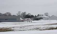
The airport covers an area of 79 acres (32 ha) at an elevation of 851 feet (259 m) above mean sea level. It has one runway designated 9/27 with a turf surface measuring 2,800 by 200 feet (853 x 61 m).[1]
For the 12-month period ending April 10, 2012, the airport had 14,000 general aviation aircraft operations, an average of 38 per day. At that time there were 68 aircraft based at this airport: 98.5% single-engine and 1.5% multi-engine.[1]
References
- ↑ 1.0 1.1 1.2 1.3 1.4 FAA Airport Master Record for 88C (Form 5010 PDF). Federal Aviation Administration. Effective November 15, 2012.
- ↑ "Palmyra Municipal (88C)" (PDF). Wisconsin Department of Transportation. Retrieved May 11, 2013.
- ↑ "History". The Palmyra Flying Club. Retrieved May 11, 2013.
- ↑ "2011–2015 NPIAS Report, Appendix A" (PDF, 2.03 MB). National Plan of Integrated Airport Systems. Federal Aviation Administration. October 4, 2010.
- ↑ 5.0 5.1 Whisner, Ryan (January 23, 2013). "Town of Palmyra likely to continue fighting annexation". Daily Union.
- ↑ 6.0 6.1 Whisner, Ryan (March 12, 2013). "Palmyra town board to legally challenge annexation". Daily Union.
- ↑ Massey, Jim (January 23, 2013). "Land squabble: Village, town, agriculture officials debate annexation plan". The Country Today (Eau Claire Press Company).
External links
| Wikimedia Commons has media related to Town of Palmyra Airport. |
- Aerial image from USGS The National Map
- Resources for this airport:
- FAA airport information for 88C
- AirNav airport information for 88C
- FlightAware airport information and live flight tracker
- SkyVector aeronautical chart for 88C