Palín, Escuintla
| Palín | |
|---|---|
| Municipality | |
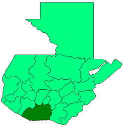
 Palín Location in Guatemala | |
| Coordinates: 14°24′14″N 90°41′55″W / 14.40389°N 90.69861°WCoordinates: 14°24′14″N 90°41′55″W / 14.40389°N 90.69861°W | |
| Country |
|
| Department |
|
| Municipality | Palín |
| Government | |
| • Type | Municipal |
| Area | |
| • Municipality | 88 km2 (34 sq mi) |
| Elevation | 1,147 m (3,763 ft) |
| Population (census 2002)[1] | |
| • Municipality | 36,756 |
| • Density | 420/km2 (1,100/sq mi) |
| • Urban | 24,680 |
| • Ethnicities | Ladino, Poqomam |
| • Religions | Roman Catholicism, Evangelicalism |
| Climate | Aw |
| Website | http://www.munidepalin.com/ |
Palín is a municipality in the Escuintla department of Guatemala. The town of Palín, which is the municipal seat, is located on the foothills of the Sierra Madre volcanic chain, south of Guatemala-City.
Palín was formally established as a municipality in 1935.[2]
References
- ↑ "XI Censo Nacional de Poblacion y VI de Habitación (Censo 2002)". Insituto Nacional de Estadística (INE). 2002.
- ↑ "Municipalidad de Palín - Historia". Municipalidad de Palín. 2007.
External links
| |||||||||||||