Oud-Turnhout
| Oud-Turnhout | |||
|---|---|---|---|
| Municipality | |||
 | |||
| |||
 Oud-Turnhout Location in Belgium | |||
|
Location of Oud-Turnhout in the province of Antwerp 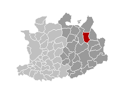 | |||
| Coordinates: 51°19′N 04°59′E / 51.317°N 4.983°ECoordinates: 51°19′N 04°59′E / 51.317°N 4.983°E | |||
| Country | Belgium | ||
| Community | Flemish Community | ||
| Region | Flemish Region | ||
| Province | Antwerp | ||
| Arrondissement | Turnhout | ||
| Government | |||
| • Mayor | Jef Kersemans (CD&V) | ||
| • Governing party/ies | CD&V, Groen!, VLD | ||
| Area | |||
| • Total | 38.80 km2 (14.98 sq mi) | ||
| Population (1 January 2013)[1] | |||
| • Total | 12,905 | ||
| • Density | 330/km2 (860/sq mi) | ||
| Postal codes | 2360 | ||
| Area codes | 014 | ||
| Website | www.oud-turnhout.be | ||

Oud-Turnhout (Dutch pronunciation: [ˌʌu̯t ˈtʏrnɦʌu̯t]) is a municipality located in the Belgian province of Antwerp. The municipality only comprises the town of Oud-Turnhout proper. On January 1, 2006 Oud-Turnhout had a total population of 12,653. The total area is 38.80 km² which gives a population density of 326 inhabitants per km².
There are 3 parishes: Zwaneven in the east, St. Bavo in the centre and Oosthoven in the North. Zwaneven is in the upmarket residential area referred to as "De Lint", where many Dutch people live, fleeing high taxes and strict building regulations in the Netherlands. Houses here are easily priced €750,000 and over.
Attractions
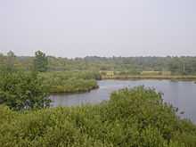
In the northern part of the village "The Liereman" is one of Flanders' largest nature reserves.
Famous inhabitants
- Karel Van Miert, politician, European Commissioner
- Margriet Hermans, Politician and Singer
References
- ↑ Population per municipality on 1 January 2013 (XLS; 607.5 KB)
External links
 Media related to Oud-Turnhout at Wikimedia Commons
- Official website (Dutch)
 |
Ravels | | ||
| Turnhout | |
Arendonk | ||
| ||||
| | ||||
| Kasterlee | Retie |
| ||||||||||||||||