Otterburn, Northumberland
| Otterburn | |
 Otterburn |
|
 Otterburn |
|
| Population | ~500 |
|---|---|
| OS grid reference | NY885935 |
| Unitary authority | Northumberland |
| Ceremonial county | Northumberland |
| Region | North East |
| Country | England |
| Sovereign state | United Kingdom |
| Post town | NEWCASTLE UPON TYNE |
| Postcode district | NE19 |
| Dialling code | 01830 |
| Police | Northumbria |
| Fire | Northumberland |
| Ambulance | North East |
| EU Parliament | North East England |
| UK Parliament | Hexham |
|
|
Coordinates: 55°14′10″N 2°10′55″W / 55.236°N 2.182°W
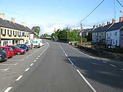
Otterburn is a small village in Northumberland, England, 31 miles (50 km) northwest of Newcastle Upon Tyne on the banks of the River Rede, near the confluence of the Otter Burn, from which the village derives its name. It lies within the Cheviot Hills about 16 miles (26 km) from the Scottish border. The parish of Otterburn is at the heart of Redesdale, a remote Northumbrian upland valley steeped in history and blessed with natural beauty.
History
Otterburn was the site of a major battle in 1388 between English and Scottish armies. The engagement, in which the Scots took Sir Henry Percy captive, is the subject of the English ballad Chevy Chase and the Scots ballad Otterburn.
The battle of Otterburn ended in an English rout. Despite James Douglas, 2nd Earl of Douglas being killed, Percy was captured and over a thousand of the English were taken, left dead on the field or slain as they fled. The dead were carried to Elsdon church, 3 miles (4.8 km) from Otterburn, where they were buried.
Governance
Otterburn is in the parliamentary constituency of Hexham.
Economy
Today, the village is noted for its proximity to the Otterburn Training Area, one of the UK’s largest army training ranges at some 60,000 acres (240 km2).
Landmarks
- Otterburn Hall, now a hotel, is a Neo-Elizabethan structure, built in 1870 for Lord James Douglas, and which is now currently shut.
- The Percy Arms Hotel, in the centre of the village, closed in 2012.
- St John the Evangelist's Church, Otterburn
- Otterburn Mill is now a retail outlet.
- Otterburn Tower, changed name to Otterburn Castle, now a hotel, was built in 1830 incorporating part of an eighteenth-century house, which itself may have incorporated the thirteenth-century tower house which originally stood on the site.[1]
- The "Percy Cross" stands in the midst of a small plantation, a mile north of the village. Near this peaceful spot, on an August evening in 1388, an English army of 8,000 men followed Sir Henry Percy into battle against the Scots, led by James Douglas, 2nd Earl of Douglas.
Notable people
References
External links
| Wikimedia Commons has media related to Otterburn, Northumberland. |
- http://bellingham.journallive.co.uk/vids-pics/your-photos-return-to-otterburn.html#239588
- http://www.parish-council.com/Otterburn/index.asp
- Otterburn Tower - Northumbrian country house founded by a cousin of William the Conqueror in 1086
- The village of Otterburn on UKVillage