Osceola Township, Clarke County, Iowa
| Osceola Township | |
|---|---|
| Township | |
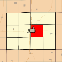 Location in Clarke County | |
| Coordinates: 41°01′54″N 093°43′57″W / 41.03167°N 93.73250°WCoordinates: 41°01′54″N 093°43′57″W / 41.03167°N 93.73250°W | |
| Country |
|
| State |
|
| County | Clarke |
| Area | |
| • Total | 32.19 sq mi (83.38 km2) |
| • Land | 32.16 sq mi (83.29 km2) |
| • Water | 0.04 sq mi (0.09 km2) 0.11% |
| Elevation | 1,102 ft (336 m) |
| Population (2000) | |
| • Total | 481 |
| • Density | 15/sq mi (5.8/km2) |
| GNIS feature ID | 0468478 |
Osceola Township is a township in Clarke County, Iowa, USA. As of the 2000 census, its population was 481.
Geography
Osceola Township covers an area of 32.19 square miles (83.4 km2) and contains no incorporated settlements. According to the USGS, it contains one cemetery, Maple Hill.
Transportation
Osceola Township contains one airport or landing strip, Osceola Municipal Airport.
References
External links
| |||||||||||||||||