Orrstown, Pennsylvania
| Orrstown, Pennsylvania | |
|---|---|
| Borough | |
 | |
| Coordinates: 40°03′31″N 77°36′33″W / 40.05861°N 77.60917°WCoordinates: 40°03′31″N 77°36′33″W / 40.05861°N 77.60917°W | |
| Country | United States |
| State | Pennsylvania |
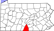
| County | Franklin |
| Settled | 1833 |
| Government | |
| • Type | Borough Council |
| • Mayor | Michael Shawn Richardson |
| Area | |
| • Total | 0.1 sq mi (0.3 km2) |
| Elevation | 686 ft (209 m) |
| Population (2000) | |
| • Total | 231 |
| • Density | 3,714.2/sq mi (1,434.1/km2) |
| Time zone | Eastern (EST) (UTC-5) |
| • Summer (DST) | EDT (UTC-4) |
| Zip code | 17244 |
| Area code(s) | 717 |
Orrstown is a borough in Franklin County, Pennsylvania, United States. The population was 231 at the 2000 census.
History
Orrstown was founded in 1833 by the Orr brothers. Orrstown (P.O.) is situated in Southampton township in Franklin County, on the old State road from Shippensburg to Strasburg, five miles west of the former places. Settlements were made in that neighborhood as early as the year 1738, and for many years prior to the completion of the Pennsylvania railroad, down to within a very few years past. a very large number of horses and cattle were annually passed along the State road from the great west to the markets of the east. The town, which is one of the most beautiful in the county was laid out in 1833, by John, William and James Orr. Sons of Scot-Irish Thomas Orr and Martha Breckenridge of the Breckenridge-Culbertson clan of “Culbertson Row”. They called it at first Southampton, after the township; but in 1835, when application was made for a post office of be called Southampton, the Post Office Department refused the grant for the reason that there was already an office of that name, the Hon. George Chambers, who was then in Congress, name the office “Orrstown” and the name has since be attached to the town. It was incorporated as a borough on May 3, 1847, and now in 1878 the town contains one hotel, two stores, one carriage factory, and four churches; one Lutheran, one Presbyterian, one United Brethren and one Winebrennarin. The populations is three hundred and twenty-five.
Source: Historical Sketch of Franklin County, Penn. I.H. M’Cauley, 1878
Geography
Orrstown is located at 40°3′31″N 77°36′33″W / 40.05861°N 77.60917°W (40.058482, -77.609213).[1]
According to the United States Census Bureau, the borough has a total area of 0.1 square miles (0.26 km2), all of it land.
Demographics
| Historical population | |||
|---|---|---|---|
| Census | Pop. | %± | |
| 1910 | 247 | — | |
| 1920 | 217 | −12.1% | |
| 1930 | 211 | −2.8% | |
| 1940 | 294 | 39.3% | |
| 1950 | 295 | 0.3% | |
| 1960 | 318 | 7.8% | |
| 1970 | 262 | −17.6% | |
| 1980 | 247 | −5.7% | |
| 1990 | 220 | −10.9% | |
| 2000 | 231 | 5.0% | |
| 2010 | 262 | 13.4% | |
| Est. 2012 | 263 | 0.4% | |
| Sources:[2][3][4] | |||
As of the census[3] of 2000, there were 231 people, 79 households, and 59 families residing in the borough. The population density was 3,714.2 people per square mile (1,486.5/km²). There were 85 housing units at an average density of 1,366.7 per square mile (547.0/km²). The racial makeup of the borough was 99.57% White, 0.43% from other races. Hispanic or Latino of any race were 0.43% of the population.
There were 79 households out of which 32.9% had children under the age of 18 living with them, 65.8% were married couples living together, 3.8% had a female householder with no husband present, and 24.1% were non-families. 17.7% of all households were made up of individuals and 8.9% had someone living alone who was 65 years of age or older. The average household size was 2.67 and the average family size was 2.98.
In the borough the population was spread out with 24.7% under the age of 18, 9.1% from 18 to 24, 27.7% from 25 to 44, 18.6% from 45 to 64, and 19.9% who were 65 years of age or older. The median age was 38 years. For every 100 females there were 958 males. For every 100 females age 18 and over, there were 851 males.
The median income for a household in the borough was $38,542, and the median income for a family was $39,583. Males had a median income of $27,188 versus $21,250 for females. The per capita income for the borough was $14,346. None of the families and 1.4% of the population were living below the poverty line.
References
- ↑ "US Gazetteer files: 2010, 2000, and 1990". United States Census Bureau. 2011-02-12. Retrieved 2011-04-23.
- ↑ "Census of Population and Housing". U.S. Census Bureau. Retrieved 11 December 2013.
- ↑ 3.0 3.1 "American FactFinder". United States Census Bureau. Retrieved 2008-01-31.
- ↑ "Incorporated Places and Minor Civil Divisions Datasets: Subcounty Resident Population Estimates: April 1, 2010 to July 1, 2012". Population Estimates. U.S. Census Bureau. Retrieved 11 December 2013.
| |||||||||||||||||||||||||||||