Orocué
| Orocue | ||
|---|---|---|
| Municipality and town | ||
| ||
| Nickname(s): San Miguel del Macuco, Caño San Miguel | ||
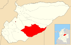 Location of the municipality and town of Orocue in the Casanare Department of Colombia | ||
| Coordinates: 1°48′34″N 72°45′37″W / 1.80944°N 72.76028°W | ||
| Country |
| |
| Region | Orinoquía Region | |
| Department | Casanare Department | |
| Area | ||
| • Municipality and town | 41.777 km2 (16.130 sq mi) | |
| • Urban | 8.24 km2 (3.18 sq mi) | |
| Elevation | 187 m (614 ft) | |
| Population (2012) | ||
| • Municipality and town | 8,102 | |
| Time zone | Colombia Standard Time (UTC-5) | |
| Website | http://www.orocue-casanare.gov.co | |
| [1][2] | ||
.svg.png)
Orocue is a town and municipality in the Department of Casanare, Colombia, located on the shore of the Meta River. Historically, it went by the name San Miguel del Macuco.[3]
It is located 180 km from Yopal, and 546 km from Bogotá.[4]
See also
References
- ↑ Municipio de Orocué
- ↑ "Orocue Map". Colombia Google Satellite Maps. Retrieved 2014-05-24.
- ↑ "A Study of the Saliba Language". World Digital Library. Retrieved 24 April 2013.
- ↑ Municipio de Orocué
External links
- Municipio de Orocué - Official website
| ||||||||
Coordinates: 4°47′39″N 71°20′24″W / 4.79417°N 71.34°W