Orleans Levee Board
From 1890 through 2006, the Orleans Levee Board was the body in charge of supervising the levee and floodwall system in Orleans Parish, Louisiana, which is intended to protect the city of New Orleans from flooding. The role included requirements definition prior to construction, operation, and ongoing maintenance. Over the years the Board also took on various activities relating to land use on and around the levees.
In the wake of the catastrophic engineering failures sustained by New Orleans' levee and floodwall system in the aftermath of Hurricane Katrina's landfall, two new regional flood protection authorities were created to supersede multiple parochial levee boards, including Orleans Parish's Levee Board. Most of the Orleans Levee District now falls under the jurisdiction of the Southeast Louisiana Flood Protection Authority - East, charged with the oversight of all flood-protection infrastructure for Greater New Orleans on the East Bank of the Mississippi River. The Southeast Louisiana Flood Protection Authority - West possesses the same metro-wide jurisdiction for the West Bank of the Mississippi, and it includes that portion of the Orleans Levee District on the West Bank (i.e., Algiers).
Until the end of 2006, the Orleans Levee Board was a major governmental entity which functioned independently of municipal government in and around Orleans Parish. (Orleans Parish is coextensive with the city of New Orleans; their boundaries are one and the same). The purpose of the agency governed by the Orleans Levee Board, the Orleans Levee District, was to protect New Orleans from flooding, and to protect and operate the equipment placed and assigned for that purpose. Starting in the 1920s, the Board undertook a massive flood-protection initiative involving the construction of a stepped seawall several hundred feet north of a portion of the existing south shore of Lake Pontchartrain. The intervening area was filled to several feet above sea level and was to serve as a "super levee" protecting the city from the Lake's storm surge.
This "lakefill" land-reclamation project was ultimately developed to include Lakeshore Drive, the residential subdivisions of Lakeshore, Lake Vista, Lake Terrace, and Lake Oaks; the principal campus of the University of New Orleans ("UNO")and the UNO Research & Technology Park; the New Orleans Lakefront Airport; hundreds of acres of public parks; and a number of commercial areas. This project resulted in the Orleans Levee Board's deep engagement in land development, long-term leases, green space maintenance, marina operation and, after the state legalized gaming in 1992, casino gambling.[1] Such activities led critics of the Board to accuse its members of being more concerned with lucrative subsidiary activities than with their Board's primary assigned task (flood protection).
History
The Orleans Levee District was created by the Louisiana legislature in 1890 for the purpose of protecting the low-lying city of New Orleans from floods. At the time, communities along the Mississippi River were largely in charge of creating their own levees to protect themselves, as no unified levee system existed. Most neighboring parishes had (and some still have) similar parochial levee boards.
In 1924, the state legislature authorized the levee district's Board of Commissioners, or Orleans Levee Board (O.L.B.), to acquire 33,000 acres (130 km²) of land on the east bank of the Mississippi River about 50 miles (80 km) south of New Orleans in order to build the Bohemia Spillway between the River and the Gulf of Mexico. (1924 La. Acts 99). Approximately half of this land was public property transferred from the state; the other half was either expropriated, or purchased under threat of expropriation, from private owners according to a legal finding. (1928 La. Acts 246; 1942 La. Acts 311).[2]
In the aftermath of the Great Mississippi Flood of 1927, the U.S. Congress gave the United States Army Corps of Engineers supervision and control over the design and construction of flood-control infrastructure throughout the Mississippi River Valley.
In 1934, New Orleans Lakefront Airport opened on land dredged from Lake Pontchartrain by the Levee Board, part of a larger "lakefill" land-reclamation project initiated to construct a super levee for the protection of the northern perimeter of the city. The airport was originally named "Shushan Airport" after Orleans Levee Board president Abraham Lazar Shushan; it was renamed "New Orleans Airport" after Shushan's indictment for corruption in the Louisiana Scandals of the late 1930s.
Governor Jimmie Davis, in his second term from 1960 to 1964, named the New Orleans attorney Gerald J. Gallinghouse as the president of the levee board. In that capacity, Gallinghouse delivered more than 300 speeches warning of the need to be prepared for weather disasters, another of which was on its way, Hurricane Betsy.[3]
After Hurricane Betsy in 1965, Congress ordered the U.S. Army Corps of Engineers henceforth to design and build flood protection in the Lake Pontchartrain and Vicinity Hurricane Protection Project. The O.L.B. became the local sponsor, and its duties regarding flood protection were now limited to collecting its 30% cost-share for project design and construction and maintaining the completed structures. Despite Congress’s mandate that the Corps now had the authority to design/build flood protection, the O.L.B. still retained extensive assets which had to be managed.
A 2002 lawsuit detailed the Orleans Levee Board's considerable independent financial means.
From the Levee Board's Legal Statement at trial:[4]
- "With regard to the more general question of the levee district's budget, the Orleans Levee District receives very little funding from the state. The levee district generates its own revenues from the Lakefront Airport, a casino, leases of property, fees from boat slips and marinas, and taxes. The district also receives income from various investment accounts currently worth $57 million. The levee board does not dispute these facts. At oral argument, counsel for the levee board pointed out that the district receives some state funds, even though they are usually in the form of capital outlays dedicated to specific projects. Because the state funds are already earmarked for other purposes, the state monies cannot be used to pay a judgment against the levee district. See Hudson, 174 F.3d at 688-89."
Orleans Levee Board and Hurricane Katrina
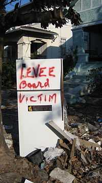
On Tuesday, August 30, 2005, the Orleans Levee Board was at the center of the greatest crisis ever to face the city of New Orleans when, in the aftermath of Hurricane Katrina, multiple levee and floodwall breaches in the Industrial Canal, 17th Street Canal, and London Avenue Canal resulted in the flooding of some 80% of the city. The flood is believed to have caused over 1,600 deaths; destroyed or severely damaged homes, businesses, and property in the majority of the city; and contributed to the emergence of lawlessness, looting, and murder within New Orleans in the days afterward.
Investigations after the disaster revealed that the design of the levee and floodwall system, built under contract and overseen by the U.S. Army Corps of Engineers, had profoundly-inadequate design specifications.
Governmental reform
After Katrina and the levee failures, the O.L.B. was vilified. The immediate prevailing position was that the U.S. Army Corps of Engineers, the federal sponsor, had been “forced to partner” with local politically-appointed officials who had no engineering experience and who were not engaged in the important business of flood protection. There were calls for the elimination of the Orleans Levee Board and other local and regional boards.
During a special session of the Louisiana Legislature, a bill submitted by Sen. Walter Boasso (D-Arabi) was passed into law, which consolidated the levee boards of various parishes within Greater New Orleans. The law created two new regional levee boards, Southeast Louisiana Flood Protection Authority-East and Southeast Louisiana Flood Protection Authority-West, separated by the Mississippi River. The Orleans Levee Board ceased to exist on January 1, 2007. The new regional flood-protection authorities assumed control of the Board's flood-protection infrastructure.
Lakefront Airport, the marinas (except for the city-owned Municipal Yacht Harbor), Lakeshore Drive, and the lakefront park system (except for West End Park, administered by New Orleans' Parks and Parkways Department) are now operated and maintained by the Louisiana State Division of Administration Non-Flood Protection Asset Management Authority.
References
- ↑ "?".
- ↑ "?".
- ↑ "Gerald Joseph Gallinghouse". New Orleans Times-Picayune. Retrieved June 29, 2013.
- ↑ "?".