Oregon Route 51
| ||||
|---|---|---|---|---|
 | ||||
| Route information | ||||
| Maintained by ODOT | ||||
| Length: | 8.70 mi (14.00 km) | |||
| Existed: | 1932 – present | |||
| Major junctions | ||||
| South end: |
| |||
| North end: |
| |||
| Highway system | ||||
| ||||

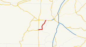
Oregon Route 51 is an Oregon state highway running between Monmouth, Oregon and an intersection with Oregon Route 22 west of Salem. It encompasses the Independence Highway No. 193 (see Oregon highways and routes), and the Monmouth-Independence Highway No. 43. The route lies completely within Polk County. The Independence Highway previously continued south to US 20.
Route description
OR 51 starts, at its southern terminus, in the city of Monmouth, at an intersection with Oregon Route 99W. It heads due east from there for approximately 2½ miles, reaching the neighboring city of Independence. In Independence, it turns north, running parallel to the Willamette River, and continues for 6 miles (9.7 km). OR 51 terminates at an intersection with OR 22 near Brunks Corner.
While no significant improvements are planned to OR 51 itself; a proposed project to improve OR 22 includes conversion of the (notoriously dangerous) intersection between OR 51 and OR 22 into a grade-separated interchange.[1]
Major intersections
- Note: OR 51 uses several different highways (see Oregon highways and routes); the milepoint column shows mileage along these highways, not adjusted for equations, with the highway number in front.
The entire route is in Polk County.
| Location | mi[2] | km | Destinations | Notes | |
|---|---|---|---|---|---|
| Monmouth | 0.00 | 0.00 | |||
| Independence | 2.35 6.34 | 3.78 10.20 | South Main Street – Buena Vista, Albany | ||
| 0.00 | 0.00 | ||||
| 1.000 mi = 1.609 km; 1.000 km = 0.621 mi | |||||
References
- ↑ Project 22, Polk County, Oregon
- ↑ Oregon Department of Transportation, Public Road Inventory (primarily the Digital Video Log), accessed March 2008