Oosterbeek
| Oosterbeek | |
|---|---|
| Coordinates: 51°59′5″N 5°50′40″E / 51.98472°N 5.84444°E | |
| Country | Netherlands |
| Province | Gelderland |
| Municipality | Renkum |
| Population (1 January 2008) | 11.138[1] |
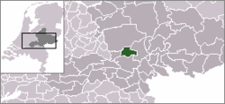
Oosterbeek is a village in the eastern Netherlands. It is located in the municipality of Renkum, Gelderland, about 5 km west of Arnhem.
The oldest part of the village of Oosterbeek is the Benedendorp (Lower Village), on the northern bank of the river, the Lower Rhine, a branch of the Rhine.[2] Parts of the church now known as the Hervormde Kerk (Reformed Church) date back to the second half of the 10th century.
In the 19th century several mansions were built on the higher ground to the north of the old village, such as De Hemelse Berg (destroyed in 1944) and Hartenstein. The construction of smaller buildings in the same area eventually led to the Bovendorp (Upper Village).
Today, Oosterbeek is probably best known for being involved in and heavily damaged during the September 1944 Battle of Arnhem. General Urquhart had his headquarters in the aforementioned Hartenstein, which is now home to the Airborne Museum. To the north of the built-up area lies the Arnhem Oosterbeek War Cemetery.
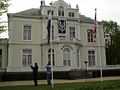
In Oosterbeek is also the location of Hotel de Bilderberg, where the Bilderberg Group first met in 1954.
Oosterbeek was a separate municipality until 1818, when the area was divided between Doorwerth and Renkum.[3]
Transport
- Railway station: Oosterbeek
Airborne March
Every first Saturday of September the commemorative event Airborne March is held. The event started in 1947 and hosts thousands of people who walk in the distances 10 kilometers, 15 kilometers and 25 kilometers individually or in groups. Since the early years of the twenty-first century individuals can also walk the 40 kilometer distance.[4]
Well-known people
- Eric Corton (1969) - singer, actor, presentor (born in Oosterbeek)
- Albertino Essers (1969) - darts player
- Esmée Denters (1988) - singer
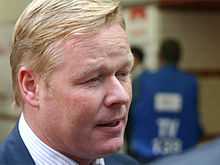
- Ronald Koeman (1969) - ex Footballer, current coach of Feyenoord (lived in Oosterbeek for a couple of years)
- Jan Beelaerts van Blokland (1909-2005) - soldier and member of the resistance
- Jette van der Meij (1954) - actress
Photos
-
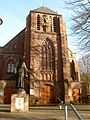
The Roman Catholic St. Bernulphus Church (1884)
-
_Oosterbeek_2008.jpg)
The Reformed Church
-
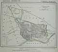
A map of Oosterbeek (1867)
-
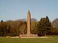
War Monument
-
The Hartenstein Airborne Museum
References
- ↑ Cijfers Gemeente Renkum
- ↑ Stenvert, R. et al. (2000). Monumenten in Nederland: Gelderland, p. 268–271. Zwolle: Waanders Uitgevers. ISBN 90-400-9406-3
- ↑ Ad van der Meer and Onno Boonstra, Repertorium van Nederlandse gemeenten, KNAW, 2006.
- ↑ of the Airborne March