Ontario Highway 65
| ||||
|---|---|---|---|---|
| Route information | ||||
| Maintained by the Ministry of Transportation of Ontario | ||||
| Length: | 123.3 km[1] (76.6 mi) | |||
| Existed: | August 7, 1937[2] – present | |||
| Major junctions | ||||
| West end: |
| |||
|
| ||||
| East end: | Ontario–Quebec border near Notre-Dame-du-Nord | |||
| Highway system | ||||
| ||||

King's Highway 65, commonly referred to as Highway 65, is a provincially maintained highway in the Canadian province of Ontario. The route begins at Highway 66 and travels 123.3 kilometres (76.6 mi) southeast to the Quebec border. At its midpoint, the route is concurrent with Highway 11.
Route description
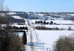
Highway 65 currently travels from Highway 66 at a junction east of Matachewan, southeast to New Liskeard then northeast to the Quebec provincial border. The total length of Highway 65 is 123.3 kilometres (76.6 mi). With the exception of the community of Elk Lake, the section of the route between Highway 66 and Highway 11 passes through a remote and sparsely populated wilderness. The route becomes concurrent with Highway 11 and follows that route north for 2.7 kilometres (1.7 mi), bypassing the urban section of New Liskeard in the process.[3]
The route's continuation into Quebec does not have a provincial route number, but has developed the name 'Rue Ontario' by the local town of Notre-Dame-du-Nord. Rue Ontario ends at Route 101 in Notre-Dame-du-Nord, 2.6 kilometres (2 miles) east of the provincial border.
Highway 65 is entirely situated in Timiskaming District. It travels through the communities of Elk Lake, Kenabeek and New Liskeard.
History
Highway 65 was first established on August 7, 1937, when the New Liskeard to Matachewan Road was assumed by the Department of Highways.[2] The route was extended 22.5 kilometres (14.0 mi) east to the Ontario–Quebec border on February 22, 1956.[2] It has remained unchanged since.[3]
Major intersections
The following table lists the major junctions along Highway 65, as noted by the Ministry of Transportation of Ontario.[1] The entire route is located in Timiskaming District.[3]
| Location | km[1] | mi | Destinations | Notes | |
|---|---|---|---|---|---|
| Unorganized West Timiskaming District | 0.0 | 0.0 | |||
| Elk Lake | 32.9 | 20.4 | |||
| 33.9 | 21.1 | ||||
| McCool | 71.3 | 44.3 | |||
| New Liskeard | 97.9 | 60.8 | Beginning of concurrency with Highway 11 | ||
| 100.6 | 62.5 | End of concurrency with Highway 11 | |||
| Casey Township | 118.5 | 73.6 | Casey Mine Road (south) / Development Road (north) | ||
| 123.3 | 76.6 | ||||
| 1.000 mi = 1.609 km; 1.000 km = 0.621 mi | |||||
References
- ↑ 1.0 1.1 1.2 Ministry of Transportation of Ontario (2008). "Annual Average Daily Traffic (AADT) counts". Retrieved February 13, 2012.
- ↑ 2.0 2.1 2.2 "Appendix 3 - Schedule of Assumptions and Reversions". Annual Report (Report). Department of Highways. March 31, 1938. pp. 80, 205.
- ↑ 3.0 3.1 3.2 Ontario Back Road Atlas (Map). Cartography by MapArt. Peter Heiler. 2010. p. 105. § J17–18. ISBN 978-1-55198-226-7.
External links
- Google Maps: Highway 65 route, Highway 66 (Matachewan) to New Liskeard segment
- Google Maps: Highway 65 route, New Liskeard to Quebec border segment
- Highway 65 pictures and information
| ||||||||||||||||||||||||||