Ontario Highway 47
| ||||||||||
|---|---|---|---|---|---|---|---|---|---|---|
| Route information | ||||||||||
| Length: | 34.3 km[1] (21.3 mi) | |||||||||
| Existed: | October 20, 1937[2] – January 1, 1998[3] | |||||||||
| Major junctions | ||||||||||
| West end: |
| |||||||||
| East end: |
| |||||||||
| Location | ||||||||||
| Regions: |
York Durham | |||||||||
| Towns: |
Stouffville Uxbridge Scugog | |||||||||
| Highway system | ||||||||||
<td width="100%" align=center" colspan="3" style="padding:0;vertical-align:middle;text-align:center">Current highways
| ||||||||||

King's Highway 47, commonly referred to as Highway 47 and locally as Stouffville Road, Toronto Street and Brock Street, was a provincially maintained highway in the Canadian province of Ontario. The mostly rural route travelled through the towns of Whitchurch-Stouffville, Goodwood, and Uxbridge on its east–west path between Highway 48 and Highway 12. The route was established in 1937, existing until it was transferred to the Regional Municipality of Durham and the Regional Municipality of York at the beginning of 1998.
Route description
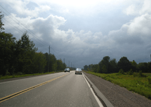
At the time of its decommissioning, Highway 47 began at Highway 48, and travelled east through a rural portion of Whitchurch-Stouffville along what is now York Regional Road 40 (Bloomington Road), passing through rolling farmland. Only a decade prior, the highway travelled through the town of Stouffville along Main Street, then turned north along the Tenth line, following it to Bloomington Road and York - Durham Line, where it curved gently into the 1997 routing of the highway. The re-routing served to bypass this urban section.
Within the Regional Municipality of Durham, the route passed through Goodwood, where it curved northeast through forests. The highway then zig-zagged northeast to the town of Uxbridge. East of there, the highway continued through marshes, past Durham Regional Road 23 (Lakeridge Road), and into flat farmland. The route ended at Highway 12 south of Greenbank.[4]
History
The Stouffville to Greenbank Road was first assumed by the Department of Highways as Highway 47 on October 20, 1937, connecting Stouffville and Uxbridge with Highway 12, south of Greenbank.[2][5] The highway remained generally unchanged, with the exception of a short westward extension on February 10, 1954. On that day, the route was extended to meet Highway 48, which was itself extended south to Scarborough.[6]
During the early-1990s, Highway 47 was rerouted north of Stouffville, following Bloomington Road instead of Tenth Line and Main Street.[7] The gentle curve at the York–Durham boundary was removed and a signalized intersection created in its place.[3] On January 1, 1998, the responsibility for signage and maintenance of Highway 47 was transferred to the Regional Municipalities of Durham and York.[3] It was subsequently redesignated as Durham Regional Highway 47 and an eastward extension of York Regional Road 40.[4]
Major intersections
The following table lists the major junctions along Highway 47, as noted by the Ministry of Transportation of Ontario.[1]
| Division | Location | km[1] | mi | Destinations | Notes |
|---|---|---|---|---|---|
| York | Whitchurch–Stouffville | 0.0 | 0.0 | Continues west as Stouffville Road | |
| 2.1 | 1.3 | ||||
| 4.2 | 2.6 | ||||
| 8.6 | 5.3 | Bloomington Road travels west while York–Durham Line travels north–south | |||
| Durham | |||||
| Goodwood | 12.2 | 7.6 | |||
| Uxbridge | 17.1 | 10.6 | |||
| 24.5 | 15.2 | Western junction with Durham Regional Road 8 | |||
| 24.7 | 15.3 | Eastern junction with Durham Regional Road 8 | |||
| 27.0 | 16.8 | ||||
| Scugog | 34.3 | 21.3 | |||
| 1.000 mi = 1.609 km; 1.000 km = 0.621 mi | |||||
See also
References
- ↑ 1.0 1.1 1.2 Highway Planning Office (1989). Provincial Highways Distance Table. Ministry of Transportation of Ontario. p. 64.
- ↑ 2.0 2.1 "Appendix 3 - Schedule of Assumptions and Reversions". Annual Report (Report). Department of Highways. March 31, 1938. p. 81.
- ↑ 3.0 3.1 3.2 Highway Transfers List "Who Does What" (Report). Ministry of Transportation of Ontario. June 20, 2001. p. 2.
- ↑ 4.0 4.1 Ontario Back Road Atlas (Map). Cartography by MapArt. Peter Heiler. 2010. p. 31. § E33–G25. ISBN 978-1-55198-226-7.
- ↑ Official Road Map (Map). Department of Highways. 1937/38. § L7–8. Check date values in:
|date=(help) - ↑ "Appendix 3". Annual Report (Report). Department of Highways. March 31, 1954. p. 155.
- ↑ Dexter, Brian (December 16, 1993). "Spectre of Stouffville Dump 'Unbelievable,' Mayor Says". The Toronto Star. p. NY4.
| ||||||||||||||