Onkaparinga Hills, South Australia
| Onkaparinga Hills | |||||||||||||
|---|---|---|---|---|---|---|---|---|---|---|---|---|---|
|
Spriggs Road | |||||||||||||
| Population | 2,693 (2006 Census) | ||||||||||||
| Established | 1840s | ||||||||||||
| Postcode(s) | 5163 | ||||||||||||
| Location | 33.5 km (21 mi) from Adelaide | ||||||||||||
| LGA(s) | City of Onkaparinga | ||||||||||||
| State electorate(s) | Mawson, Reynell | ||||||||||||
| Federal Division(s) | Kingston | ||||||||||||
| |||||||||||||
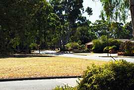
Onkaparinga Hills is a southern suburb of Adelaide, in the City of Onkaparinga. It covers an area of approx. 22 km2 or 2164 hectares. It has a population of 2693 people (2006 Census). It's a leafy suburb that encompasses parts of the Onkaparinga River, Onkaparinga River National Park and the Onkaparinga River Recreational Park.
Nearly 60% of families in the area are couples with children, compared to an Australian average of 45.3%. The median rent in 2006 was $230. The current median cost of a home in the area is $390 000. 93.5% of people speak English only at home (Australian average 78.5%) and 91% are Australian citizens compared to the Australian average of 86.1%.
History
Prior to European colonisation, the area was inhabited by the Kaurna people. The name Onkaparinga is derived from the Kaurna word ngankiparrinnga, meaning ‘The Women’s River’.
European settlement dates from the 1840s. Most of the settlers were initially farmers, with vineyards later being established. After the war there was significant development and again in the early 1990s. The population is now relatively stable. There are still sections of the area used for vineyards, farming and grazing.
Notes
- ^ Bonzle.com
- ^ Australian Bureau of Statistics
- ^ City of Onkaparinga Council Website
- ^ Aboriginal Culture and History, City of Onkaparinga Council Website
- ^ History Overview, City of Onkaparinga Council Website
- ^ Domain Suburb Profile, Domain.com
- ^ History of the Population, City of Onkaparinga Council Website
Coordinates: 35°08′49″S 138°33′04″E / 35.147°S 138.551°E