Ongata Rongai
| Ongata Rongai | |
|---|---|
 Ongata Rongai Location of Ongata Rongai | |
| Coordinates: 1°24′S 36°46′E / 1.4°S 36.77°ECoordinates: 1°24′S 36°46′E / 1.4°S 36.77°E | |
| Country |
|
| County | Kajiado County |
| Population (2009) | 40,178 |
| Time zone | EAT (UTC+3) |
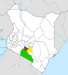
Ongata Rongai, also locally known as Rongai or simply Rongaa, is a settlement in Kenya's Kajiado County located between the Kaputiei plains and the Western slopes of the Ngong hills.[1] It is a fast developing residential urban aggregation in the outskirts of Nairobi with a population of 35,000 in the 1999 National Census but currently estimated between 66,042[2] and 147,000.[3] The city is situated 17 km south of Nairobi, the capital city of Kenya and lies at 1731 m (5682 ft) a.s.l.
Origins
Rongai began in the late 1940s in two locations. First as a cattle market in present day Ongata Rongai shopping centre (first stage) and as a stone mining township in present day Kware (quarry) and Gataka areas. The two centres then spread linearly towards each other. Since the early 1990s rapid development allowed them to join together into a high density urban aggregation making up what is now Ongata Rongai proper, covering around 16 square kilometres. However, greater Ongata Rongai is a medium-to-low density area and includes Kandisi, Rimpa, Nkoroi, Merisho, Olekasasi, Tuala and Maasai lodge areas, and covers a much larger area.The first school was started on 1949 which was named Ongata Ronkai Primary School which is located along Gataka Road.
Economy
Rongai is a multi-class area which is however dominated by the middle-class. Although largely located within Nairobi metropolitan, it does not fall within the administrative boundaries of the city and is separated from Nairobi city proper by the Mbagathi river. It is itself divided into two administrative locations, Nkaimurunya and Rongai, which are separated by the Magadi road. Within Ongata Rongai there is the Kandisi river, a tributary of the Mbagathi river. It has two major industrial ventures: Kitengela glass, an artefacts manufacturer tucked away in the far-flung Tuala township area, and Tam feeds, an agro-processing industry located in Gataka.
Culture
Notably, Ongata Rongai is famous for its customized public service vehicles operating on 125/126 route;(otherwise known as 'nganya' or 'pimped matatus'). Such vehicles usually have animated graphics on the outer body while the inside is fitted with free wi-fi,numerous speakers and LCD screens for loud music surrounding.
Education
This area is home to a number of institutions such as the Africa Nazarene University, Laiser-Hill school, Nkaimurunya Secondary School, Nakeel boys, Olekasasi mixed school, Adventist University of Africa, and Maxwell Adventist Academy, which is on the property of the headquarters of the Seventh-day Adventist Church for the East-Central African Division. There are many primary schools in this area including St. Mary's and P.C.E.A Educational centre among other.
See also
References
- ↑ "Chapter 3: the Maasai: Socio-historical context and group ranches". Maasai herding – An analysis of the livestock production system of Maasai pastoralists in eastern Kajiado County, Kenya. FAO. Retrieved 15 June 2011.
- ↑ "Directory of Cities, Towns, and Regions in Kenya: Langata Rongai". Global Gazetteer Version 2.2. Falling Rain Genomics. Retrieved 15 June 2011.
- ↑ "BOH Healthcare". Africa Rising. Retrieved 15 June 2011.
| |||||||||||||||||||||||||||||
