Omassery
| Omassery ഓമശേരി ഓമശേരി | |
|---|---|
| Town | |
|
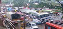
Omassery bus stand | |
 Omassery Location in Kerala, India | |
| Coordinates: 11°18′0″N 75°58′30″E / 11.30000°N 75.97500°ECoordinates: 11°18′0″N 75°58′30″E / 11.30000°N 75.97500°E | |
| Country |
|
| State | Kerala |
| District | Kozhikode |
| Government | |
| • Body | Omassery |
| • Member of Parliament | MK RAGHAVAN |
| • M.L.A | VM Ummer Master |
| • Panchayath President | KM Komala Valli |
| Area | |
| • Total | 25.46 km2 (9.83 sq mi) |
| Population (2011) | |
| • Total | 25,420 |
| • Density | 998/km2 (2,580/sq mi) |
| Languages | |
| • Official | Malayalam, English |
| Time zone | IST (UTC+5:30) |
| PIN | 673582 |
| Telephone code | 91495228 |
| Vehicle registration | KL-57 |
| Nearest city | Kozhikode |
| Sex ratio | 1000:1032 ♂/♀ |
| Literacy | 88.05%% |
| Lok Sabha constituency | Kozhikode |
| Civic agency | Omassery |

Omassery is a town in Kozhikode district, Kerala, India and it is a junction between Thiruvambady, Thamarassery, Mukkam, Koduvally, Kodencheri and Kattangal. Omassery is located 29 kilometers southeast of Kozhikode in the eastern part of Kerala; better known as Malabar (Northern Kerala). Omassery is a fast developing place and is well connected to the other parts of the state. Besides that, it is known as the gateway to the hill ranges of Western Ghats in Malabar.
Geography

Omassery is located at 11°18′0″N 75°58′30″E. The total area of the Panchayath is 25.46 km².[1]
Demographics
As of 2001 census the total population of the panchayath is 25,420 ,[2] which constitute 12511 Males and 12909 females. The population density is 998 per km² which is more than the state average. The sex ratio is 1000:1032. The people are highly literate. The literacy rate is 88.05 (Male: 93.62 and female 82.76).
Neighboring Places
Koodathai, Venappara, Neeleswaram, Ambalakkandy, Vennakode, Malayamma,Velimanna, Kallurutty, Puthur, Nadammal Poyil & Manipuram
Panchayath Wards and present members
Omassery Panchayath consists of 19 wards. In ward number order, with ward, member name and party indicated:[3]
- Koodathai K M Komalavally (President) (IUML)
- Kakkadakunnu K P Sadasivan (CPIM)
- Chemmaruthai Shindhu Shaji (INC)
- Peruvilly Gracy (INC)
- Korothiri Biju P R (CPIM)
- Omassery EAST Fathima Moossa (INDEPENDENT)
- Omassery WEST U K Fathima Abu (IUML)
- Ambalakkandy K T Muhammed (IUML)
- Allumthara P P Moideenkutty (IUML)
- Vennakkode Babu Kolkoth (INDEPENDENT)
- NadammalPoyil C K Kadeeja MUHAMMED(IUML)
- Kaniyarkandam Rafeenathulkhan (IUML)
- Kulathakkara ABDULLA KUTTY (IUML)
- Velimanna Sakeena K T (IUML)
- Puthur. Abdulnasser (IUML)
- Mangad WEST Sailaja (CPIM)
- Mangad EAST K K Radhakrishnan (CPIM)
- Chakkikave Leela E P (CPIM)
- Meppally Juraina P K (INDEPENDENT)
Major Institutuions
01) Pleasant English School, Omassery(CBSE)
02) Holy Family High School, Venappara
03) Vadihuda Higher Secondary School(Unaided), Omassey
04) Al Irshad Technical Higher Secondary School, Techyad
05) Vidya Poshini ALP School, Omassery
06) Vadihuda English School(CBSE), Omassery
07) Al Irshad Central School(English Medium), Techyad
08) Al Irshad High School(Malayalam Medium), Techyad
09) Al Irshad Industrial School, Techyad
10) SANTHI School of Nursing, Omassery
11) SANTHI PARAMEDICAL TRAINING CENTRE, Omassery
12) Vadihuda Arbic College, Omassery
13) Almanar Arabic College Omassery
14) Pleasant Arts College., Omassery
15) Al Irshad Women's College, Techyad
16) Vadihuda Orphanage & Destitute Home, Omassery
17) Izzathul Islam Madrassa, Omassery
18) Winpoint Guidance Academy, Omassery
19) SANTHI College of Nursing, Omassery
20) G.M.L.P.School Velimanna
21) Sunanul Huda Madrasa, Omassery
22) Badrul Huda Madrasa, Omassery
23) Al madrassathul islamiya, Omassery
Transport
- By Air
Calicut International Airport (Karipur), the nearest airport is just 45 kilometres away from this area.
By Train
The nearest Railway station is at Kozhikode.
- By Road
Omassery is on the State Highway (Koyilandy - Edavanna). The location is well connected by roads from various corners and is a main junction for surrounding various panchayaths and villages. Moreover it gives more geographical importance to this place as this is an important gateway to the hill ranges of western Ghat of Malabar.Thiruvambady, Thamarassery, Koduvally, Mukkam and Kodencheri are near by places of Omassery.
There is one bus stand and bus services available to places such as Kozhikode, Mukkam, Koduvally, Thamarassery, Thiruvambady, Kodenchery, Anakkam Poyil.
The Kilometer chart from Kozhikode to Omassery is given below.

The Kilometer chart through road from Omassery is given below.
| Kozhikode - 29 km | Thamarassery - 9 km | Manjeri - 36 km |
| Mukkam - 7 km | Malappuram - 48 km | Ernakulam - 202 km |
| Perinthalmanna - 60 km | Areekode - 20 km | Palakkad - 122 km |
| Thiruvambady - 6 km | Thrissur - 133 km | Anakkampoyil - 19 km |
| Koduvally - 6 km | Koyilandy - 37 km | Thiruvanathapuram - 414 km |
| Kodencheri - 10 km | Kalpetta - 58 km | Nilambur - 50 km |
Hospitals
- Santhi Hospital Omassery : Santhi Hospital is a 300 bedded hospital multi-specialty hospital. The hospital facilities reach an approximate population of over 10 lakh spread over 375 km2.[4]
- Govt. Community Health Centre, Omassery
- Govt. Ayurveda Dispensary,Omassery (Koodathai Bazar)
- Govt. Veterinary Hospital
Other Clinics
- SANTHI DENTAL CLINIC,Santhi Hospital Campus Omassery ,orthodontics Dental Implants and a full range of routine dental treatments.
- Dentare Multi Speciality Dental Clinic (Dr Shiyas &Dr Hibashiyas) : Specialised in Cosmetic Dentistry, orthodontics Dental Implants and a full range of routine dental treatments.
- ConfiDental Clinic, Omassery
- Taj Yunani Clinic, Omassery
- Similiya Homeo Clinic, Omassery
- Dr.Sudheer's Clinic, Thazhe Omasseri
- Nagarjuna Ayurvedha Oushdhasala, Omassery
Govt. Offices
- Grama Panchayath Office Omassery - Tel : 0495-2281253
- Sub Post Office Omassery - Tel : 0495-2281180
- KSEB Section Office Omassery- Tel : 0495-2283635
- Telephone Exchange Omassery- Tel : 0495-2281398,2281400
- Krishi Bhavan Omassery - Tel : 0495-2287674
- Milk Co-Operative Society tel : 0495-2281236,
- Village Office Puthur
- Akshaya e-centre, Omassery - Tel : 0495-2283641
Banks
- State Bank Of India
- South Malabar Gramin Bank, Omassery
- Omassery Service Co-Op. Bank
- Federal Bank
Non-banking financial compaies
- Manappuram Finance Ltd Omassery
- Muthoot Fincorp Omassery
ATM
- SBI ATM
- Federal Bank ATM
Religious Places
- Cholakkal Juma Masjid, Omassery
- Anwarul Islam Masjid Omassery
- Rayarukandy Sunni Masjid, Omassery
- Nadukil Shiva temple
- Puthur Subrahmanya temple, Mangad
- Pazhedath Shiva Temple
- Chokur Sree Rama Temple
- Holy Family Church, Venappara
- Thechyad Juma Masjid
- Velimanna Juma Masjid
- Kulikkapra Mahadeva kshethram,Ambalathingal
- KADAMKUNI SHIVA KSHETRAM
- Izzathul islam mdrasa
- vadi huda
Charity Organisations
- SEVANA Charitable Society, Omassery
- Shihab Thangal Memorial Charitable Trust (SMCT), Omassery
- Karunyam: A charity initiative by youths in Omassery.
- C.H.Memmorial Sports & Arts Club Velimanna.
- Sukrutham: A charity initiative by Santi Hospital Omassery for the Kidney patients of the underprivileged sections of the society whose numbers are increasing day by day. Since its inception on May 2008 m ore than 2000 dialysis have been conducted out of which 68% received concession.[5]
- Pain and Palliative Care Clinic: This clinic is guided by the Pain and Palliative Society of Calicut, Government Medical College which has a team of highly qualified and trained doctors accompanied by nurses and volunteers. The clinic was incepted in the year 2003, until now more than 250 patients have been registered in the clinic and among them about 55% were cancer patients.[6]
- Islamic Welfare Trust:Founded in 1979 it is multifaceted charitable organization with the sole objective to uplift the underprivileged sections of the society through education and medical care.
- Al Irshad Charitable Society, Omassery