Oliver County, North Dakota
| Oliver County, North Dakota | |
|---|---|
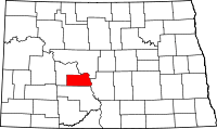 Location in the state of North Dakota | |
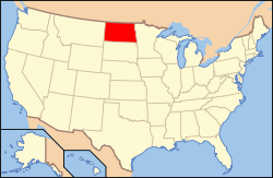 North Dakota's location in the U.S. | |
| Founded | May 18, 1885 |
| Seat | Center |
| Largest city | Center |
| Area | |
| • Total | 731 sq mi (1,893 km2) |
| • Land | 723 sq mi (1,873 km2) |
| • Water | 8.7 sq mi (23 km2), 1.2% |
| Population (Est.) | |
| • (2014) | 1,850 |
| • Density | 2.6/sq mi (1/km²) |
| Congressional district | At-large |
| Time zone | Central: UTC-6/-5 |
Oliver County is a county located in the U.S. state of North Dakota. As of the 2010 census, the population was 1,846,[1] making it the fifth-least populous county in North Dakota. Its county seat and only city is Center.[2]
The county was created by the 1885 territorial legislature and was organized on May 18, 1885.[3] It was named for Harry S. Oliver of Lisbon, North Dakota (1855-1909), a Republican politician and member of the Dakota Territory House of Representatives at the time. Sanger (Raymond) was the county seat from 1885 to 1902, when the title went to Center.[4]
Oliver County is included in the Bismarck, ND Metropolitan Statistical Area.
Geography
According to the U.S. Census Bureau, the county has a total area of 731 square miles (1,890 km2), of which 723 square miles (1,870 km2) is land and 8.7 square miles (23 km2) (1.2%) is water.[5] It is the fifth-smallest county in North Dakota by area.
Major highways
 North Dakota Route 25
 North Dakota Route 31
 North Dakota Route 48
 North Dakota Route 1806
 North Dakota Route 200A
Adjacent counties
- McLean County (northeast)
- Burleigh County (east)
- Morton County (south)
- Mercer County (northwest)
Demographics
| Historical population | |||
|---|---|---|---|
| Census | Pop. | %± | |
| 1890 | 464 | — | |
| 1900 | 990 | 113.4% | |
| 1910 | 3,577 | 261.3% | |
| 1920 | 4,425 | 23.7% | |
| 1930 | 4,262 | −3.7% | |
| 1940 | 3,859 | −9.5% | |
| 1950 | 3,091 | −19.9% | |
| 1960 | 2,610 | −15.6% | |
| 1970 | 2,322 | −11.0% | |
| 1980 | 2,495 | 7.5% | |
| 1990 | 2,381 | −4.6% | |
| 2000 | 2,065 | −13.3% | |
| 2010 | 1,846 | −10.6% | |
| Est. 2014 | 1,850 | 0.2% | |
As of the census of 2000, there were 2,065 people, 791 households, and 604 families residing in the county. The population density was 1/km² (3/sq mi). There were 903 housing units at an average density of 0/km² (1/sq mi). The racial makeup of the county was 97.58% White, 0.15% Black or African American, 1.26% Native American, 0.10% Asian, and 0.92% from two or more races. 0.63% of the population were Hispanic or Latino of any race. 59.2% were of German, 13.6% Norwegian and 6.5% American ancestry.
There were 791 households out of which 35.50% had children under the age of 18 living with them, 69.20% were married couples living together, 3.90% had a female householder with no husband present, and 23.60% were non-families. 21.00% of all households were made up of individuals and 10.70% had someone living alone who was 65 years of age or older. The average household size was 2.61 and the average family size was 3.05.
In the county the population was spread out with 27.40% under the age of 18, 4.70% from 18 to 24, 23.50% from 25 to 44, 30.10% from 45 to 64, and 14.20% who were 65 years of age or older. The median age was 42 years. For every 100 females there were 107.50 males. For every 100 females age 18 and over, there were 106.20 males.
The median income for a household in the county was $36,650, and the median income for a family was $45,430. Males had a median income of $40,577 versus $19,015 for females. The per capita income for the county was $16,271. About 11.20% of families and 14.90% of the population were below the poverty line, including 23.60% of those under age 18 and 13.90% of those age 65 or over.
Communities
City
- Center (county seat)
Unincorporated communities
See also
References
- ↑ 1.0 1.1 "State & County QuickFacts". United States Census Bureau. Retrieved November 1, 2013.
- ↑ "Find a County". National Association of Counties. Retrieved 2011-06-07.
- ↑ "Dakota Territory, South Dakota, and North Dakota: Individual County Chronologies". Dakota Territory Atlas of Historical County Boundaries. The Newberry Library. 2006. Retrieved February 3, 2015.
- ↑ "County History". Official Portal for North Dakota State Government. Retrieved 4 May 2011.
- ↑ "2010 Census Gazetteer Files". United States Census Bureau. August 22, 2012. Retrieved February 1, 2015.
- ↑ "U.S. Decennial Census". United States Census Bureau. Retrieved February 1, 2015.
- ↑ "Historical Census Browser". University of Virginia Library. Retrieved February 1, 2015.
- ↑ Forstall, Richard L., ed. (April 20, 1995). "Population of Counties by Decennial Census: 1900 to 1990". United States Census Bureau. Retrieved February 1, 2015.
- ↑ "Census 2000 PHC-T-4. Ranking Tables for Counties: 1990 and 2000" (PDF). United States Census Bureau. April 2, 2001. Retrieved February 1, 2015.
 |
McLean County | | ||
| Mercer County | |
Burleigh County | ||
| ||||
| | ||||
| Morton County |
| |||||||||||||||||||||
| ||||||||||||||||||