Oleni
For the municipal unit in Achaea, see Olenia. For the island off the Russian north coast, see Oleniy Island.
| Oleni Ωλένη | |
|---|---|
 Oleni | |
|
Location within the regional unit 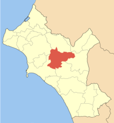 | |
| Coordinates: 37°44′N 21°33′E / 37.733°N 21.550°ECoordinates: 37°44′N 21°33′E / 37.733°N 21.550°E | |
| Country | Greece |
| Administrative region | West Greece |
| Regional unit | Elis |
| Municipality | Pyrgos |
| Elevation | 240 m (790 ft) |
| Population (2001)[1] | |
| • Municipal unit | 9,026 |
| Time zone | EET (UTC+2) |
| • Summer (DST) | EEST (UTC+3) |
| Postal code | 270 64 |
| Area code(s) | 26210 |
| Vehicle registration | ΗΑ |
| Website |
www |
Oleni (Greek: Ωλένη) is a village and a former municipality in Elis, West Greece, Greece. Since the 2011 local government reform it is part of the municipality Pyrgos, of which it is a municipal unit.[2] The seat of the municipality was in Karatoula. The municipal unit was named after the ruined medieval town Olena. It consists of a wide valley around Karatoula and Magoula, and the hills west and east of the valley. It is located about 10 km northeast of Pyrgos, 13 km northwest of Olympia and 20 km southeast of Amaliada. The largest community is Goumero. The ancient town Amphidolis was located near present Karatoula.
Subdivisions
The municipal unit Oleni is subdivided into the following communities (constituent villages in brackets):
- Agia Anna
- Arvaniti
- Charia
- Cheimadio
- Goumero
- Karatoula (Karatoula, Kleidereika, Marmara)
- Karya (Karya, Varvarina, Sitochori)
- Klindia
- Koutsochera
- Lanthi (Lanthi, Moni Kremastis)
- Latzoi (Latzoi, Agios Georgios, Almyriki, Grammatikos)
- Magoula (Magoula, Katsomaliareika)
- Mouzaki
- Oleni
- Pefki
- Sopi
Historical population
| Year | Population |
|---|---|
| 1991 | 7,560 |
| 2001 | 9,026 |
References
- ↑ De Facto Population of Greece Population and Housing Census of March 18th, 2001 (PDF 39 MB). National Statistical Service of Greece. 2003.
- ↑ Kallikratis law Greece Ministry of Interior (Greek)
External links
See also
 |
Amaliada | Pineia | | |
| Pyrgos | |
Foloi | ||
| ||||
| | ||||
| Pyrgos | Archaia Olympia |
| ||||||||||||||||||