Old Towne, Orange Historic District
|
Old Towne Orange Historic District | |
| |
 | |
| Location | Roughly bounded by Walnut Ave., Waverly St., W.O. Hart Park, La Veta Ave., Clark St., and Atchison Topeka Railroad Track, Orange, California |
|---|---|
| Coordinates | 33°47′2″N 117°51′2″W / 33.78389°N 117.85056°WCoordinates: 33°47′2″N 117°51′2″W / 33.78389°N 117.85056°W |
| Architect | multiple |
| Architectural style | Bungalow/Craftsman, Mission/Spanish Revival, Classical Revival |
| Governing body | Local |
| NRHP Reference # | 97000617 |
| Added to NRHP | July 11, 1997[1] |
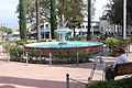
Old Towne, Orange Historic District, a one square-mile around the original plaza of Orange, California, contains many of the original structures built in the period after the City's incorporation. It is a vibrant commercial district, containing Orange County's oldest operating bank and the oldest operating soda fountain. The Historic District was listed on the National Register of Historic Places in 1997, and is the largest National Register District in California. The Old Towne Preservation Association is a non-profit organization dedicated to maintaining the district.
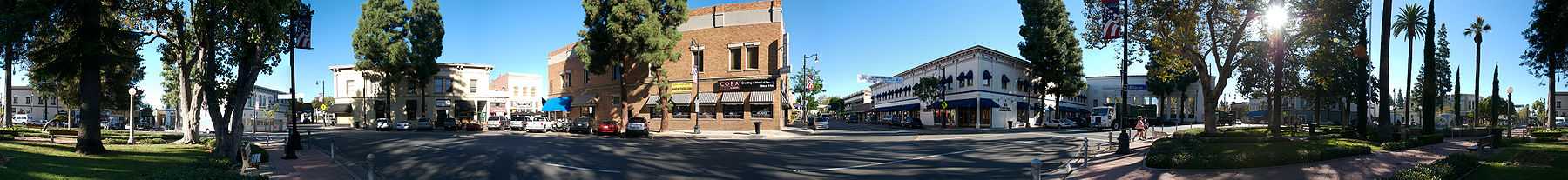
According to State Historic Resource Surveys, Orange is unique among the region and the state in that it has the second largest concentration of historic buildings. A list of all of the buildings and sites in Orange that appear in the National Register of Historic Places can be found at National Register of Historic Places listings in Orange County, California.
Architectural styles in Old Towne Orange
- Bungalow (see also California Bungalow—Bungalow)
- Craftsman Bungalow
- Craftsman (see also American Craftsman)
- Hip Roof Cottage (see also Hip roof)
- Mediterranean (see also Mediterranean Revival Style architecture)
- Prairie (see also Prairie Style architecture)
- Spanish Colonial (see also Spanish Colonial Revival Style architecture)
- Victorian (see also Victorian architecture)
References
- ↑ "National Register Information System". National Register of Historic Places. National Park Service. 2008-04-15.
| ||||||||||||||||||||||||||