Okeford Fitzpaine
| Okeford Fitzpaine | |
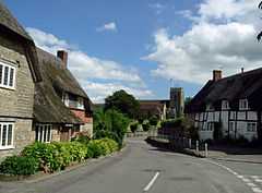 Okeford Fitzpaine, looking towards the parish church |
|
 Okeford Fitzpaine |
|
| Population | 913 |
|---|---|
| OS grid reference | ST806110 |
| District | North Dorset |
| Shire county | Dorset |
| Region | South West |
| Country | England |
| Sovereign state | United Kingdom |
| Police | Dorset |
| Fire | Dorset |
| Ambulance | South Western |
| EU Parliament | South West England |
Coordinates: 50°53′53″N 2°16′36″W / 50.8981°N 2.2768°W
Okeford Fitzpaine /ˈoʊkfərd fɪtsˈpeɪn/ is a village and civil parish in the English county of Dorset, situated in the Blackmore Vale 3 miles (4.8 km) south of the town of Sturminster Newton in the North Dorset administrative district. It is sited on a thin strip of greensand under the scarp face of the Dorset Downs.[1] In the 2011 census the civil parish—which includes the hamlet of Belchalwell to the west and most of Fiddleford to the north—had 404 dwellings,[2] 380 households and a population of 913.[3]
In 1086 in the Domesday Book Okeford Fitzpaine was recorded as Adford;[4] it had 40 households, 16 ploughlands, 21 acres (8.5 ha) of meadow and 1 mill. It was in Sturminster Newton Hundred and the tenant-in-chief was Glastonbury Abbey.[5] Since then it has been known as "Aukford Alured" and "Ockford Phippin", the latter echoing the modern colloquial "Fippenny Ockford" and its shorthand, "Ockford".[6]
Within the parish are about 55 listed houses,[7] a green listed telephone box, and a tiny museum exhibiting the village's own early 19th-century fire engine and the World War II air-raid siren issued to the village post office. There is a small school, a public house and a village shop.
TV presenter Jack Hargreaves, known for having devised and presented How!, Out of Town and Old Country, lived at Belchalwell.
References
- ↑ Ralph Wightman (1983). Portrait of Dorset (4 ed.). Robert Hale Ltd. p. 136. ISBN 0 7090 0844 9.
- ↑ "Area: Okeford Fitzpaine (Parish). Dwellings, Household Spaces and Accommodation Type, 2011 (KS401EW)". Neighbourhood Statistics. Office for National Statistics. Retrieved 14 February 2015.
- ↑ "Area: Okeford Fitzpaine (Parish), Key Figures for 2011 Census: Key Statistics". Neighbourhood Statistics. Office for National Statistics. Retrieved 19 January 2015.
- ↑ "Dorset H-R". The Domesday Book Online. domesdaybook.co.uk. Retrieved 14 February 2015.
- ↑ "Place: Okeford [Fitzpaine]". Open Domesday. domesdaymap.co.uk. Retrieved 14 February 2015.
- ↑ Roland Gant (1980). Dorset Villages. Robert Hale Ltd. p. 50. ISBN 0 7091 8135 3.
- ↑ Search on Okeford Fitzpaine
External links
| Wikimedia Commons has media related to Okeford Fitzpaine. |
