Ohio State Route 292
| ||||
|---|---|---|---|---|
 | ||||
| Route information | ||||
| Maintained by ODOT | ||||
| Length: | 26.50 mi[1] (42.65 km) | |||
| Existed: | 1932 – present | |||
| Major junctions | ||||
| South end: |
| |||
| North end: |
| |||
| Location | ||||
| Counties: | Logan, Hardin | |||
| Highway system | ||||
| ||||

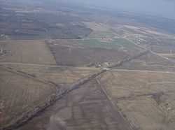
State Route 292 (SR 292) is a two-lane north–south state highway in the western portion of the U.S. state of Ohio. The southern terminus of the highway is at a diamond interchange with the U.S. Route 33 expressway approximately 1 mile (1.6 km) southeast of the village of Zanesfield. Its northern terminus is at a Y-intersection with State Route 31 just south of the city limits of Kenton.
Route description
State Route 292 travels through the northeastern quadrant of Logan County and the southern portion of Hardin County. No segment of the highway is incorporated within the National Highway System.[2]
History
Certified in 1932, State Route 292 was originally a spur route that traveled from Ridgeway to Mount Victory via its current routing from Ridgeway up to the current State Route 273 junction, and State Route 273 from that point east to State Route 31 in Mount Victory. .[3][4] Five years later, the highway was extended south to East Liberty, and with an extension of State Route 273 over what was State Route 292 east to Mount Victory, State Route 292 was also extended north from the State Route 273 intersection north to a new northern terminus at State Route 31 just south of Kenton.[5][6]
By 1997, when U.S. Route 33 was converted to a four-lane expressway through southeastern Logan County, State Route 292 was extended again, taking over several miles of the U.S. highway's former two-lane alignment, as far as a point in southern Jefferson Township between Zanesfield and Valley Hi, where State Route 292 arrived at what is currently its southern terminus at a diamond interchange with the new expressway.[7][8]
Major intersections
| County | Location | mi[1] | km | Destinations | Notes |
|---|---|---|---|---|---|
| Logan | Jefferson Township | 0.00 | 0.00 | ||
| Perry Township | 8.95 | 14.40 | Eastern terminus of SR 540 | ||
| Bokes Creek Township | 10.81 | 17.40 | |||
| Hardin | Hale Township | 19.31 | 31.08 | ||
| Buck Township | 26.50 | 42.65 | |||
| 1.000 mi = 1.609 km; 1.000 km = 0.621 mi | |||||
References
- ↑ 1.0 1.1 Ohio Department of Transportation. "Technical Services Straight Line Diagrams". Retrieved 2010-09-28.
- ↑ National Highway System: Ohio (PDF) (Map). Federal Highway Administration. December 2003. Retrieved 2010-09-29.
- ↑ Ohio State Map (Map). Ohio Department of Transportation. 1931.
- ↑ Ohio State Map (Map). Ohio Department of Transportation. 1932.
- ↑ Ohio State Map (Map). Ohio Department of Transportation. 1936.
- ↑ Ohio State Map (Map). Ohio Department of Transportation. 1937.
- ↑ Ohio State Map (Map). Ohio Department of Transportation. 1995.
- ↑ Ohio State Map (Map). Ohio Department of Transportation. 1997.
External links
Route map: Bing