Obi Islands
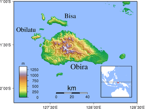
Topographic map of Obi Islands
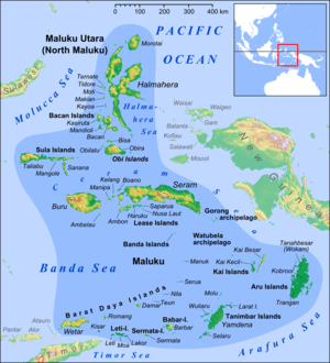
Location map of Obi Islands among the Maluku Islands
The Obi Islands (also known as Ombirah,[1] Indonesian Kepulauan Obi) are a group of islands in the Indonesian province of North Maluku. They lie north of Buru and Ceram.
The largest in the group is Obi Island. Nearby are the islands of Bisa, Gomumu, Obilatu, Tapat, Tobalai.
Two languages are spoken on the islands, Galela and Tobelo, both Papuan.
Notes
- ↑ Goodall, George (Editor)(1943) Philips' International Atlas London, George Philip and Son map 'East Indies' pp.91-92
Coordinates: 1°30′S 127°45′E / 1.500°S 127.750°E
| ||||||||||