Nunn, Colorado
| Town of Nunn, Colorado | |
|---|---|
| Town | |
|
Looking west from Logan Street towards U.S. 85 in Nunn, Colorado | |
 Location of Nunn shown within Colorado | |
| Coordinates: 40°42′14″N 104°46′51″W / 40.70389°N 104.78083°WCoordinates: 40°42′14″N 104°46′51″W / 40.70389°N 104.78083°W | |
| Country |
|
| State |
|
| County[1] | Weld |
| Incorporated (town) | March 28, 1908[2] |
| Government | |
| • Type | Statutory Town[1] |
| • Mayor | Duane Bayne |
| • Mayor Pro Tem | Deanna Gournoe |
| Area | |
| • Total | 1.8 sq mi (4.6 km2) |
| • Land | 1.8 sq mi (4.6 km2) |
| • Water | 0.0 sq mi (0.0 km2) 0.0% |
| Elevation[3] | 5,177 ft (1,578 m) |
| Population (2000) | |
| • Total | 471 |
| • Density | 266.7/sq mi (102.7/km2) |
| Time zone | MST (UTC-7) |
| • Summer (DST) | MDT (UTC-6) |
| ZIP code[4] | 80648 |
| Area code(s) | 970 |
| FIPS code | 08-55045 |
| GNIS feature ID | 0204688 |
| Website | townofnunn.org |

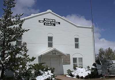
Nunn is a Statutory Town in Weld County, Colorado, United States. The population was 471 at the 2000 census. The town is small rural agricultural community located on the Colorado Eastern Plains north of Greeley. Somewhat isolated, it is surrounded by flat cultivated countryside of the Colorado Piedmont in area historically known for raising cattle, sheep, sugar beets, beans and potatoes. The town was founded as a shipping point on the Denver Pacific Railroad in the late 19th century and today sits along the western side of U.S. Highway 85 between Greeley and Cheyenne, Wyoming. It consists of a small grid of single-family homes on gravel streets. The town suffered a decline in both its economy and population beginning in the middle 20th century, and today the former storefronts along Logan Street parallel to the highway are largely boarded up. The remaining industry in town consists of a grain elevator and a cafe, as well as several industrial farm facilities on the outskirts of town. A major landmark is a large water tower emblazoned with the words "watch Nunn grow". The remaining economic activity has largely shifted southward to the towns of Pierce and Ault. The town also has a town park and a municipal hall.
Geography
Nunn is located at 40°42′14″N 104°46′51″W / 40.70389°N 104.78083°W.[5]
According to the United States Census Bureau, the town has a total area of 1.8 square miles (4.7 km2), all of it land.
Demographics
| Historical population | |||
|---|---|---|---|
| Census | Pop. | %± | |
| 1910 | 143 | — | |
| 1920 | 149 | 4.2% | |
| 1930 | 196 | 31.5% | |
| 1940 | 190 | −3.1% | |
| 1950 | 182 | −4.2% | |
| 1960 | 228 | 25.3% | |
| 1970 | 269 | 18.0% | |
| 1980 | 295 | 9.7% | |
| 1990 | 324 | 9.8% | |
| 2000 | 471 | 45.4% | |
As of the census[6] of 2000, there were 471 people, 158 households, and 118 families residing in the town. The population density was 266.7 people per square mile (102.7/km²). There were 174 housing units at an average density of 98.5 per square mile (38.0/km²). The racial makeup of the town was 78.98% White, 0.42% African American, 1.91% Native American, 0.21% Asian, 14.86% from other races, and 3.61% from two or more races. Hispanic or Latino of any race were 24.84% of the population.
There were 158 households out of which 38.6% had children under the age of 18 living with them, 62.7% were married couples living together, 7.6% had a female householder with no husband present, and 24.7% were non-families. 22.8% of all households were made up of individuals and 8.9% had someone living alone who was 65 years of age or older. The average household size was 2.98 and the average family size was 3.50.
In the town the population was spread out with 33.5% under the age of 18, 7.4% from 18 to 24, 31.0% from 25 to 44, 16.3% from 45 to 64, and 11.7% who were 65 years of age or older. The median age was 31 years. For every 100 females there were 101.3 males. For every 100 females age 18 and over, there were 96.9 males.
The median income for a household in the town was $35,714, and the median income for a family was $40,357. Males had a median income of $27,292 versus $21,875 for females. The per capita income for the town was $14,769. About 17.2% of families and 19.0% of the population were below the poverty line, including 24.8% of those under age 18 and 9.4% of those age 65 or over.
Uranium-mining controversy
In October 2006, Vancouver-based Powertech (USA) Inc. announced preliminary plans to mine uranium by in-situ leaching and possibly open-pit mining from a deposit in sandstones of the Fox Hills Formation several miles west of Nunn.
Some local residents have formed Coloradoans Against Resource Destruction (C.A.R.D.) to oppose the proposed mining. They and a landowners' organization called Stewards of the Land point out that the proposed mining area is only six miles northeast of the Fort Collins city limit, and that the Fox Hills Formation is a major water-supply aquifer. C.A.R.D. and SOTL dispute the safety of both in-situ leaching and open-pit mining for uranium.
On July 19, 2007, Powertech held an informational meeting at the Nunn Community Center.
See also
- Outline of Colorado
- State of Colorado
- Colorado cities and towns
- Colorado municipalities
- Colorado counties
- Colorado metropolitan areas
- Front Range Urban Corridor
- North Central Colorado Urban Area
- Denver-Aurora-Boulder, CO Combined Statistical Area
- Greeley, CO Metropolitan Statistical Area
- Colorado cities and towns
- in-situ leaching
- open-pit mining
- uranium mining
- uranium mining in Colorado
References
- ↑ 1.0 1.1 "Active Colorado Municipalities". State of Colorado, Department of Local Affairs. Retrieved 2007-09-01.
- ↑ "Colorado Municipal Incorporations". State of Colorado, Department of Personnel & Administration, Colorado State Archives. 2004-12-01. Retrieved 2007-09-02.
- ↑ "US Board on Geographic Names". United States Geological Survey. 2007-10-25. Retrieved 2008-01-31.
- ↑ "ZIP Code Lookup" (JAVASCRIPT/HTML). United States Postal Service. Retrieved November 26, 2007.
- ↑ "US Gazetteer files: 2010, 2000, and 1990". United States Census Bureau. 2011-02-12. Retrieved 2011-04-23.
- ↑ "American FactFinder". United States Census Bureau. Retrieved 2008-01-31.
External links
- Town of Nunn contacts
- CDOT map of the Town of Nunn
- Powertech (USA) Inc.
- Coloradoans Against Resource Destruction / NunnGlow website
- Powertech Exposed
| |||||||||||||||||||||||||||||||||
