Nueva Vizcaya
| Nueva Vizcaya | |||
|---|---|---|---|
| Province | |||
|
Nueva Vizcaya Provincial Capitol | |||
| |||
| Nickname(s): Citrus Capital of the Philippines; Southern Gateway of the Cagayan Valley Region; Watershed Haven of the Northern Philippines; Gateway to the Eighth Wonder of the World (Banaue Rice Terraces) | |||
 Location in the Philippines | |||
| Coordinates: 16°29′N 121°09′E / 16.483°N 121.150°ECoordinates: 16°29′N 121°09′E / 16.483°N 121.150°E | |||
| Country |
| ||
| Region | Cagayan Valley (Region II) | ||
| Founded | 1839 | ||
| Capital | Bayombong | ||
| Government | |||
| • Governor | Ruth Padilla (NP) | ||
| • Vice Governor | Lambert Galima (NP) | ||
| Area[1] | |||
| • Total | 3,975.67 km2 (1,535.01 sq mi) | ||
| Area rank | 34th out of 81 | ||
| Population (2010)[2] | |||
| • Total | 421,355 | ||
| • Rank | 61st out of 81 | ||
| • Density | 110/km2 (270/sq mi) | ||
| • Density rank | 68th out of 81 | ||
| Demonym | Novo Vizcayano | ||
| Divisions | |||
| • Independent cities | 0 | ||
| • Component cities | 0 | ||
| • Municipalities | 15 | ||
| • Barangays | 275 | ||
| • Districts | Lone district of Nueva Vizcaya | ||
| Time zone | PHT (UTC+8) | ||
| ZIP code | 3700 to 3714 | ||
| Dialing code | 78 | ||
| ISO 3166 code | PH-NUV | ||
| Spoken languages | Ilocano, Pangasinan, Tagalog, Gaddang, Isinai, English | ||
| Website |
www | ||


.png)
Nueva Vizcaya (English: New Biscay) is a province of the Philippines located in the Cagayan Valley region in Luzon. Its capital is Bayombong.
It is bordered by Benguet on the west, Ifugao on the north, Isabela on the northeast, Quirino on the east, Aurora on the southeast, Nueva Ecija on the south, and Pangasinan on the southwest.
Etymology
The name Nueva Vizcaya derives from the name given at the time to the western Basque territories of Spain, or less likely from the province of Biscay (called Vizcaya in Spanish) itself.
History
Spanish period
The areas of present-day Nueva Vizcaya used to be a territory of the vast La Provincia de Cagayan,[3] which was once an integral political unit with one governor. The history of organized religion in the province of Nueva Vizcaya dates back to the year 1607 when the Dominican Order arrived at the hinterlands of the province to preach their beliefs. It was not until 1609, however, that the first settlement of a religious order was established in the southern half of the province. In 1702, a convent was erected in Burubur at the foot of the Caraballo mountains in Santa Clara, which is now a barangay of the town of Aritao. It was on this site that the first mass in Nueva Vizcaya was celebrated and the first baptism of a Christian convert was held. In 1839, upon the advice of the alcalde mayor of Cagayan,[4] then-Governor Luis Lardizabal issued an order creating the politico-military province of Nueva Vizcaya.[3] The order was approved by a Royal Decree on April 10, 1841. The original province covered the areas of present-day Nueva Vizcaya, Mountain Province and a large portion of Isabela.[3] Civil government was established in the province by the Philippine Commission in 1902.[4]

The territories of Nueva Vizcaya were greatly reduced as a result of the formal creation of the province of Isabela in May 1865, wherein a large portion of its northern territory was ceded to the newly-born province.[3][4]
American period
In 1908, the northwestern territory of Nueva Vizcaya was annexed to the newly-organized sub-province of Ifugao.[3] The survey executed by the Bureau of Lands in 1914 further caused the diminution of its area and reduced again upon the enactment of the Administrative Code of 1917.[4]
World War II
During the Second World War, Balete Pass was the scene of a major battle between the Japanese and American forces, with the Americans gaining the victory in 31 May 1945.[3][5]:510,535
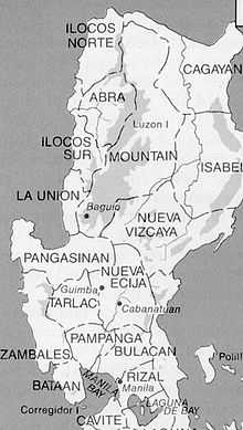
the province and its original boundaries
Post-war era
In 1971, with the passage of Republic Act No. 6394, Quirino, which was then a sub-province of Nueva Vizcaya, was separated from its mother province and made into a regular province.[3][4][6][7]
Since Nueva Vizcaya's birth as a province, traces of the culture and customs of its early settlers—the Ilongots (Bugkalot), Igorots, Ifugaos, Isinais, and the Gaddangs—can still be seen. The influx of civilization and the infusion of modern technology to the life stream of the province induced many immigrants from adjacent provinces to migrate to this province.
Every last week of May, Nueva Vizcaya celebrates the Ammungan festival (formerly Panagyaman festival), a week-long affair culminating on May 24, the province's foundation day.
Geography
Physical
Surrounded by North Luzon's three large mountain ranges, Nueva Vizcaya is generally mountainous, varying from steep mountains to rolling hills, with some valleys and plains.[4] It is bordered west by the Cordillera mountains, east by the Sierra Madre mountains, and south by the Caraballo mountains.[3] The province (and the whole Cagayan Valley) are separated from the Central Luzon plains by the Caraballo mountains.
The province has a total land area of 3975.7 square kilometers,.[1] The southernmost province in the Cagayan Valley region, Nueva Vizcaya lies approximately 268 kilometers north of Metro Manila and can be reached by land via the Cagayan Valley Road (Maharlika Highway).
Administrative
Nueva Vizcaya is subdivided into 15 municipalities, with Bayombong as the provincial capital and major educational center, Bambang (the agricultural hub) and Solano (the financial district) as the major commercial centers, and Kayapa as the summer capital and "vegetable bowl" of the province. All municipalities belong to the lone legislative district of the province.[8]
| Seal | Municipality | Land area (km2)[8] |
Population (2010)[9] |
Pop. density (per km2) |
No. of barangays |
ZIP code | Income class[8] |
Location |
|---|---|---|---|---|---|---|---|---|
| |
||||||||
| Alfonso Castañeda | 375.40 | 7,428 | 20 | 6 | 3714 | 4th |  | |
| | Ambaguio | 156.26 | 13,452 | 86 | 8 | 3701 | 5th |  |
| | Aritao | 265.60 | 37,115 | 140 | 22 | 3704 | 2nd |  |
| | Bagabag | 183.90 | 35,462 | 190 | 17 | 3711 | 2nd |  |
| | Bambang | 345.00 | 47,657 | 140 | 25 | 3702 | 1st |  |
| | Bayombong † | 136.00 | 57,416 | 420 | 25 | 3700 | 1st |  |
| | Diadi | 181.20 | 16,484 | 91 | 19 | 3712 | 4th |  |
| | Dupax del Norte | 347.30 | 25,697 | 74 | 15 | 3706 | 3rd |  |
| | Dupax del Sur | 374.70 | 18,146 | 48 | 19 | 3707 | 2nd |  |
| | Kasibu | 318.80 | 33,379 | 100 | 30 | 3703 | 4th |  |
| | Kayapa | 482.90 | 21,453 | 44 | 30 | 3708 | 3rd |  |
| | Quezon | 187.50 | 19,385 | 100 | 12 | 3713 | 4th |  |
| | Santa Fe | 399.81 | 14,427 | 36 | 16 | 3705 | 3rd |  |
| | Solano | 139.80 | 56,134 | 400 | 22 | 3709 | 1st |  |
| | Villaverde | 81.50 | 17,720 | 220 | 9 | 3710 | 5th |  |
| | Nueva Vizcaya Total | 3,975.67 | 421,355 | 110 | 275 | 3700 - 3714 | 2nd[8] | |
Barangays
The 15 municipalities of the province comprise a total of 275 barangays, with Roxas in Solano as the most populous in 2010, and Santa Rosa in Santa Fe as the least.[9][8]
Government
Nueva Vizcaya has one congressional district, although there has been a longtime proposal to divide the province into two congressional districts: "North District," comprising the northern municipalities; and "South District," composed of the southern towns.
Demographics

| Population census of Nueva Vizcaya | ||
|---|---|---|
| Year | Pop. | ±% p.a. |
| 1990 | 301,179 | — |
| 1995 | 334,965 | +2.01% |
| 2000 | 366,962 | +1.98% |
| 2007 | 397,837 | +1.12% |
| 2010 | 421,355 | +2.11% |
| Source: National Statistics Office[10][11] | ||
Economy

Agriculture is the main industry in the province, together with rice, corn, fruits and vegetables as major crops.[12] Nueva Vizcaya is a major producer of citrus crops in the country, principally pomelo, ponkan and oranges. Nueva Vizcaya Agricultural Terminal in Bambang supply the demand of neighboring provinces and to Metro Manila. There is a mining industry in the province which added to the province income.[13][14]
According to the Bureau of Mines and Geo-Sciences, deposits of metallic minerals which were discovered in the province are copper, gold, molybdenum and pyrite. Non-metallic deposits include red clay, white clay and limestone. Sand and gravel are the most abundant deposits in the province.
On January 11, 2008, the Cagayan Bureau of Fisheries and Aquatic Resources (BFAR) stated that tilapia (species of cichlid fishes from the tilapiine cichlid tribe) production grew and Cagayan Valley is now the Philippines’ tilapia capital (Saint Peter’s fish). Production supply grew 37.25% since 2003, with 14,000 metric tons (MT) in 2007. The recent aquaculture congress found that the growth of tilapia production was due to government interventions: provision of fast-growing species, accreditation of private hatcheries to ensure supply of quality fingerlings, establishment of demonstration farms, providing free fingerlings to newly constructed fishponds, and the dissemination of tilapia to Nueva Vizcaya (in Diadi town). Former cycling champion Lupo Alava is a multi-awarded tilapia raiser in Bagabag, Nueva Vizcaya. Also, Nueva Vizcaya Gov. Luisa Lloren Cuaresma also entered into similar aquaculture endeavors in addition to tilapia production.[15]
Education
Nueva Vizcaya has two universities. There's a lot of High Schools and Elementary/Middle Schools found in the province.
University
- Nueva Vizcaya State University has two campus: Bayombong Campus and Bambang Campus
- Saint Mary's University in Bayombong
College/Vocational
- Aldersgate College (in Solano)
- PLT College Inc. (in Bayombong)
- King's College of the Philippines (formerly: Eastern Luzon Colleges) (in Bambang)
- Nueva Vizcaya Institute (in Aritao)
- Vizcaya Institute of Computer Science (in Bayombong)
- Sierra College (in Bayombong)
- Nueva Vizcaya Caregiver Academy (in Solano)
- Solano Intitute of Technology (in Solano)
- Fuzeko Polytechnic College (in Solano)
- Northern Luzon Technical Institute (in Bayombong)
Tourist Attractions
This landlocked province is famous for its high quality citrus fruits. Unsurprisingly, this has given it the nickname of “Citrus Capital of the Philippines.”

- Saint Dominic Cathedral. A living vestige of the grandeur that was the old town is its Catholic Church that was preserved to become the first cathedral in the province. Razed by fire twice and rebuilt in the same old site, it is now approximately twice its original size. The cathedral maintains the original façade and as such a veritable treasure, a relic of the past for its historic and aesthetic remains of a proud Christian past.
- Nueva Vizcaya Provincial Capitol Complex is decidedly symbolic of the noble aspiration, foresight and noble vision of its builder, Governor Patricio G. Dumlao. Located along the national road, it houses all the provincial government offices. The capitol building is a study of architectural ingenuity. It has a park with exotic plant species, concrete benches and sidewalks lighted with giant lamps and man-made lagoon ideal for rowing the colorful mini-boats operated by handicapables, also called the Luneta of the north.
- Dalton Pass/Balete Pass is a rugged piece of terrain where a part of the Caraballo Sur reaches south and joins the Sierra Madre. Because of its strategic importance as the only access between Pampanga and Cagayan Valley, the pass became the scene of much bloody fighting during the final stages of World War II. Japanese Shobu soldiers headed by General Tomoyuki Yamashita tried to hold their positions while Filipino and American soldiers under the leadership of Colonel Robert Lapham, were determined to dislodge them from February to March 1945. By the close of hostilities, the blood of almost seventeen thousand Japanese fighting units and the US-Filipino allied forces mingled with the soil. Markers that commemorate their sacrifice stand by the road’s highest point, with good view into the highlands. The shrine is a reminder for Gen. James L. Dalton who was killed by a sniper’s bullet during the end of World War II. Located 3,000 feet above sea level, Balete Pass is also the gateway to Cagayan Valley and the Ifugao Rice Terraces
- Capisaan Cave System is the FIFTH longest cave in the country at 4.2 kilometers. Located in Barangay Capisaan, Kasibu - it has layers of cave network including Lion and Alayan Caves with rare calcite formations and a subterranean river which doubles as a passageway to the best part of the cave. Brgy. Capisaan is about four hours by jeep from Solano on feeder and clay type soil road carved out of mountain sides. Other caves in the area are Alayan, Lion and Sabrina Cave.
- Alayan Cave at Malabing Valley, Brgy. Capisaan, Kasibu is ranked as one of the best in the country. It is a multi-chambered cave with living calcite formations and subterranean river. Tours can be arranged with the Sang-at-Salug Mountaineering Group or the Provincial Government of Nueva Vizcaya.
- Heaven Caveat Malabing Valley, Brgy. Capisaan, Kasibu has two big chambers of various calcite formations and a mezanine of pure white limestones where one has take off their footwear before exploration.
- Imugan Waterfalls, Sta. Fe, Nueva Vizcaya is a two level falls with shallow catch basin. Trek over streams/rivers emanating from the falls. Enjoy trekking, exploration, swimming, fishing and cultural immersion. Also within the area is the Imugan Mountain Fresh Factory which utilizes wild berries and other fruits to produce spreads and jams while visitors can watch the production process and shop for preserved fruit spreads. Imugan is about 30 minutes from National Highway.
- Kayapa Fruits and Vegetable Farms is a three-hour drive from Bambang highway. Travel over forested mountains and hills, cool climate, streams/rivers and terraced slopes of vegetables, fruits, flowers and rice fields. Kayapa town cuts travel time from Nueva Vizcaya to Baguio City by two hours during summer. Bambang fruit and vegetable stalls also serve as outlets for fresh produce from Kayapa frequented daily by buyers from Manila and Baguio City.

- St. Vincent Ferrer of Dupax in Dupax del Sur is one of the biggest and oldest unreinforced brick churches (18th century) in the Cagayan Valley. The church has all the requisites of an Old Spanish brick church like wooden altar, columns and lattices and a museum which houses centuries old church artifacts. Other well-preserved Spanish monuments include a Spanish Flagpole and Dampol Bridge - an unreinforced bridge made of bricks. In the 1960s, after being Christianized, the Ilongots gave up their head-hunting ways and started to call themselves Bugkalots in order to bury their bloody but proud past. The Isinais, formerly called Mallats or Imaalats were gentle and easily embraced Christianity. The church, declared by the National Museum as a National Cultural Treasure is a forty-five minute drive from Bayombong.

- Mt. Ugu in Kayapa, this mountain offers trails that pass through native communities of the Kalanguya tribes and is becoming a favorite mountaineering destination among outdoor enthusiasts.
- Mt. Palali stands at 1,705 meters asl. The municipalities of Quezon and Bayombong bound Mt. Palali. Once the hunting ground of the Bugkalots, Gaddangs and the Ifugaos, the mountain offers a magnificent view of the low-lying municipalities of Nueva Vizcaya. Its diptherocarp forest contains unique diversity of flora and fauna and is historically a crash site of a WW II tora-tora plane
- Ambaguio Town is the gateway to Mount Pulag, the second highest in the country at 2,922 meters above sea level. Guided tours offer treks along hanging bridges, climbing through mossy forest and remote farming barangays with friendly Kalanguya tribe. Walk through an area of bonsai forest and grasslands of dwarf bamboos over a horizon of clouds. Mt. Pulag is a perfect eco-tourism destination and is home to the pitcher plant, giant cloud rat and whiskered pitta. Ambaguio is 20 kilometers from Bayombong and is home to four indigenous tribes namely Kalanguya, Ibaloy, Kankanaey and Karao. For trips and arrangements contact the Municipal Tourism Council.
- People's Museum and Library in Bayombong stands beside the St. Dominic Cathedral. A two-storey historical building which houses the Novo Vizcayano’s history and heritage. The former seat of the provincial government now showcases the culture and tradition of the tribes of Nueva Vizcaya.
- Paraiso Tribu Vizcayano (also known as Lower Magat Ecotourism Park) is being develop by the Province of Nueva Vizcaya as a high-end back-to-nature resort facility showcasing the rich culture and natural attractions of the province.

- Rizal Shrine in Brgy. Casat, Bayombong, Nueva Vizcaya it is one of the tallest statues of José Rizal.
- Bangan Hill National Park - A historic landmark and cultural treasure. It is the site of the annual "Stations of the Cross" staged by the local Catholic church during the Lenten season using live actors depicting the last moments leading to Jesus Christ's crucifixion. Also great for hiking enthusiasts.
- PLT Wellness and Resort in Brgy. Bascaran, Solano. Known for the longest zip line and biggest swimming pool not only in the province but also in the Cagayan Valley region.
- There's a lot of waterfalls found in the province like: Mapalyao Falls, Señora Falls both found in Quezon; Uddiawan Falls in Solano; Edralin Falls in Kasibu
References
- ↑ 1.0 1.1 "List of Provinces". PSGC Interactive. Makati City, Philippines: National Statistical Coordination Board. Retrieved 16 December 2013.
- ↑ "Total Population by Province, City, Municipality and Barangay: as of May 1, 2010" (PDF). 2010 Census of Population and Housing. National Statistics Office. Retrieved 18 December 2013.
- ↑ 3.0 3.1 3.2 3.3 3.4 3.5 3.6 3.7 Lancion, Jr., Conrado M.; de Guzman, Rey (cartography) (1995). "The Provinces". Fast Facts about Philippine Provinces (The 2000 Millenium ed.). Makati, Metro Manila: Tahanan Books. pp. 118, 48, 49, 84. ISBN 971-630-037-9. Retrieved 16 January 2015.
- ↑ 4.0 4.1 4.2 4.3 4.4 4.5 "Provincial Profile". Province of Nueva Vizcaya (official website). Retrieved 17 January 2015.
- ↑ Smith, R.R., 2005, Triumph in the Philippines, Honolulu: University Press of the Pacific, ISBN 1410224953
- ↑ "Republic Act No. 4734 - An Act Creating the Subprovince of Quirino in the Province of Nueva Vizcaya". Chan Robles Virtual Law Library. Retrieved 13 January 2015.
- ↑ "Brief History of Quirino". Province of Quirino (official website). Retrieved 13 January 2015.
- ↑ 8.0 8.1 8.2 8.3 8.4 "Province: Nueva Vizcaya". Philippine Statistics Authority - National Statistical Coordination Board. Retrieved 18 January 2015.
- ↑ 9.0 9.1 "2010 Census of Population and Housing: Total Population by Province, City, Municipality and Barangay:as of May 1, 2010" (PDF). National Statistics Office. Retrieved 5 December 2014.
- ↑ name=NSO10
- ↑ "Population and Annual Growth Rates for The Philippines and Its Regions, Provinces, and Highly Urbanized Cities" (PDF). 2010 Census and Housing Population. National Statistics Office. Retrieved 26 August 2013.
- ↑ name=FastFactsPhilProv
- ↑ http://manilastandardtoday.com/2013/10/17/oceanagold-inks-deal/
- ↑ http://manilastandardtoday.com/2013/09/13/oceanagold-to-invest-20m/
- ↑ Abs-Cbn Interactive, Cagayan Valley country’s tilapia capital
External links
| Wikimedia Commons has media related to Nueva Vizcaya. |
- Official website of the Province of NUEVA VIZCAYA
- Philippine Standard Geographic Code
- Philippine Census Information
- Local Governance Performance Management System
 |
Ifugao | Isabela | | |
| Benguet | |
Quirino | ||
| ||||
| | ||||
| Pangasinan | Nueva Ecija | Aurora |
| ||||||||||||||

| ||||||||||||||||||||||||||||||||||


| |||||||||||||||||||||||||||||||||||||||||||||