Notre-Dame-des-Prairies, Quebec
| Notre-Dame-des-Prairies | |
|---|---|
| City | |
 Location within Joliette RCM. | |
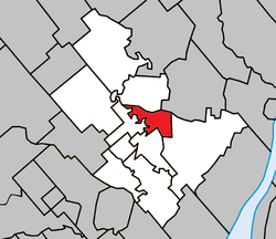
 Notre-Dame-des-Prairies Location in central Quebec. | |
| Coordinates: 46°03′N 73°26′W / 46.050°N 73.433°WCoordinates: 46°03′N 73°26′W / 46.050°N 73.433°W[1] | |
| Country |
|
| Province |
|
| Region | Lanaudière |
| RCM | Joliette |
| Constituted | January 1, 1957 |
| Government[2] | |
| • Mayor | Alain Larue |
| • Federal riding | Joliette |
| • Prov. riding | Joliette |
| Area[2][3] | |
| • Total | 18.80 km2 (7.26 sq mi) |
| • Land | 18.20 km2 (7.03 sq mi) |
| Population (2011)[3] | |
| • Total | 8,868 |
| • Density | 487.3/km2 (1,262/sq mi) |
| • Pop 2006-2011 |
|
| • Dwellings | 4,068 |
| Time zone | EST (UTC−5) |
| • Summer (DST) | EDT (UTC−4) |
| Postal code(s) | J6E |
| Area code(s) | 450 and 579 |
| Highways |
|
| Website |
www |
Notre-Dame-des-Prairies is a town in the Lanaudière region of Quebec, Canada, part of the Joliette Regional County Municipality. It is a suburb of Joliette, located along the eastern shores of the L'Assomption River.
History
In 1950, the Parish of Notre-Dame-des-Prairies was established. The name refers to the prairies or planes of the Saint-Lawrence Lowlands that characterize the landscape. In 1957, the municipality was formed by separating from the Parish Municipality of Saint-Charles-Borromée. In 2005, the municipality changed statutes and became the City of Notre-Dame-des-Prairies.[4]
Demographics
Population trend:[5]
- Population in 2011: 8868 (2006 to 2011 population change: 7.8%)
- Population in 2006: 8230
- Population in 2001: 7316
- Population in 1996: 6837
- Population in 1991: 6465
Private dwellings occupied by usual residents: 4002 (total dwellings: 4068)
Mother tongue:
- English as first language: 0.6%
- French as first language: 97.6%
- English and French as first language: 0%
- Other as first language: 1.8%
See also
- List of cities in Quebec
References
- ↑ Reference number 388194 of the Commission de toponymie du Québec (French)
- ↑ 2.0 2.1 Geographic code 61030 in the official Répertoire des municipalités (French)
- ↑ 3.0 3.1 Statistics Canada 2011 Census - Notre-Dame-des-Prairies census profile
- ↑ "Notre-Dame-des-Prairies (Ville)" (in French). Commission de toponymie du Québec. Retrieved 2009-10-09.
- ↑ Statistics Canada: 1996, 2001, 2006, 2011 census
 |
Notre-Dame-de-Lourdes | Sainte-Élisabeth | | |
| Saint-Charles-Borromée | |
Saint-Thomas | ||
| ||||
| | ||||
| Joliette |
| ||||||||||||||||||||||