Northumberland National Park
| Northumberland National Park | |
| Protected Area | |
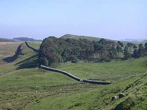 View of Hadrian's Wall, Northumberland National Park | |
| Country | United Kingdom |
|---|---|
| Part | England |
| Counties | Northumberland |
| style=""color: #cde5b2"" | IUCN category | V - Protected Landscape/Seascape |
Northumberland National Park is the northernmost national park in England. It covers an area of more than 1030 km2 between the Scottish border in the north to just south of Hadrian's Wall. It is one of the least populated and least visited of the National Parks. The park lies entirely within Northumberland, covering about a quarter of the county.
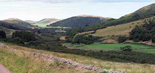
The park covers several distinct areas. In the north are the Cheviots, a range of hills that mark the border between England and Scotland. Further south, the hills give way to areas of rolling moorland, some of which have been covered by forestry plantations to form Kielder Forest. The southernmost part of the park covers the dramatic central section of Hadrian's Wall.
The 10,000 year history of the region is explored through the many archaeological sites, ranging from prehistoric monuments and Roman remains to Pele towers, constructed as a defence against Border Reivers.
The Park's official symbol is the curlew.
Etymology
The Northumberland National Park takes its name from the English county of Northumberland. Northumberland means "country north of the River Humber" and is related to the name "Northumbria" which refers to the old Anglo-Saxon kingdom which once covered much of Northern England. Since the national park lies totally within the boundaries of Northumberland, that is the name it took.
Geography
The Northumberland National Park covers a large area of Western Northumberland and borders the English county of Cumbria and the Scottish county of The Scottish borders. The national park encompasses much of the Cheviot hills and adjoins the Southern uplands of Scotland, of which the Cheviot hills are sometimes referred to as being a part of. Kielder Forest lies within much of the park and in other areas forms a forest park. Kielder Forest is the largest man-made forest in Europe and surrounds Kielder Water .
Otterburn Training Area
The Ministry of Defence in the United Kingdom owns much of the land in the national park as the Otterburn Training Area. Some areas of this training area are off-limits, but others can be accessed only at certain times or with permission. The training area accounts for 23% of the Northumberland National Park.
Dark Sky Park status
In December 2013 the International Dark-Sky Association conferred Dark Sky Park status on the area, becoming the largest protected Dark Sky Park in Europe.[1]
-

In the South of the Park, timber-harvesting is a large part of Kielder Forest's main purpose
-

Hadrian's Wall represents a part of the National Park's historical importance
-
Sighty Cragg
-
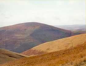
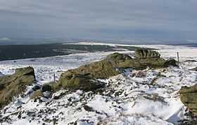
Shillhope Law
References
- ↑ "Dark sky status awarded to Northumberland Park area". bbc.co.uk. 2013-12-09. Retrieved 2013-12-09.
External links
![]() Media related to Northumberland National Park at Wikimedia Commons
Media related to Northumberland National Park at Wikimedia Commons
![]() Northumberland National Park travel guide from Wikivoyage
Northumberland National Park travel guide from Wikivoyage
- Homepage for Northumberland National Park Authority
- Homepage for Northumberland National Park Mountain Rescue Team
| ||||||||||||||||||||||