Noakhali Sadar Upazila
| Noakhali Sadar নোয়াখালি সদর | |
|---|---|
| Upazila | |
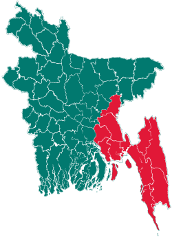
 Noakhali Sadar Location in Bangladesh | |
| Coordinates: 22°50′N 91°6′E / 22.833°N 91.100°ECoordinates: 22°50′N 91°6′E / 22.833°N 91.100°E | |
| Country |
|
| Division | Chittagong Division |
| District | Noakhali District |
| Area | |
| • Total | 336.06 km2 (129.75 sq mi) |
| Population (2011) | |
| • Total | 526,000 |
| • Density | 1,565/km2 (4,050/sq mi) |
| Time zone | BST (UTC+6) |
| Website | Official Map of Noakhali Sadar |
Noakhali Sadar (Bengali: নোয়াখালি সদর) is an Upazila of Noakhali District in the Division of Chittagong, Bangladesh. The Upazila has recently been divided, creating two more Upazilas: Subarnchar and Kabir Hat.
Geography
Noakhali Sadar is located at 22°50′00″N 91°06′00″E / 22.8333°N 91.1000°E. It has 100,219 households and a total area of 336 km².
Demographics
According to the 2011 Bangladesh census, Noakhali Sadar had a population of 526,000. Males constituted 49.82% of the population, and females 50.18%. Noakhali Sadar had an average literacy rate of 51.7%, against the national average of 32.4%.[1]
Administration
Noakhali Sadar has 1 Municipality, 13 Unions, 9 Wards, 166 Mauzas, 36 Mahallas, and 173 villages.
Notable personalities
Freedom Fighters
- Shahid Abdul Odud BLF
- Shahid Abdur Rob BLF
- Momin Ullah B.Sc (BLF)Presently Advocate he was the first Secretary of District JSD, Founder of Bhulua College & School
- Nizam Uddin Faruk(BLF)
- Abul Hossain(BLF)
- Biplobi Sailesh Roy (an associate of Masterda Surya Sen-1930)
Other notable people
- Kamal Uddin Ahmed Author, Political Analyst
- Qazi Abdul Lateef
See also
References
- ↑ "Population Census Wing, BBS.". Archived from the original on 2005-03-27. Retrieved November 10, 2006.
External links
- Amar Sangbad News
- Chaloman Noakhali Online
- Noakhali Science and Technology University
- Noakhali Web | Online Newspaper & Communily Portal
| |||||||||||||||||||||||||||||||||||||||||||||||||||||